While the left side offers excellent views during departure from Montreal, the right side provides superior scenery during the critical descent phase into London, including the Thames estuary, Chiltern Hills, and London's urban geography. The landing views outweigh the takeoff advantage.
Flown YHU to LHR? Did we get it right?
Flight Path
Montreal to London is 3,225 miles (5,191 km), a flight of about 7 hours 15 minutes.
The flight path crosses the Atlantic at approximately 51°N latitude. Notable features include: the Newfoundland coast and Grand Banks region (visible 2–3 hours after takeoff), the open Atlantic Ocean (5–6 hours of flight), the Irish coast and Celtic Sea (visible 1–2 hours before landing), and the Welsh hills and English Midlands (visible during final descent into London).
Great circle distance and headings ›

Phase by phase
Takeoff from YHU
LEFTLeft side captures the St. Lawrence River valley and the Laurentian Mountains as the aircraft climbs northeast out of St. Hubert. The river's distinctive meandering path and forested ridgelines are visible within the first 10–15 minutes of flight.
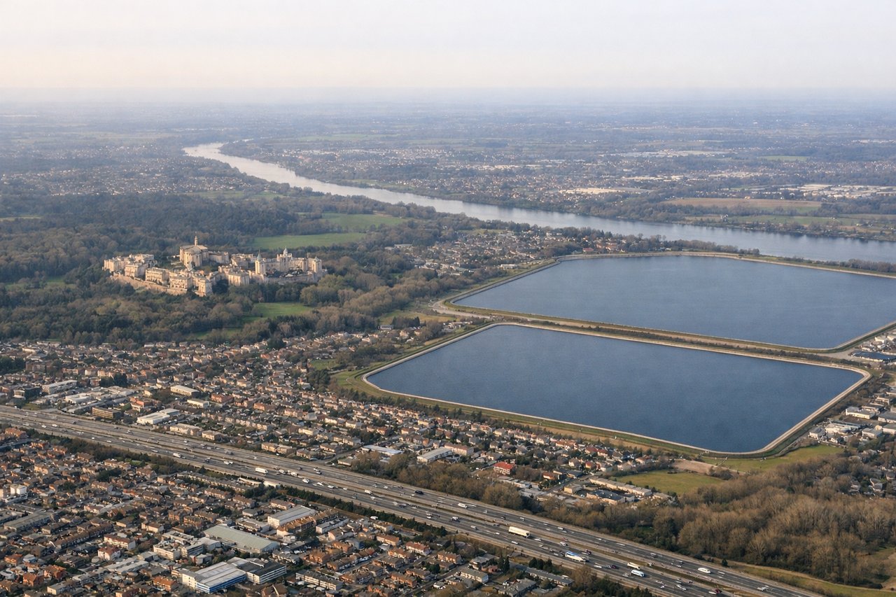
Landing at LHR
RIGHTRight side offers the best views during descent into Heathrow. The aircraft approaches from the west over the Thames estuary and the Chiltern Hills, with the Thames's distinctive meanders and London's urban sprawl visible on the right as you descend through 5,000–8,000 feet.
Will your flight be in sunlight?
Pick a date and time in the Sun Map to watch the sun move across your whole flight.
About This Route
Which side of the plane should I sit on flying from St Hubert (YHU) to Heathrow (LHR)?
Sit on the Right side of the plane for the best views on flights from Montreal to London. While the left side offers excellent views during departure from Montreal, the right side provides superior scenery during the critical descent phase into London, including the Thames estuary, Chiltern Hills, and London's urban geography. The landing views outweigh the takeoff advantage.
What can I see during takeoff from St Hubert in Montreal?
During takeoff from St Hubert (YHU), sit on the Left side for the best views. Left side captures the St. Lawrence River valley and the Laurentian Mountains as the aircraft climbs northeast out of St. Hubert. The river's distinctive meandering path and forested ridgelines are visible within the first 10–15 minutes of flight. Notable sights include: St. Lawrence River (flowing southeast), Laurentian Mountains (north of Montreal), Ottawa River valley (visible further northwest), Lake of Two Mountains (west of takeoff path).
What can I see when landing at Heathrow in London?
When landing at Heathrow (LHR), sit on the Right side for the best views. Right side offers the best views during descent into Heathrow. The aircraft approaches from the west over the Thames estuary and the Chiltern Hills, with the Thames's distinctive meanders and London's urban sprawl visible on the right as you descend through 5,000–8,000 feet. Notable sights include: River Thames (with visible meanders), Chiltern Hills (southwest of London), Greater London urban area, Windsor Castle area (visible on approach path).
How long is the flight from Montreal to London?
The flight from St Hubert (YHU) to Heathrow (LHR) takes about 7 hours 15 minutes. The shortest flight path between them is 3,225 miles (5,191 km); winds and air traffic control usually add a few percent.
What does the Montreal to London flight path pass over?
The flight path crosses the Atlantic at approximately 51°N latitude. Notable features include: the Newfoundland coast and Grand Banks region (visible 2–3 hours after takeoff), the open Atlantic Ocean (5–6 hours of flight), the Irish coast and Celtic Sea (visible 1–2 hours before landing), and the Welsh hills and English Midlands (visible during final descent into London).