The left side wins narrowly thanks to the Rocky Mountain glimpse at departure and its alignment with the Himalayan and Tibetan Plateau scenery crossed during the long cruise phase, even though the landing itself favors the right side.
Flown YOP to BLR? Did we get it right?
Flight Path
Rainbow Lake to Bangalore is 7,390 miles (11,893 km), a flight of about 13 hours 45 minutes.
Mackenzie Mountains and Great Bear Lake in Canada's Northwest Territories, sea ice over the Beaufort Sea and Arctic Ocean, the taiga and Verkhoyansk Range of Siberia, and the Tibetan Plateau with Himalayan peaks before the descent into the Indian subcontinent
Great circle distance and headings ›

Phase by phase
Takeoff from YOP
LEFTClimbing out of Rainbow Lake, the aircraft turns onto its long northbound track toward the polar route, and the west-facing left side catches a distant view of the northern Rocky Mountain foothills of British Columbia rising above the flat boreal muskeg. The right side only shows the featureless lake-and-forest mosaic of the Peace River lowlands.
Landing at BLR
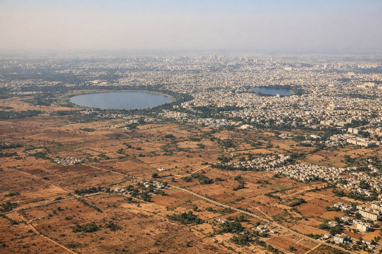
RIGHTOn the descent into Bangalore, the approach path from the north gives the right side a view over the sprawling city and its tech corridor, with the low green rise of Nandi Hills visible on the horizon. The left side mainly faces open Deccan farmland with little to distinguish it.
Will your flight be in sunlight?
Pick a date and time in the Sun Map to watch the sun move across your whole flight.
About This Route
Which side of the plane should I sit on flying from Rainbow Lake Airport (YOP) to Kempegowda International Airport Bengaluru (BLR)?
Sit on the Left side of the plane for the best views on flights from Rainbow Lake to Bangalore. The left side wins narrowly thanks to the Rocky Mountain glimpse at departure and its alignment with the Himalayan and Tibetan Plateau scenery crossed during the long cruise phase, even though the landing itself favors the right side.
What can I see during takeoff from Rainbow Lake Airport in Rainbow Lake?
During takeoff from Rainbow Lake Airport (YOP), sit on the Left side for the best views. Climbing out of Rainbow Lake, the aircraft turns onto its long northbound track toward the polar route, and the west-facing left side catches a distant view of the northern Rocky Mountain foothills of British Columbia rising above the flat boreal muskeg. The right side only shows the featureless lake-and-forest mosaic of the Peace River lowlands. Notable sights include: Northern Rocky Mountain foothills (BC border ranges), Peace River lowlands, boreal muskeg and lake mosaic around Rainbow Lake.
What can I see when landing at Kempegowda International Airport Bengaluru in Bangalore?
When landing at Kempegowda International Airport Bengaluru (BLR), sit on the Right side for the best views. On the descent into Bangalore, the approach path from the north gives the right side a view over the sprawling city and its tech corridor, with the low green rise of Nandi Hills visible on the horizon. The left side mainly faces open Deccan farmland with little to distinguish it. Notable sights include: Nandi Hills north of the city, Bangalore's urban and IT-corridor skyline, scattered lakes like Hebbal and Ulsoor on the Deccan Plateau.
How long is the flight from Rainbow Lake to Bangalore?
The flight from Rainbow Lake Airport (YOP) to Kempegowda International Airport Bengaluru (BLR) takes about 13 hours 45 minutes. The shortest flight path between them is 7,390 miles (11,893 km); winds and air traffic control usually add a few percent.
What does the Rainbow Lake to Bangalore flight path pass over?
Mackenzie Mountains and Great Bear Lake in Canada's Northwest Territories, sea ice over the Beaufort Sea and Arctic Ocean, the taiga and Verkhoyansk Range of Siberia, and the Tibetan Plateau with Himalayan peaks before the descent into the Indian subcontinent