While left side wins at takeoff for Ottawa's river and Parliament views, the right side delivers more sustained interest across the flight — the Adirondacks and Appalachian ridgelines through Pennsylvania and Virginia are better framed on the right heading southwest, and the Atlanta arrival view of the skyline on the right is the flight's visual highlight.
Flown YOW to ATL? Did we get it right?
Flight Path
Ottawa to Atlanta is 931 miles (1,499 km), a flight of about 2 hours 25 minutes.
The flight tracks southwest over the Adirondack Mountains of upstate New York, then crosses the Appalachian Ridge and Valley province through Pennsylvania and Maryland. The Blue Ridge Mountains appear as parallel forested ridgelines through Virginia and into North Carolina. The Great Smoky Mountains are visible on the western horizon as the route descends toward Georgia. The Tennessee River valley and Chattanooga area pass beneath before the final descent into Atlanta.
Great circle distance and headings ›Phase by phase
Takeoff from YOW
LEFTOttawa's dominant runway 25 departure heads southwest, putting the left (south) side facing the Ottawa River valley and downtown Ottawa. You get a clear view of the Parliament Hill complex, the Rideau Canal, and the broad Ottawa River as you climb out.
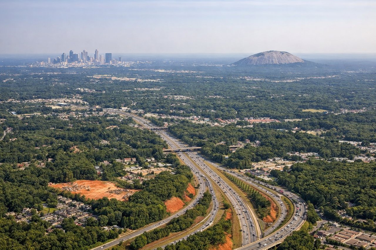
Landing at ATL
RIGHTAtlanta's primary arrival on runway 27L/27R comes in from the east heading west, so the right (north) side looks over downtown Atlanta's skyline during the approach. You get a prolonged view of the Midtown and Downtown skyscraper clusters as the aircraft descends over the eastern suburbs.
Will your flight be in sunlight?
Pick a date and time in the Sun Map to watch the sun move across your whole flight.
About This Route
Which side of the plane should I sit on flying from Ottawa Macdonald Cartier International (YOW) to The William B Hartsfield Atlanta International (ATL)?
Sit on the Right side of the plane for the best views on flights from Ottawa to Atlanta. While left side wins at takeoff for Ottawa's river and Parliament views, the right side delivers more sustained interest across the flight — the Adirondacks and Appalachian ridgelines through Pennsylvania and Virginia are better framed on the right heading southwest, and the Atlanta arrival view of the skyline on the right is the flight's visual highlight.
What can I see during takeoff from Ottawa Macdonald Cartier International in Ottawa?
During takeoff from Ottawa Macdonald Cartier International (YOW), sit on the Left side for the best views. Ottawa's dominant runway 25 departure heads southwest, putting the left (south) side facing the Ottawa River valley and downtown Ottawa. You get a clear view of the Parliament Hill complex, the Rideau Canal, and the broad Ottawa River as you climb out. Notable sights include: Parliament Hill and the Peace Tower, Ottawa River and Gatineau Hills to the north, Rideau Canal corridor, downtown Ottawa core.
What can I see when landing at The William B Hartsfield Atlanta International in Atlanta?
When landing at The William B Hartsfield Atlanta International (ATL), sit on the Right side for the best views. Atlanta's primary arrival on runway 27L/27R comes in from the east heading west, so the right (north) side looks over downtown Atlanta's skyline during the approach. You get a prolonged view of the Midtown and Downtown skyscraper clusters as the aircraft descends over the eastern suburbs. Notable sights include: Downtown Atlanta skyline, Midtown Atlanta towers, Stone Mountain visible to the east on approach, I-285 perimeter highway loop.
How long is the flight from Ottawa to Atlanta?
The flight from Ottawa Macdonald Cartier International (YOW) to The William B Hartsfield Atlanta International (ATL) takes about 2 hours 25 minutes. The shortest flight path between them is 931 miles (1,499 km); winds and air traffic control usually add a few percent.
What does the Ottawa to Atlanta flight path pass over?
The flight tracks southwest over the Adirondack Mountains of upstate New York, then crosses the Appalachian Ridge and Valley province through Pennsylvania and Maryland. The Blue Ridge Mountains appear as parallel forested ridgelines through Virginia and into North Carolina. The Great Smoky Mountains are visible on the western horizon as the route descends toward Georgia. The Tennessee River valley and Chattanooga area pass beneath before the final descent into Atlanta.