While takeoff favors the right for St. Lawrence River views, the landing experience on the left—with Lake Amatitlán and the dramatic volcanic basin—is more visually distinctive and memorable. The landing view outweighs the takeoff advantage.
Flown YUL to GUA? Did we get it right?
Flight Path
Montreal to Guatemala City is 2,347 miles (3,778 km), a flight of about 5 hours.
The flight path crosses the Yucatan Peninsula (flat, low-lying limestone terrain with scattered cenotes visible as dark circular features), the Gulf of Mexico's western edge, and the Petén region of Guatemala (dense rainforest canopy, largely featureless from altitude). The transition from temperate North American geography to tropical Central American terrain is gradual but noticeable around the Yucatan crossing. No major mountain ranges are crossed until final descent into Guatemala's highlands.
Great circle distance and headings ›

Phase by phase
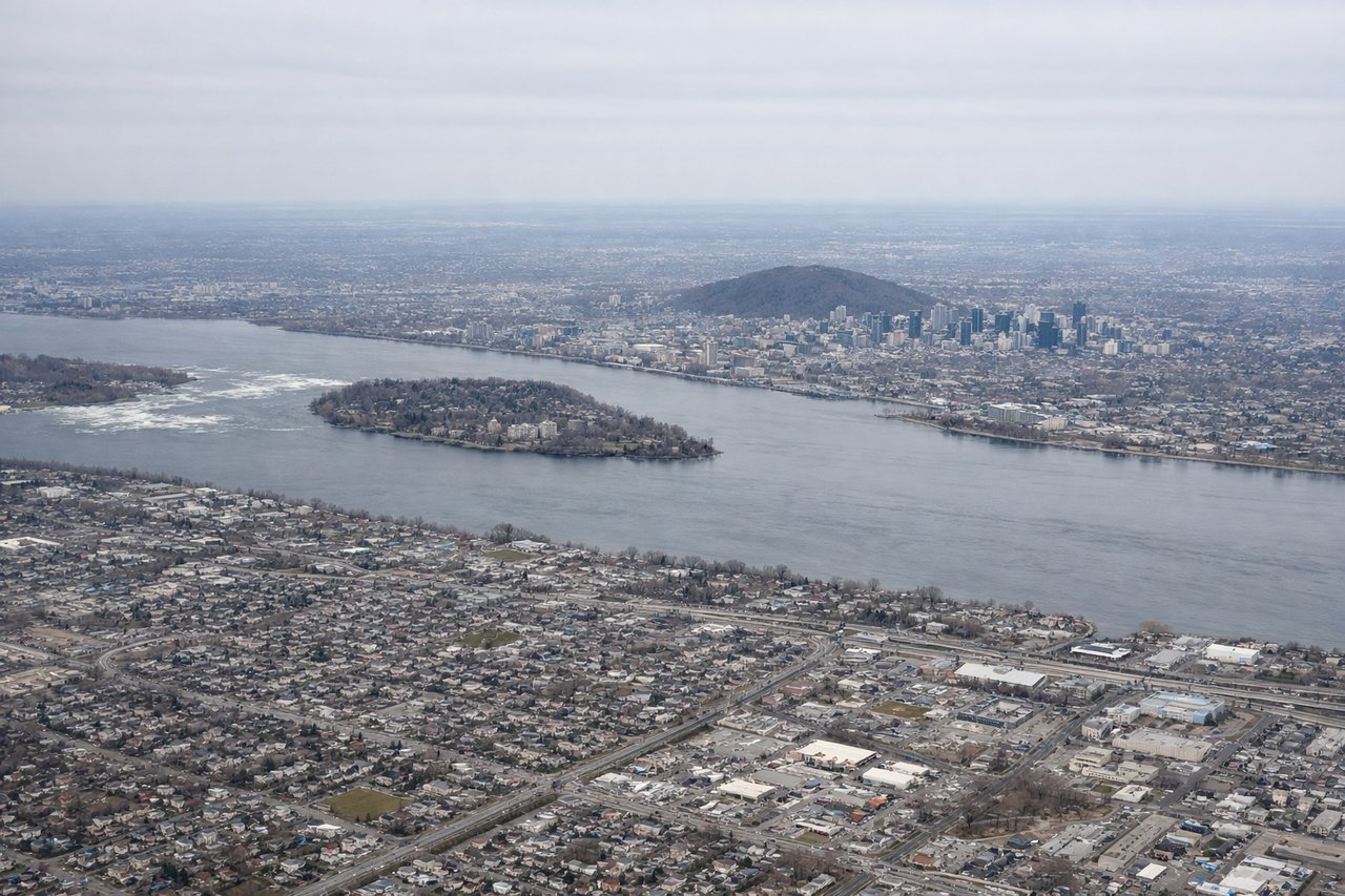
Takeoff from YUL
RIGHTRight side captures the St. Lawrence River valley and the Laurentian Mountains to the north, which dominate the visual landscape during northeastward climb. Left side shows suburban sprawl with less distinctive geography.
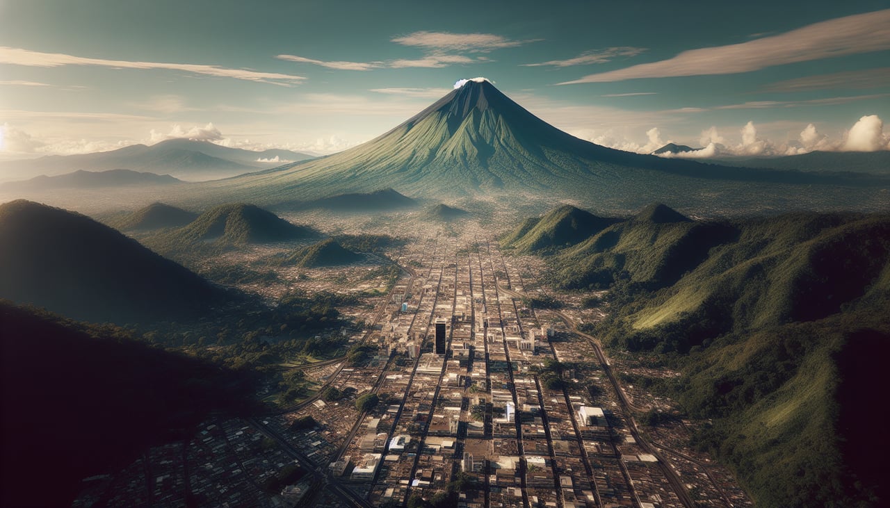
Landing at GUA
LEFTLeft side provides views of the volcanic highlands and Lake Amatitlán as you descend into Guatemala City's basin. Right side shows less distinctive terrain. Approach typically comes from the northeast, making left-side views of the surrounding highlands and water features more rewarding.
Will your flight be in sunlight?
Pick a date and time in the Sun Map to watch the sun move across your whole flight.
About This Route
Which side of the plane should I sit on flying from Montreal International Dorval (YUL) to La Aurora (GUA)?
Sit on the Left side of the plane for the best views on flights from Montreal to Guatemala City. While takeoff favors the right for St. Lawrence River views, the landing experience on the left—with Lake Amatitlán and the dramatic volcanic basin—is more visually distinctive and memorable. The landing view outweighs the takeoff advantage.
What can I see during takeoff from Montreal International Dorval in Montreal?
During takeoff from Montreal International Dorval (YUL), sit on the Right side for the best views. Right side captures the St. Lawrence River valley and the Laurentian Mountains to the north, which dominate the visual landscape during northeastward climb. Left side shows suburban sprawl with less distinctive geography. Notable sights include: St. Lawrence River (flowing southeast below), Laurentian Mountains (northern horizon), Montreal urban area (directly below during initial climb), Île Jésus/Laval (northeast sector).
What can I see when landing at La Aurora in Guatemala City?
When landing at La Aurora (GUA), sit on the Left side for the best views. Left side provides views of the volcanic highlands and Lake Amatitlán as you descend into Guatemala City's basin. Right side shows less distinctive terrain. Approach typically comes from the northeast, making left-side views of the surrounding highlands and water features more rewarding. Notable sights include: Lake Amatitlán (southwest of airport, visible during descent), Volcanic highlands and ridgelines (surrounding the basin), Guatemala City urban area (filling the valley floor), Palencia ridge (eastern approach).
How long is the flight from Montreal to Guatemala City?
The flight from Montreal International Dorval (YUL) to La Aurora (GUA) takes about 5 hours. The shortest flight path between them is 2,347 miles (3,778 km); winds and air traffic control usually add a few percent.
What does the Montreal to Guatemala City flight path pass over?
The flight path crosses the Yucatan Peninsula (flat, low-lying limestone terrain with scattered cenotes visible as dark circular features), the Gulf of Mexico's western edge, and the Petén region of Guatemala (dense rainforest canopy, largely featureless from altitude). The transition from temperate North American geography to tropical Central American terrain is gradual but noticeable around the Yucatan crossing. No major mountain ranges are crossed until final descent into Guatemala's highlands.