Yuma to Phoenix is 160 miles (258 km), a flight of about 50 minutes.
While the right side wins at takeoff for the Colorado River and agricultural views, the left side delivers the more dramatic payoff on landing with the Phoenix skyline, Tempe Town Lake, and Camelback Mountain all in view. For the short 45-minute flight, the landing approach into PHX is the visual highlight, and the left side owns it.
Flight Path
The flight crosses the Sonoran Desert lowlands, passing over the Painted Rock Mountains and Estrella Mountain Regional Park area. The Gila River corridor is visible as a pale sandy wash cutting east-west across the desert. The terrain is largely flat desert scrub with isolated volcanic mountain ranges rising abruptly from the basin floor, characteristic of Basin and Range geology.
Great circle distance and headings ›Phase by phase
Takeoff from YUM
RIGHTYuma typically departs eastbound on runway 21L/03R or uses runway 08/26. On an eastbound departure toward Phoenix, the right side gives you a clear look south over the Colorado River delta area and the agricultural patchwork of the Yuma Valley before the terrain opens into desert. The left side faces north into relatively featureless desert flats.
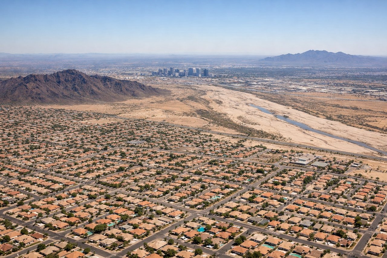
Landing at PHX
LEFTPhoenix Sky Harbor sits on the east side of the Phoenix metro. Arrivals typically come in from the west or southwest on runway 26 or 25L/R. On approach from the Yuma direction, the left side gives you the best view of downtown Phoenix, the Salt River, and Tempe Town Lake directly below the flight path. The right side looks south toward the South Mountain Park massif.
Will your flight be in sunlight?
Pick a date and time in the Sun Map to watch the sun move across your whole flight.
About This Route
Which side of the plane should I sit on flying from Yuma International Airport / Marine Corps Air Station Yuma (YUM) to Phoenix Sky Harbor International (PHX)?
Sit on the Left side of the plane for the best views on flights from Yuma to Phoenix. While the right side wins at takeoff for the Colorado River and agricultural views, the left side delivers the more dramatic payoff on landing with the Phoenix skyline, Tempe Town Lake, and Camelback Mountain all in view. For the short 45-minute flight, the landing approach into PHX is the visual highlight, and the left side owns it.
What can I see during takeoff from Yuma International Airport / Marine Corps Air Station Yuma in Yuma?
During takeoff from Yuma International Airport / Marine Corps Air Station Yuma (YUM), sit on the Right side for the best views. Yuma typically departs eastbound on runway 21L/03R or uses runway 08/26. On an eastbound departure toward Phoenix, the right side gives you a clear look south over the Colorado River delta area and the agricultural patchwork of the Yuma Valley before the terrain opens into desert. The left side faces north into relatively featureless desert flats. Notable sights include: Colorado River corridor, Yuma agricultural fields (one of the most irrigated desert regions in the US), Laguna Dam area to the northeast, Sand Tank Mountains on the distant horizon.
What can I see when landing at Phoenix Sky Harbor International in Phoenix?
When landing at Phoenix Sky Harbor International (PHX), sit on the Left side for the best views. Phoenix Sky Harbor sits on the east side of the Phoenix metro. Arrivals typically come in from the west or southwest on runway 26 or 25L/R. On approach from the Yuma direction, the left side gives you the best view of downtown Phoenix, the Salt River, and Tempe Town Lake directly below the flight path. The right side looks south toward the South Mountain Park massif. Notable sights include: Downtown Phoenix skyline, Tempe Town Lake and Salt River bed, South Mountain Park (largest municipal park in the US), Camelback Mountain.
How long is the flight from Yuma to Phoenix?
The flight from Yuma International Airport / Marine Corps Air Station Yuma (YUM) to Phoenix Sky Harbor International (PHX) takes about 50 minutes. The shortest flight path between them is 160 miles (258 km); winds and air traffic control usually add a few percent.
What does the Yuma to Phoenix flight path pass over?
The flight crosses the Sonoran Desert lowlands, passing over the Painted Rock Mountains and Estrella Mountain Regional Park area. The Gila River corridor is visible as a pale sandy wash cutting east-west across the desert. The terrain is largely flat desert scrub with isolated volcanic mountain ranges rising abruptly from the basin floor, characteristic of Basin and Range geology.