Cranbrook to Vancouver is 334 miles (537 km), a flight of about 1 hour 15 minutes.
The right side strings together the Purcell Mountains and Kootenay Lake on departure with the North Shore Mountains and Vancouver's skyline on arrival, giving a more continuous and dramatic sequence of named landmarks than the left side's more distant, less varied southern views.
Flight Path
The route crosses the Selkirk and Monashee Mountains, passes near the Arrow Lakes and the Okanagan Valley (Kelowna area), then continues over the Coast Mountains foothills before descending into the Fraser Valley.
Great circle distance and headings ›Phase by phase
Takeoff from YXC
RIGHTClimbing out of Cranbrook and turning west, the right side looks north across the Rocky Mountain Trench toward the Purcell Mountains and the north end of Kootenay Lake, giving a longer, clearer view of the peaks as the aircraft banks onto its westbound heading. The left side sees similar trench scenery but the mountains are more distant and quickly slide behind.
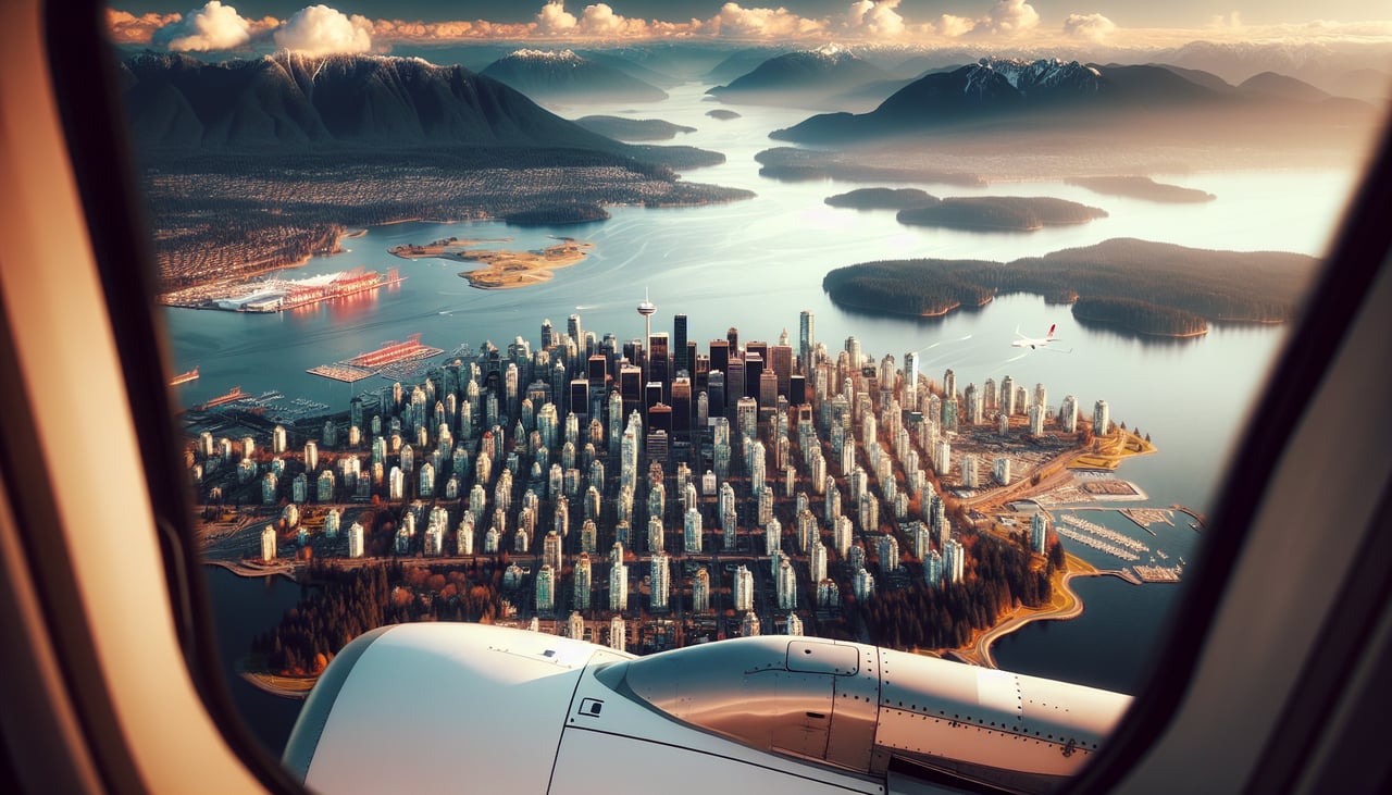
Landing at YVR
RIGHTOn the typical westbound approach into YVR's 26 runways, the aircraft descends over the Fraser Valley with downtown Vancouver, Burrard Inlet, and the North Shore Mountains (Grouse, Seymour, Cypress) visible close on the right. The left side faces south toward Boundary Bay and the U.S. border, with Mount Baker visible but much farther away and less dominant.
Landmarks on this routeAll landmarks →
Will your flight be in sunlight?
Pick a date and time in the Sun Map to watch the sun move across your whole flight.
About This Route
Which side of the plane should I sit on flying from Cranbrook (YXC) to Vancouver International (YVR)?
Sit on the Right side of the plane for the best views on flights from Cranbrook to Vancouver. The right side strings together the Purcell Mountains and Kootenay Lake on departure with the North Shore Mountains and Vancouver's skyline on arrival, giving a more continuous and dramatic sequence of named landmarks than the left side's more distant, less varied southern views.
What can I see during takeoff from Cranbrook in Cranbrook?
During takeoff from Cranbrook (YXC), sit on the Right side for the best views. Climbing out of Cranbrook and turning west, the right side looks north across the Rocky Mountain Trench toward the Purcell Mountains and the north end of Kootenay Lake, giving a longer, clearer view of the peaks as the aircraft banks onto its westbound heading. The left side sees similar trench scenery but the mountains are more distant and quickly slide behind. Notable sights include: Rocky Mountain Trench, Purcell Mountains, Kootenay Lake (north arm), St. Mary River valley.
What can I see when landing at Vancouver International in Vancouver?
When landing at Vancouver International (YVR), sit on the Right side for the best views. On the typical westbound approach into YVR's 26 runways, the aircraft descends over the Fraser Valley with downtown Vancouver, Burrard Inlet, and the North Shore Mountains (Grouse, Seymour, Cypress) visible close on the right. The left side faces south toward Boundary Bay and the U.S. border, with Mount Baker visible but much farther away and less dominant. Notable sights include: North Shore Mountains (Grouse, Seymour, Cypress), downtown Vancouver skyline, Burrard Inlet, Lions Gate area.
How long is the flight from Cranbrook to Vancouver?
The flight from Cranbrook (YXC) to Vancouver International (YVR) takes about 1 hour 15 minutes. The shortest flight path between them is 334 miles (537 km); winds and air traffic control usually add a few percent.
What does the Cranbrook to Vancouver flight path pass over?
The route crosses the Selkirk and Monashee Mountains, passes near the Arrow Lakes and the Okanagan Valley (Kelowna area), then continues over the Coast Mountains foothills before descending into the Fraser Valley.