The Manhattan approach on the left at EWR is one of the most spectacular urban arrivals in North America and outweighs the takeoff advantage on the right. Sit left for the full New York Harbor panorama on descent.
Flight Path
The flight tracks south-southeast over the Laurentian Plateau, crosses the Ottawa River valley, passes over the Adirondack Mountains of upstate New York (visible as a broad forested highland), then the Mohawk Valley corridor, before descending over the Hudson Valley and into the New York metro area. The Adirondacks are the most visually distinctive midpoint feature — a broad, dark, lake-dotted highland with no major urban development.
Great circle distance and headings ›.jpeg?width=600)
.jpg?width=600)
Phase by phase
Takeoff from YXR
RIGHTTimiskaming Regional typically departs runway 28 heading west-southwest, putting Lake Timiskaming and the Ottawa River valley on the right (north) side. The lake is a long, narrow glacial trough that's visually striking from low altitude.
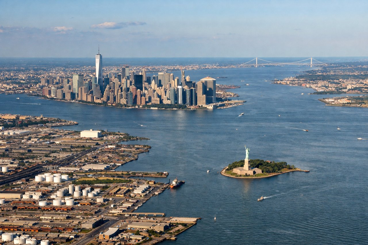
Landing at EWR
LEFTEWR approaches from the northeast on runway 22L/22R heading southwest, placing Manhattan, Upper New York Bay, and the Hudson River on the left side. This is one of the most iconic urban approaches in aviation.
Landmarks on this routeAll landmarks →
Will your flight be in sunlight?
See exactly which side of the plane gets sun and shade at your departure time.
About This Route
Which side of the plane should I sit on flying from Timiskaming Rgnl (YXR) to Newark Liberty International (EWR)?
Sit on the Left side of the plane for the best views on flights from Earlton to Newark. The Manhattan approach on the left at EWR is one of the most spectacular urban arrivals in North America and outweighs the takeoff advantage on the right. Sit left for the full New York Harbor panorama on descent.
What can I see during takeoff from Timiskaming Rgnl in Earlton?
During takeoff from Timiskaming Rgnl (YXR), sit on the Right side for the best views. Timiskaming Regional typically departs runway 28 heading west-southwest, putting Lake Timiskaming and the Ottawa River valley on the right (north) side. The lake is a long, narrow glacial trough that's visually striking from low altitude. Notable sights include: Lake Timiskaming, Cobalt mining district, Temiskaming Shores waterfront, boreal forest patchwork.
What can I see when landing at Newark Liberty International in Newark?
When landing at Newark Liberty International (EWR), sit on the Left side for the best views. EWR approaches from the northeast on runway 22L/22R heading southwest, placing Manhattan, Upper New York Bay, and the Hudson River on the left side. This is one of the most iconic urban approaches in aviation. Notable sights include: Manhattan skyline, Upper New York Bay, Hudson River, Verrazano-Narrows Bridge.
How long is the flight from Earlton to Newark?
The flight from Timiskaming Rgnl (YXR) to Newark Liberty International (EWR) takes Approximately 1 hour 45 minutes to 2 hours.
What does the Earlton to Newark flight path pass over?
The flight tracks south-southeast over the Laurentian Plateau, crosses the Ottawa River valley, passes over the Adirondack Mountains of upstate New York (visible as a broad forested highland), then the Mohawk Valley corridor, before descending over the Hudson Valley and into the New York metro area. The Adirondacks are the most visually distinctive midpoint feature — a broad, dark, lake-dotted highland with no major urban development.