The London approach on the left side is the highlight of this route — tracking over central London at low altitude with the Thames and city skyline is genuinely spectacular. The takeoff right-side view of Lake Timiskaming is interesting but brief. Over the Atlantic and Quebec/Labrador, neither side offers a consistent advantage, so the London arrival tips the balance to left.
Flown YXR to LHR? Did we get it right?
Flight Path
Earlton to London is 3,387 miles (5,451 km), a flight of about 7 hours 45 minutes.
Labrador coast and the Strait of Belle Isle, southern tip of Greenland ice sheet visible as a white mass on the horizon at cruise altitude, the North Atlantic with possible iceberg fields south of Greenland, the west coast of Ireland (County Clare and the Aran Islands), then Wales and the English Midlands on descent
Great circle distance and headings ›Phase by phase
Takeoff from YXR
RIGHTTimiskaming Regional Airport (YXR) typically departs runway 09/27 or 02/20. On an eastbound or northeastbound departure toward the transatlantic route, the right side gives views over Lake Timiskaming, the long narrow lake straddling the Ontario-Quebec border. The lake's distinctive elongated shape is clearly visible from low altitude.
Landing at LHR
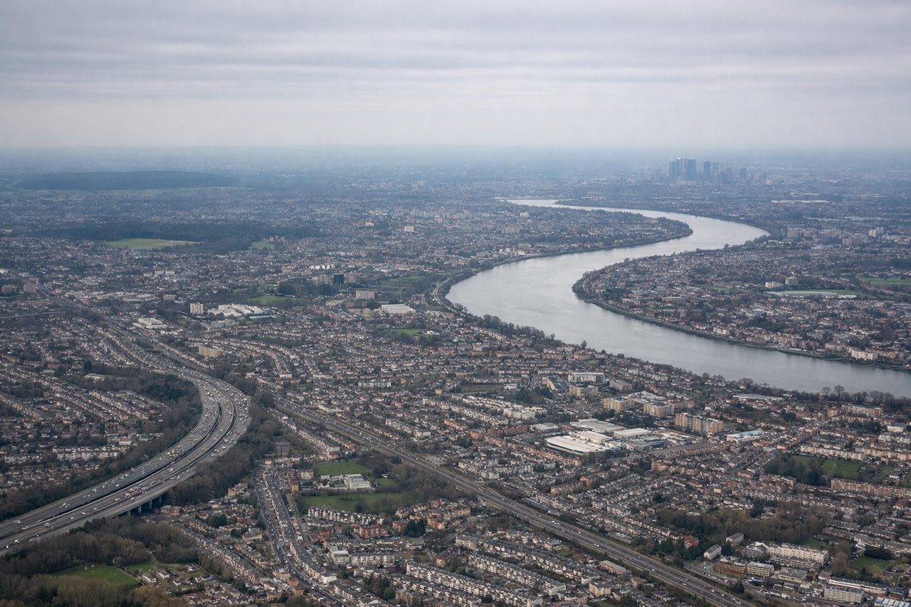
LEFTHeathrow typically uses westerly runway approaches (27L/27R) due to prevailing winds, meaning aircraft approach from the east over London. On left side seats during this approach, you get a clear view of central London including the Thames, the City skyline, and landmarks like the O2 Arena and Canary Wharf as the aircraft tracks west over the city.
Will your flight be in sunlight?
Pick a date and time in the Sun Map to watch the sun move across your whole flight.
About This Route
Which side of the plane should I sit on flying from Timiskaming Rgnl (YXR) to Heathrow (LHR)?
Sit on the Left side of the plane for the best views on flights from Earlton to London. The London approach on the left side is the highlight of this route — tracking over central London at low altitude with the Thames and city skyline is genuinely spectacular. The takeoff right-side view of Lake Timiskaming is interesting but brief. Over the Atlantic and Quebec/Labrador, neither side offers a consistent advantage, so the London arrival tips the balance to left.
What can I see during takeoff from Timiskaming Rgnl in Earlton?
During takeoff from Timiskaming Rgnl (YXR), sit on the Right side for the best views. Timiskaming Regional Airport (YXR) typically departs runway 09/27 or 02/20. On an eastbound or northeastbound departure toward the transatlantic route, the right side gives views over Lake Timiskaming, the long narrow lake straddling the Ontario-Quebec border. The lake's distinctive elongated shape is clearly visible from low altitude. Notable sights include: Lake Timiskaming (long narrow lake to the east), the Ottawa River valley in the distance, boreal forest patchwork of the Canadian Shield, agricultural clearings around Earlton and New Liskeard.
What can I see when landing at Heathrow in London?
When landing at Heathrow (LHR), sit on the Left side for the best views. Heathrow typically uses westerly runway approaches (27L/27R) due to prevailing winds, meaning aircraft approach from the east over London. On left side seats during this approach, you get a clear view of central London including the Thames, the City skyline, and landmarks like the O2 Arena and Canary Wharf as the aircraft tracks west over the city. Notable sights include: River Thames winding through central London, Canary Wharf and the City of London skyline, Windsor Castle and Windsor Great Park on final approach, the M25 motorway ring.
How long is the flight from Earlton to London?
The flight from Timiskaming Rgnl (YXR) to Heathrow (LHR) takes about 7 hours 45 minutes. The shortest flight path between them is 3,387 miles (5,451 km); winds and air traffic control usually add a few percent.
What does the Earlton to London flight path pass over?
Labrador coast and the Strait of Belle Isle, southern tip of Greenland ice sheet visible as a white mass on the horizon at cruise altitude, the North Atlantic with possible iceberg fields south of Greenland, the west coast of Ireland (County Clare and the Aran Islands), then Wales and the English Midlands on descent