Left side wins both ends of the flight. At departure you get Lake Timiskaming and the boreal Clay Belt; during the cruise south you track roughly along the Ontario interior with Georgian Bay occasionally visible to the right, but the left side picks up the Muskoka lake district below; and on approach into Pearson the left side delivers the full Toronto skyline and Lake Ontario panorama.
Flight Path
The flight tracks roughly south-southwest over the boreal transition zone north of Sudbury, then over the Canadian Shield with its exposed granite, countless small lakes, and mixed forest. The Muskoka lake district — including Lake Muskoka and Lake Rosseau — appears below around the midpoint. Further south the Shield gives way to the flat agricultural land of Simcoe County before the Greater Toronto Area suburban sprawl begins.
Great circle distance and headings ›Phase by phase
Takeoff from YXR
LEFTEarlton Airport typically departs runway 28 (westbound), so the left (south) side gives you a view over Lake Timiskaming, the long narrow lake forming the Ontario-Quebec border. You'll see the lake stretching southeast and the boreal forest patchwork of the Clay Belt below.
Landing at YYZ
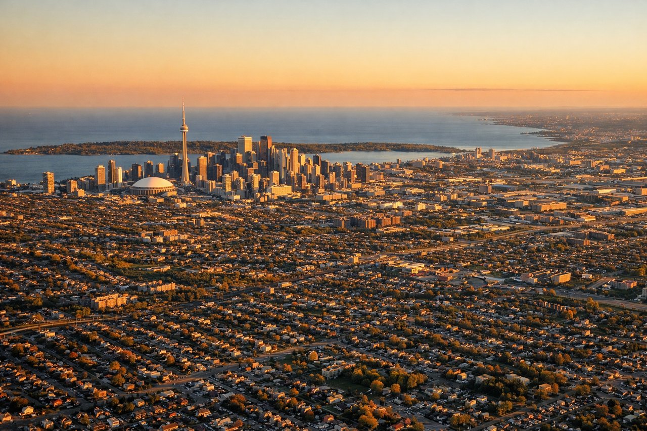
LEFTYYZ typically lands on runways 23 or 24L/24R from the northeast, meaning the aircraft approaches from the north-northeast. The left (east) side gives a clear view over downtown Toronto, the CN Tower, and Lake Ontario as you descend over the city. The right side faces northwest toward suburban sprawl with fewer distinctive features.
Landmarks on this routeAll landmarks →
Will your flight be in sunlight?
See exactly which side of the plane gets sun and shade at your departure time.
About This Route
Which side of the plane should I sit on flying from Timiskaming Rgnl (YXR) to Lester B Pearson International (YYZ)?
Sit on the Left side of the plane for the best views on flights from Earlton to Toronto. Left side wins both ends of the flight. At departure you get Lake Timiskaming and the boreal Clay Belt; during the cruise south you track roughly along the Ontario interior with Georgian Bay occasionally visible to the right, but the left side picks up the Muskoka lake district below; and on approach into Pearson the left side delivers the full Toronto skyline and Lake Ontario panorama.
What can I see during takeoff from Timiskaming Rgnl in Earlton?
During takeoff from Timiskaming Rgnl (YXR), sit on the Left side for the best views. Earlton Airport typically departs runway 28 (westbound), so the left (south) side gives you a view over Lake Timiskaming, the long narrow lake forming the Ontario-Quebec border. You'll see the lake stretching southeast and the boreal forest patchwork of the Clay Belt below. Notable sights include: Lake Timiskaming to the southeast, the Ontario-Quebec border forest corridor, the town of Earlton and surrounding farmland clearings in the Clay Belt.
What can I see when landing at Lester B Pearson International in Toronto?
When landing at Lester B Pearson International (YYZ), sit on the Left side for the best views. YYZ typically lands on runways 23 or 24L/24R from the northeast, meaning the aircraft approaches from the north-northeast. The left (east) side gives a clear view over downtown Toronto, the CN Tower, and Lake Ontario as you descend over the city. The right side faces northwest toward suburban sprawl with fewer distinctive features. Notable sights include: CN Tower and downtown Toronto skyline, Lake Ontario shoreline, Toronto Islands, Highway 401 corridor through the northern suburbs.
How long is the flight from Earlton to Toronto?
The flight from Timiskaming Rgnl (YXR) to Lester B Pearson International (YYZ) takes Approximately 1 hour to 1 hour 15 minutes on a regional turboprop.
What does the Earlton to Toronto flight path pass over?
The flight tracks roughly south-southwest over the boreal transition zone north of Sudbury, then over the Canadian Shield with its exposed granite, countless small lakes, and mixed forest. The Muskoka lake district — including Lake Muskoka and Lake Rosseau — appears below around the midpoint. Further south the Shield gives way to the flat agricultural land of Simcoe County before the Greater Toronto Area suburban sprawl begins.