Abbotsford to Houston is 1,932 miles (3,109 km), a flight of about 5 hours.
While the takeoff offers mountain scenery, the landing approach provides more sustained and dramatic views of major geographical features—the Gulf Coast, Galveston Bay, and Houston's industrial landscape. Left-side seats capture the most visually distinctive portion of the flight.
Flight Path
The flight path crosses the Cascade Range foothills, then descends into the interior Pacific Northwest. Over Washington state, you'll pass east of Mount Rainier (visible from altitude if clear). The route then crosses the Columbia River plateau and enters the Great Plains. Over Oregon and northern California, the terrain transitions from volcanic plateau to rolling grassland. Crossing into the central United States, the landscape becomes increasingly flat. The flight passes over the Great Plains of Texas, with occasional rivers (Brazos, Colorado) visible as thin lines through agricultural and ranch land. As you approach Houston, the terrain flattens further and becomes increasingly developed, with the coastal plain and bay system becoming visible 30-40 minutes before landing.
Great circle distance and headings ›Phase by phase
Takeoff from YXX
RIGHTRight-side seats offer immediate views of the North Cascades and the Fraser River valley as the aircraft climbs eastward. The mountains rise dramatically to the east and southeast of Abbotsford, making them visible within the first 10-15 minutes of flight.
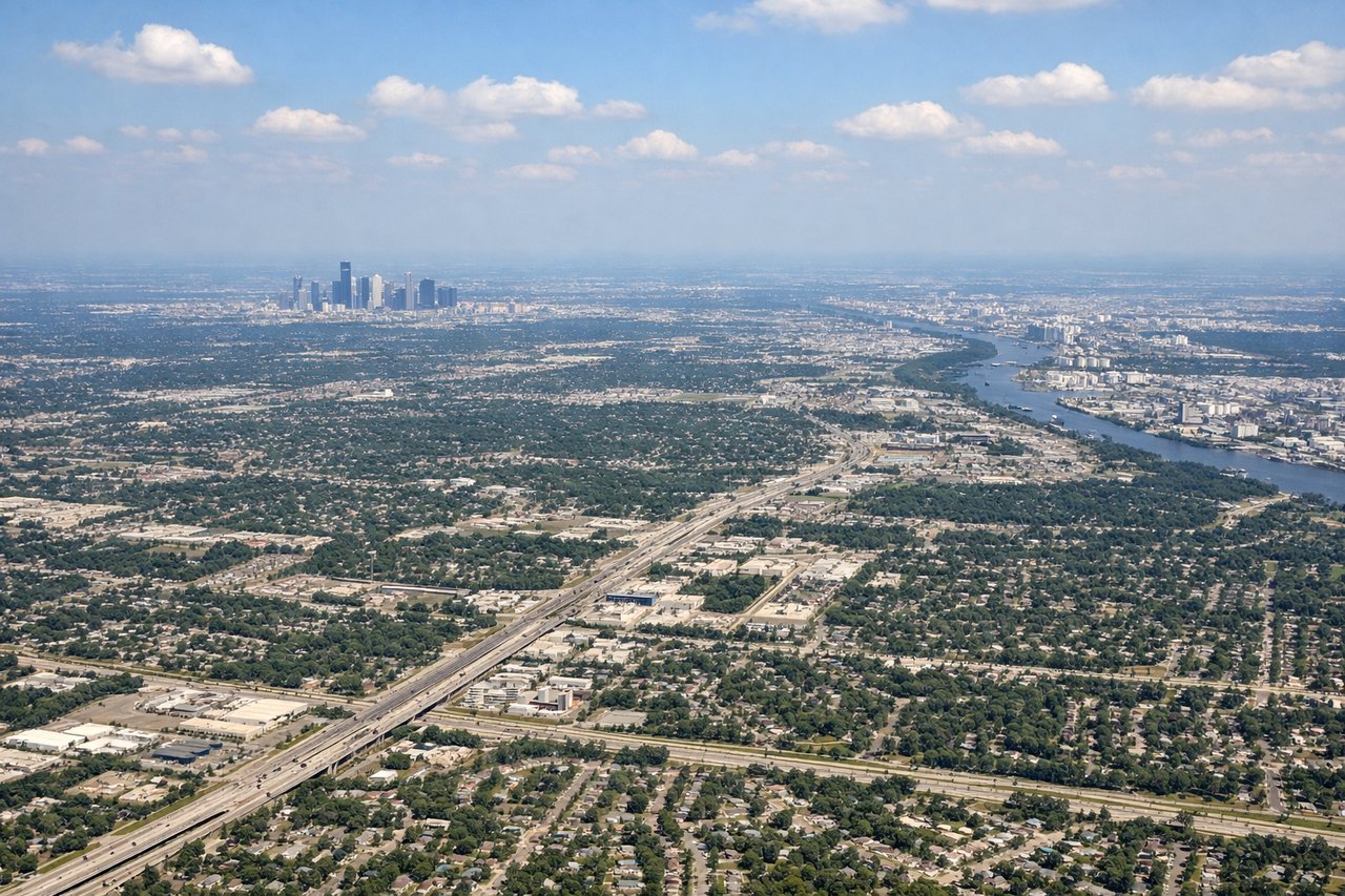
Landing at IAH
LEFTLeft-side seats provide excellent views during the descent into Houston, particularly of the Texas coastal plain, Galveston Bay, and the sprawling Houston metropolitan area. The approach typically brings the aircraft over the bay and coastal wetlands before turning inland toward IAH.
Landmarks on this routeAll landmarks →
Will your flight be in sunlight?
Pick a date and time in the Sun Map to watch the sun move across your whole flight.
About This Route
Which side of the plane should I sit on flying from Abbotsford (YXX) to George Bush Intcntl Houston (IAH)?
Sit on the Left side of the plane for the best views on flights from Abbotsford to Houston. While the takeoff offers mountain scenery, the landing approach provides more sustained and dramatic views of major geographical features—the Gulf Coast, Galveston Bay, and Houston's industrial landscape. Left-side seats capture the most visually distinctive portion of the flight.
What can I see during takeoff from Abbotsford in Abbotsford?
During takeoff from Abbotsford (YXX), sit on the Right side for the best views. Right-side seats offer immediate views of the North Cascades and the Fraser River valley as the aircraft climbs eastward. The mountains rise dramatically to the east and southeast of Abbotsford, making them visible within the first 10-15 minutes of flight. Notable sights include: North Cascades (snow-capped peaks to the southeast), Fraser River valley (winding through the foreground), Sumas Mountain (distinctive peak south of the airport), Chilliwack area (visible in the middle distance to the east).
What can I see when landing at George Bush Intcntl Houston in Houston?
When landing at George Bush Intcntl Houston (IAH), sit on the Left side for the best views. Left-side seats provide excellent views during the descent into Houston, particularly of the Texas coastal plain, Galveston Bay, and the sprawling Houston metropolitan area. The approach typically brings the aircraft over the bay and coastal wetlands before turning inland toward IAH. Notable sights include: Galveston Bay (large body of water with barrier islands), Houston Ship Channel and refineries (industrial corridor visible as geometric patterns), Trinity River (meandering through the city), Galveston Island (barrier island with developed areas).
How long is the flight from Abbotsford to Houston?
The flight from Abbotsford (YXX) to George Bush Intcntl Houston (IAH) takes about 5 hours. The shortest flight path between them is 1,932 miles (3,109 km); winds and air traffic control usually add a few percent.
What does the Abbotsford to Houston flight path pass over?
The flight path crosses the Cascade Range foothills, then descends into the interior Pacific Northwest. Over Washington state, you'll pass east of Mount Rainier (visible from altitude if clear). The route then crosses the Columbia River plateau and enters the Great Plains. Over Oregon and northern California, the terrain transitions from volcanic plateau to rolling grassland. Crossing into the central United States, the landscape becomes increasingly flat. The flight passes over the Great Plains of Texas, with occasional rivers (Brazos, Colorado) visible as thin lines through agricultural and ranch land. As you approach Houston, the terrain flattens further and becomes increasingly developed, with the coastal plain and bay system becoming visible 30-40 minutes before landing.