While takeoff favors the right for Yukon River and St. Elias views, the landing approach to Calgary from the north strongly favors the left for the dramatic Canadian Rockies and the entire descent profile. The landing experience outweighs the takeoff advantage.
Flown YXY to YYC? Did we get it right?
Flight Path
Whitehorse to Calgary is 1,043 miles (1,678 km), a flight of about 3 hours 15 minutes.
The flight path crosses from the Yukon's boreal forest and mountains southeastward across British Columbia's interior plateau, passing east of the Cassiar Mountains and west of the Rocky Mountain Trench. The midpoint (roughly over northern British Columbia near Fort St. John area) offers views of vast forested terrain with scattered lakes and rivers. As the flight progresses into Alberta, the landscape transitions from dense forest to foothills, with the Rocky Mountain front becoming increasingly prominent on the western horizon during the final 90 minutes of flight.
Great circle distance and headings ›


Phase by phase
Takeoff from YXY
RIGHTWhitehorse typically departs to the south or southeast. Right-side seats offer views of the Yukon River valley and the St. Elias Mountains to the southeast, which dominate the landscape immediately after departure.
Landing at YYC
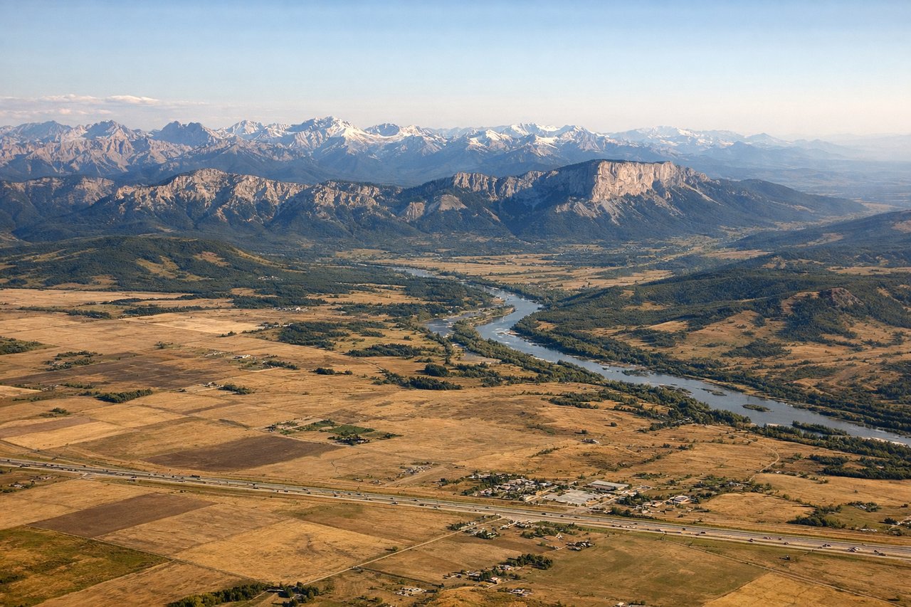
LEFTCalgary typically lands from the north on runways 16L/16R. Left-side seats provide excellent views of the Canadian Rockies to the west and southwest during descent, plus the Bow River valley and Calgary's downtown skyline as you approach from the north.
Will your flight be in sunlight?
Pick a date and time in the Sun Map to watch the sun move across your whole flight.
About This Route
Which side of the plane should I sit on flying from Whitehorse International (YXY) to Calgary International (YYC)?
Sit on the Left side of the plane for the best views on flights from Whitehorse to Calgary. While takeoff favors the right for Yukon River and St. Elias views, the landing approach to Calgary from the north strongly favors the left for the dramatic Canadian Rockies and the entire descent profile. The landing experience outweighs the takeoff advantage.
What can I see during takeoff from Whitehorse International in Whitehorse?
During takeoff from Whitehorse International (YXY), sit on the Right side for the best views. Whitehorse typically departs to the south or southeast. Right-side seats offer views of the Yukon River valley and the St. Elias Mountains to the southeast, which dominate the landscape immediately after departure. Notable sights include: Yukon River (flowing northwest through Whitehorse), St. Elias Mountains (southeastern horizon), Whitehorse city and Watson Lake highway corridor (south), boreal forest and muskeg terrain (surrounding lowlands).
What can I see when landing at Calgary International in Calgary?
When landing at Calgary International (YYC), sit on the Left side for the best views. Calgary typically lands from the north on runways 16L/16R. Left-side seats provide excellent views of the Canadian Rockies to the west and southwest during descent, plus the Bow River valley and Calgary's downtown skyline as you approach from the north. Notable sights include: Canadian Rocky Mountains (western horizon, snow-capped peaks), Bow River (flowing southeast through Calgary), Calgary downtown and Bow Tower (visible in middle distance), foothills transition zone (between mountains and prairie).
How long is the flight from Whitehorse to Calgary?
The flight from Whitehorse International (YXY) to Calgary International (YYC) takes about 3 hours 15 minutes. The shortest flight path between them is 1,043 miles (1,678 km); winds and air traffic control usually add a few percent.
What does the Whitehorse to Calgary flight path pass over?
The flight path crosses from the Yukon's boreal forest and mountains southeastward across British Columbia's interior plateau, passing east of the Cassiar Mountains and west of the Rocky Mountain Trench. The midpoint (roughly over northern British Columbia near Fort St. John area) offers views of vast forested terrain with scattered lakes and rivers. As the flight progresses into Alberta, the landscape transitions from dense forest to foothills, with the Rocky Mountain front becoming increasingly prominent on the western horizon during the final 90 minutes of flight.