The left side wins primarily on the strength of the Rockies view during departure, which is the single most dramatic landmark on an otherwise flat, prairie-dominated route; the right side's brief Lake Ontario glimpse on arrival is comparatively minor.
Flight Path
Flat prairie farmland of Saskatchewan and Manitoba, the Canadian Shield's exposed rock and lakes near the Ontario border, and scattered boreal forest before descending into southern Ontario's agricultural belt
Great circle distance and headings ›Phase by phase
Takeoff from YYC
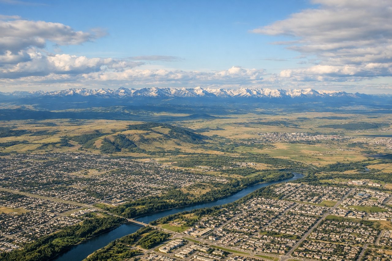
LEFTNoise abatement departures from YYC head north before turning east, giving a brief but genuine view of the Canadian Rockies' front ranges receding to the west on the left side during initial climb. Once established eastbound, the mountains fade behind, but it's the only true topographic drama on this route.
Landing at YKF
RIGHTArrivals into YKF favoring runway 26 typically approach from the east, and on a clear day passengers on the right (south) side may catch a fleeting glimpse of Lake Ontario's northern shore or the Toronto skyline in the distance before the descent turns toward flat farmland near Waterloo. The left side over this stretch shows only continuous agricultural fields.
Landmarks on this routeAll landmarks →
Will your flight be in sunlight?
See exactly which side of the plane gets sun and shade at your departure time.
About This Route
Which side of the plane should I sit on flying from Calgary International (YYC) to Waterloo Rgnl (YKF)?
Sit on the Left side of the plane for the best views on flights from Calgary to Waterloo. The left side wins primarily on the strength of the Rockies view during departure, which is the single most dramatic landmark on an otherwise flat, prairie-dominated route; the right side's brief Lake Ontario glimpse on arrival is comparatively minor.
What can I see during takeoff from Calgary International in Calgary?
During takeoff from Calgary International (YYC), sit on the Left side for the best views. Noise abatement departures from YYC head north before turning east, giving a brief but genuine view of the Canadian Rockies' front ranges receding to the west on the left side during initial climb. Once established eastbound, the mountains fade behind, but it's the only true topographic drama on this route. Notable sights include: Canadian Rockies foothills, Bow River valley, City of Calgary skyline.
What can I see when landing at Waterloo Rgnl in Waterloo?
When landing at Waterloo Rgnl (YKF), sit on the Right side for the best views. Arrivals into YKF favoring runway 26 typically approach from the east, and on a clear day passengers on the right (south) side may catch a fleeting glimpse of Lake Ontario's northern shore or the Toronto skyline in the distance before the descent turns toward flat farmland near Waterloo. The left side over this stretch shows only continuous agricultural fields. Notable sights include: Lake Ontario shoreline, distant Toronto skyline, patchwork Ontario farmland.
How long is the flight from Calgary to Waterloo?
The flight from Calgary International (YYC) to Waterloo Rgnl (YKF) takes 3h 05m.
What does the Calgary to Waterloo flight path pass over?
Flat prairie farmland of Saskatchewan and Manitoba, the Canadian Shield's exposed rock and lakes near the Ontario border, and scattered boreal forest before descending into southern Ontario's agricultural belt