The right side tracks the western, mountainous half of the route the whole way: Rockies at departure, the Great Basin ranges and Sierra Nevada foothills during cruise, and the San Gabriel Mountains plus the LA skyline on arrival. The left side stays over comparatively flat plains and desert basins with little landmark variety.
Flight Path
Rocky Mountain front ranges over Montana, the Great Salt Lake and Wasatch Range in Utah, the Basin and Range desert terrain of Nevada, and the distant Sierra Nevada before descending toward the Mojave Desert and Southern California mountains
Great circle distance and headings ›
.jpg?width=600)

.jpg?width=600)
Phase by phase
Takeoff from YYC
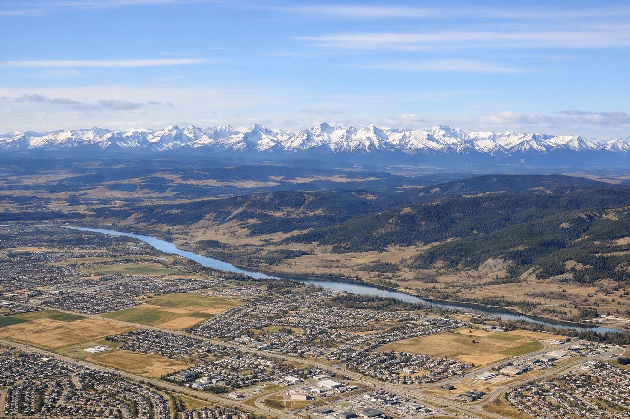
RIGHTDeparting YYC, aircraft climb north before turning south toward LAX, and that turn puts the Canadian Rockies' front ranges squarely on the right. Passengers get a clear view of the snow-dusted foothills near Kananaskis and the Bow River valley before the plane levels off. The left side only shows flat prairie fading into haze.

Landing at LAX
RIGHTOn the descent into LAX, arrivals typically cross the San Gabriel Mountains and swing over the San Fernando Valley before turning toward the coast, putting the mountain wall and the downtown LA skyline on the right side of the aircraft. The left side mostly shows flatter South Bay suburbs until the ocean appears just before touchdown.
Landmarks on this routeAll landmarks →
Will your flight be in sunlight?
See exactly which side of the plane gets sun and shade at your departure time.
About This Route
Which side of the plane should I sit on flying from Calgary International (YYC) to Los Angeles International (LAX)?
Sit on the Right side of the plane for the best views on flights from Calgary to Los Angeles. The right side tracks the western, mountainous half of the route the whole way: Rockies at departure, the Great Basin ranges and Sierra Nevada foothills during cruise, and the San Gabriel Mountains plus the LA skyline on arrival. The left side stays over comparatively flat plains and desert basins with little landmark variety.
What can I see during takeoff from Calgary International in Calgary?
During takeoff from Calgary International (YYC), sit on the Right side for the best views. Departing YYC, aircraft climb north before turning south toward LAX, and that turn puts the Canadian Rockies' front ranges squarely on the right. Passengers get a clear view of the snow-dusted foothills near Kananaskis and the Bow River valley before the plane levels off. The left side only shows flat prairie fading into haze. Notable sights include: Canadian Rockies front range, Bow River valley, Kananaskis foothills, Calgary's western suburbs.
What can I see when landing at Los Angeles International in Los Angeles?
When landing at Los Angeles International (LAX), sit on the Right side for the best views. On the descent into LAX, arrivals typically cross the San Gabriel Mountains and swing over the San Fernando Valley before turning toward the coast, putting the mountain wall and the downtown LA skyline on the right side of the aircraft. The left side mostly shows flatter South Bay suburbs until the ocean appears just before touchdown. Notable sights include: San Gabriel Mountains, San Fernando Valley, Hollywood Hills/Griffith Park, downtown Los Angeles skyline.
How long is the flight from Calgary to Los Angeles?
The flight from Calgary International (YYC) to Los Angeles International (LAX) takes 3h 05m.
What does the Calgary to Los Angeles flight path pass over?
Rocky Mountain front ranges over Montana, the Great Salt Lake and Wasatch Range in Utah, the Basin and Range desert terrain of Nevada, and the distant Sierra Nevada before descending toward the Mojave Desert and Southern California mountains