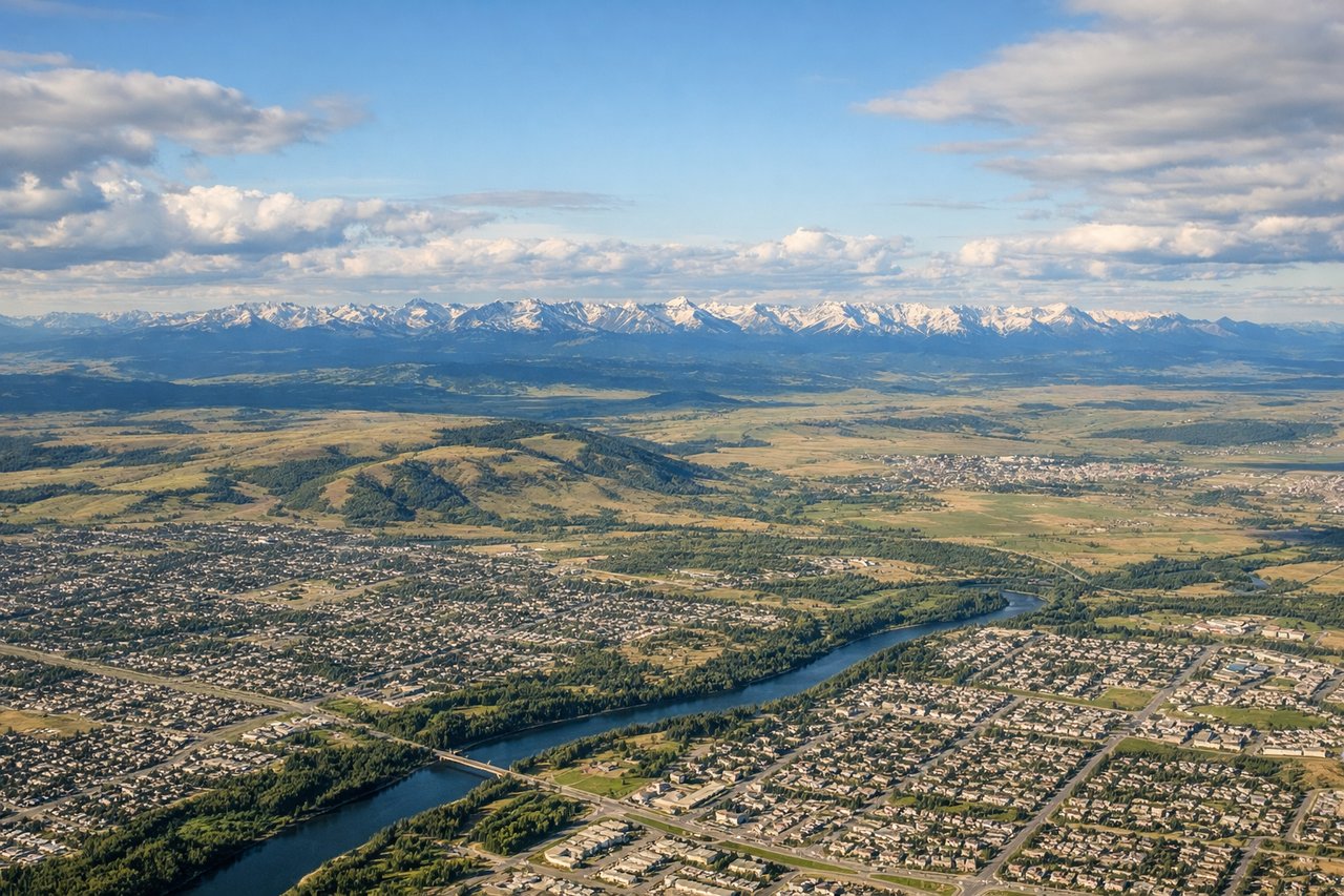
Takeoff views of the Rocky Mountains Front Ranges are more dramatic and sustained than landing views. The westbound departure climb provides 15-20 minutes of unobstructed mountain scenery. Landing views are pleasant but briefer and more obscured by approach procedures.
Flight Path
The flight path crosses the Rocky Mountains via the Bow Pass corridor or similar gap in the Front Ranges, then descends across the Interior Plateau of British Columbia. Notable features include the Cascade Range visible to the south as the aircraft approaches the Fraser Valley, and the transition from mountain terrain to agricultural lowland in the final 30 minutes of flight.
Great circle distance and headings ›
.jpg?width=600)

Phase by phase
Takeoff from YYC
LEFTYYC typically departs westbound (Runways 16L/R or 34L/R depending on wind). Left seats face the Rocky Mountains directly ahead during climb-out, offering immediate views of the Front Ranges. Right seats see the flat prairie and Calgary sprawl receding behind.
Landing at YXX
RIGHTYXX typically lands eastbound (Runway 02 or 20 depending on wind). Right seats during approach capture the Fraser Valley's agricultural landscape, the North Shore mountains across the valley, and the final descent over productive farmland. Left seats see mostly the valley floor and approach path.
Landmarks on this routeAll landmarks →
Will your flight be in sunlight?
See exactly which side of the plane gets sun and shade at your departure time.
About This Route
Which side of the plane should I sit on flying from Calgary International (YYC) to Abbotsford (YXX)?
Sit on the Left side of the plane for the best views on flights from Calgary to Abbotsford. Takeoff views of the Rocky Mountains Front Ranges are more dramatic and sustained than landing views. The westbound departure climb provides 15-20 minutes of unobstructed mountain scenery. Landing views are pleasant but briefer and more obscured by approach procedures.
What can I see during takeoff from Calgary International in Calgary?
During takeoff from Calgary International (YYC), sit on the Left side for the best views. YYC typically departs westbound (Runways 16L/R or 34L/R depending on wind). Left seats face the Rocky Mountains directly ahead during climb-out, offering immediate views of the Front Ranges. Right seats see the flat prairie and Calgary sprawl receding behind. Notable sights include: Rocky Mountains Front Ranges, Bow River valley, Calgary downtown skyline, Foothills west of the city.
What can I see when landing at Abbotsford in Abbotsford?
When landing at Abbotsford (YXX), sit on the Right side for the best views. YXX typically lands eastbound (Runway 02 or 20 depending on wind). Right seats during approach capture the Fraser Valley's agricultural landscape, the North Shore mountains across the valley, and the final descent over productive farmland. Left seats see mostly the valley floor and approach path. Notable sights include: Fraser Valley farmland and orchards, North Shore Mountains (distant), Sumas Mountain, Abbotsford city grid.
How long is the flight from Calgary to Abbotsford?
The flight from Calgary International (YYC) to Abbotsford (YXX) takes Approximately 1 hour 15 minutes.
What does the Calgary to Abbotsford flight path pass over?
The flight path crosses the Rocky Mountains via the Bow Pass corridor or similar gap in the Front Ranges, then descends across the Interior Plateau of British Columbia. Notable features include the Cascade Range visible to the south as the aircraft approaches the Fraser Valley, and the transition from mountain terrain to agricultural lowland in the final 30 minutes of flight.