Coral Harbour to Seattle is 1,856 miles (2,986 km), a flight of about 4 hours 45 minutes.
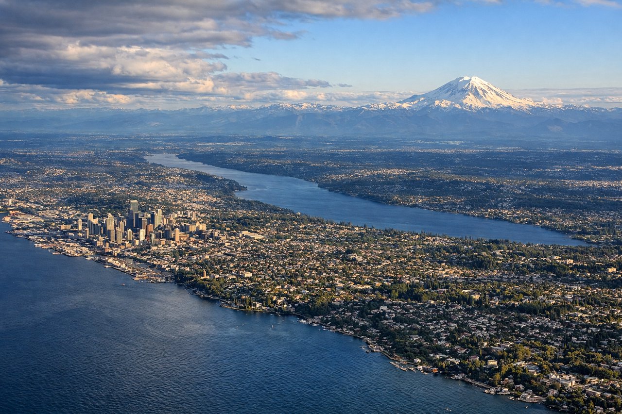
The landing view from the left side is superior—Puget Sound, the Olympic and Cascade ranges, and Seattle's geography are all genuinely impressive from altitude. The takeoff from Coral Harbour is relatively featureless tundra; the landing approach offers far more visual interest and recognizable landmarks.
Flight Path
This route crosses the Canadian Arctic and subarctic regions. Notable features along the flight path include the Northwest Territories' barren plateau, the Mackenzie River valley (if visible during descent into lower altitudes in the southern portion), and the transition from tundra to boreal forest as the aircraft moves south. The route passes east of the Rocky Mountains. At cruise altitude, the landscape below is predominantly flat to gently rolling terrain with scattered lakes and rivers. No major mountain ranges are crossed until the final approach to Seattle, where the Cascades and Olympics become prominent.
Great circle distance and headings ›

.jpg?width=600)

Phase by phase
Takeoff from YZS
RIGHTCoral Harbour typically departs to the south or southeast. Right-side seats offer views of Hudson Bay's western coastline and the tundra landscape stretching inland. The bay's ice patterns (seasonal) and the transition from water to barren terrain are the main visual features.
Landing at SEA
LEFTSeattle-Tacoma typically lands from the north on runways 16L/16R or from the south on 34L/34R depending on wind. Left-side seats on approach from the north offer views of Puget Sound, the Olympic Mountains, and the Cascade Range. On southbound approaches, left seats show Lake Washington and the Seattle skyline.
Landmarks on this routeAll landmarks →
Will your flight be in sunlight?
Pick a date and time in the Sun Map to watch the sun move across your whole flight.
About This Route
Which side of the plane should I sit on flying from Coral Harbour Airport (YZS) to Seattle Tacoma International (SEA)?
Sit on the Left side of the plane for the best views on flights from Coral Harbour to Seattle. The landing view from the left side is superior—Puget Sound, the Olympic and Cascade ranges, and Seattle's geography are all genuinely impressive from altitude. The takeoff from Coral Harbour is relatively featureless tundra; the landing approach offers far more visual interest and recognizable landmarks.
What can I see during takeoff from Coral Harbour Airport in Coral Harbour?
During takeoff from Coral Harbour Airport (YZS), sit on the Right side for the best views. Coral Harbour typically departs to the south or southeast. Right-side seats offer views of Hudson Bay's western coastline and the tundra landscape stretching inland. The bay's ice patterns (seasonal) and the transition from water to barren terrain are the main visual features. Notable sights include: Hudson Bay (immediate west), Coral Harbour settlement (directly below during initial climb), barren tundra plateau extending south, scattered lakes and ponds across the landscape.
What can I see when landing at Seattle Tacoma International in Seattle?
When landing at Seattle Tacoma International (SEA), sit on the Left side for the best views. Seattle-Tacoma typically lands from the north on runways 16L/16R or from the south on 34L/34R depending on wind. Left-side seats on approach from the north offer views of Puget Sound, the Olympic Mountains, and the Cascade Range. On southbound approaches, left seats show Lake Washington and the Seattle skyline. Notable sights include: Puget Sound (major water body), Olympic Mountains (western horizon), Cascade Range (eastern horizon), Lake Washington or Seattle downtown skyline (depending on approach direction).
How long is the flight from Coral Harbour to Seattle?
The flight from Coral Harbour Airport (YZS) to Seattle Tacoma International (SEA) takes about 4 hours 45 minutes. The shortest flight path between them is 1,856 miles (2,986 km); winds and air traffic control usually add a few percent.
What does the Coral Harbour to Seattle flight path pass over?
This route crosses the Canadian Arctic and subarctic regions. Notable features along the flight path include the Northwest Territories' barren plateau, the Mackenzie River valley (if visible during descent into lower altitudes in the southern portion), and the transition from tundra to boreal forest as the aircraft moves south. The route passes east of the Rocky Mountains. At cruise altitude, the landscape below is predominantly flat to gently rolling terrain with scattered lakes and rivers. No major mountain ranges are crossed until the final approach to Seattle, where the Cascades and Olympics become prominent.