Temuco to Santiago is 396 miles (638 km), a flight of about 1 hour 10 minutes.
Throughout the short flight, the right side keeps the Andes and its volcanic peaks in view during both departure and arrival, while the left side mostly shows the flatter central valley and distant coastal range with less visual variety.
Flight Path
Central Valley farmland, Andes foothills to the east, Maule and O'Higgins regions' river valleys
Great circle distance and headings ›


Phase by phase
Takeoff from ZCO
RIGHTDeparting ZCO northbound, the right side faces east toward the Andes, where snow-capped volcanoes like Llaima and Villarrica rise dramatically above the Araucanía lake district. The left side only shows the flatter central valley and coastal range in the distance.
Landing at SCL
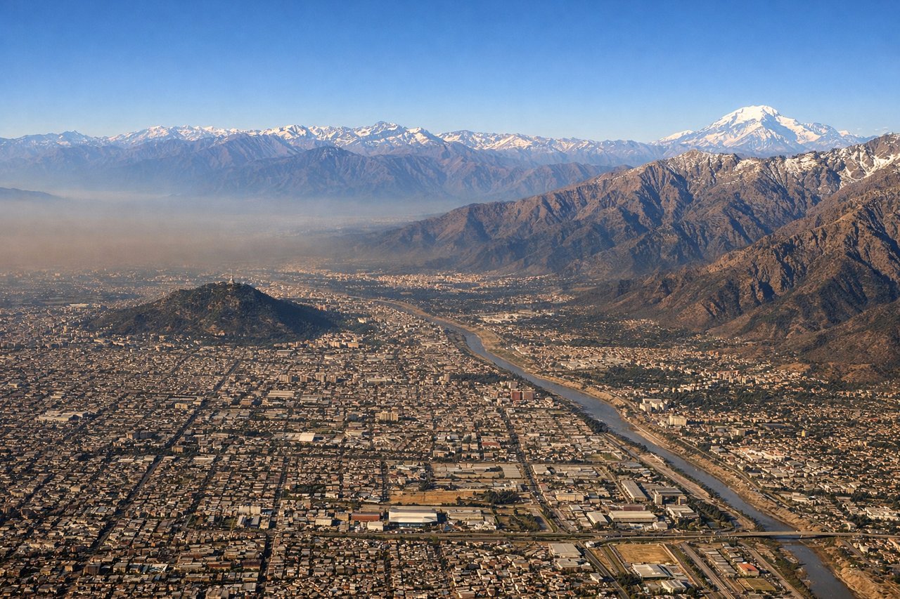
RIGHTOn approach into SCL from the south, the right side continues to face east, giving passengers a close view of the high Andes wall behind Santiago, including peaks that stay snow-capped much of the year, before the plane banks over the city's eastern foothill suburbs.
Landmarks on this routeAll landmarks →
Will your flight be in sunlight?
Pick a date and time in the Sun Map to watch the sun move across your whole flight.
About This Route
Which side of the plane should I sit on flying from La Araucanía International Airport (ZCO) to Arturo Merino Benitez International (SCL)?
Sit on the Right side of the plane for the best views on flights from Temuco to Santiago. Throughout the short flight, the right side keeps the Andes and its volcanic peaks in view during both departure and arrival, while the left side mostly shows the flatter central valley and distant coastal range with less visual variety.
What can I see during takeoff from La Araucanía International Airport in Temuco?
During takeoff from La Araucanía International Airport (ZCO), sit on the Right side for the best views. Departing ZCO northbound, the right side faces east toward the Andes, where snow-capped volcanoes like Llaima and Villarrica rise dramatically above the Araucanía lake district. The left side only shows the flatter central valley and coastal range in the distance. Notable sights include: Llaima Volcano, Villarrica Volcano, Andean foothills, Araucanía lake district.
What can I see when landing at Arturo Merino Benitez International in Santiago?
When landing at Arturo Merino Benitez International (SCL), sit on the Right side for the best views. On approach into SCL from the south, the right side continues to face east, giving passengers a close view of the high Andes wall behind Santiago, including peaks that stay snow-capped much of the year, before the plane banks over the city's eastern foothill suburbs. Notable sights include: Andes Cordillera skyline, San Ramón foothills, Maipo river valley, Santiago's eastern suburbs.
How long is the flight from Temuco to Santiago?
The flight from La Araucanía International Airport (ZCO) to Arturo Merino Benitez International (SCL) takes about 1 hour 10 minutes. The shortest flight path between them is 396 miles (638 km); winds and air traffic control usually add a few percent.
What does the Temuco to Santiago flight path pass over?
Central Valley farmland, Andes foothills to the east, Maule and O'Higgins regions' river valleys