While takeoff offers the Sandia Mountains on the left, the landing approach into SLC provides superior views of the Wasatch Range and Great Salt Lake—two of the most visually striking features on this route. The landing sequence dominates the flight experience.
Flown ABQ to SLC? Did we get it right?
Flight Path
Albuquerque to Salt Lake City is 493 miles (794 km), a flight of about 1 hour 15 minutes.
The flight path crosses the high desert plateau of central Utah. Notable features include the Book Cliffs (visible to the east around midpoint, appearing as a low escarpment on the horizon), the San Rafael Swell (south of track, not directly visible but defines the terrain), and the transition from New Mexico's volcanic plateau to Utah's sedimentary basin. The Colorado River drainage system becomes visible as the aircraft approaches Utah. No major bodies of water are crossed until the approach to the Great Salt Lake.
Great circle distance and headings ›


Phase by phase
Takeoff from ABQ
LEFTABQ typically departs north or northeast. Left seats face toward the Sandia Mountains and the Rio Grande valley, offering immediate dramatic relief. Right seats show the flat desert plateau extending toward the southeast.
Landing at SLC
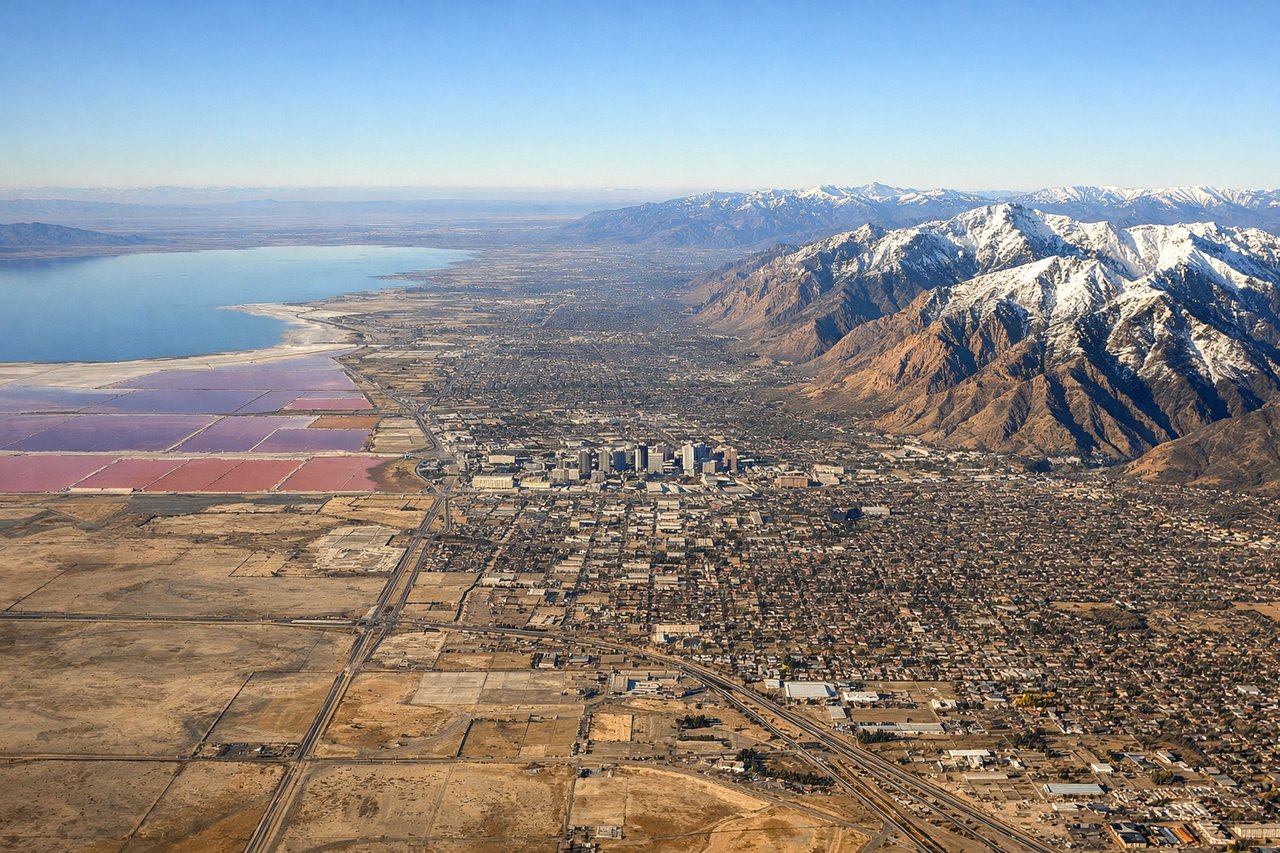
RIGHTSLC approaches from the south or southwest, typically landing on runways 16 or 34. Right seats face the Wasatch Range and the eastern shore of the Great Salt Lake during descent. Left seats show the western desert and the lake's western arm.
Will your flight be in sunlight?
Pick a date and time in the Sun Map to watch the sun move across your whole flight.
About This Route
Which side of the plane should I sit on flying from Albuquerque International Sunport (ABQ) to Salt Lake City International (SLC)?
Sit on the Right side of the plane for the best views on flights from Albuquerque to Salt Lake City. While takeoff offers the Sandia Mountains on the left, the landing approach into SLC provides superior views of the Wasatch Range and Great Salt Lake—two of the most visually striking features on this route. The landing sequence dominates the flight experience.
What can I see during takeoff from Albuquerque International Sunport in Albuquerque?
During takeoff from Albuquerque International Sunport (ABQ), sit on the Left side for the best views. ABQ typically departs north or northeast. Left seats face toward the Sandia Mountains and the Rio Grande valley, offering immediate dramatic relief. Right seats show the flat desert plateau extending toward the southeast. Notable sights include: Sandia Mountains (east, rising sharply), Rio Grande valley (north-south corridor below), Kirtland Air Force Base runways (directly beneath during climb), Albuquerque urban sprawl (west and south).
What can I see when landing at Salt Lake City International in Salt Lake City?
When landing at Salt Lake City International (SLC), sit on the Right side for the best views. SLC approaches from the south or southwest, typically landing on runways 16 or 34. Right seats face the Wasatch Range and the eastern shore of the Great Salt Lake during descent. Left seats show the western desert and the lake's western arm. Notable sights include: Wasatch Range (east, snow-capped peaks), Great Salt Lake (north and west, distinctive pale blue), Salt Lake City downtown (south-center, urban grid), Utah Valley and Provo (south, visible beyond the lake).
How long is the flight from Albuquerque to Salt Lake City?
The flight from Albuquerque International Sunport (ABQ) to Salt Lake City International (SLC) takes about 1 hour 15 minutes. The shortest flight path between them is 493 miles (794 km); winds and air traffic control usually add a few percent.
What does the Albuquerque to Salt Lake City flight path pass over?
The flight path crosses the high desert plateau of central Utah. Notable features include the Book Cliffs (visible to the east around midpoint, appearing as a low escarpment on the horizon), the San Rafael Swell (south of track, not directly visible but defines the terrain), and the transition from New Mexico's volcanic plateau to Utah's sedimentary basin. The Colorado River drainage system becomes visible as the aircraft approaches Utah. No major bodies of water are crossed until the approach to the Great Salt Lake.