The left (east) side delivers the dramatic Wasatch Front at takeoff, likely glimpses of the San Juan Mountains and Colorado Plateau canyon country during cruise, and the striking Sandia Mountains on final approach into Albuquerque—far more terrain drama than the flatter, less distinctive western views.
Flown SLC to ABQ? Did we get it right?
Flight Path
Salt Lake City to Albuquerque is 493 miles (794 km), a flight of about 1 hour 20 minutes.
Colorado Plateau canyon country, San Rafael Swell, Four Corners region, distant San Juan Mountains
Great circle distance and headings ›


Phase by phase
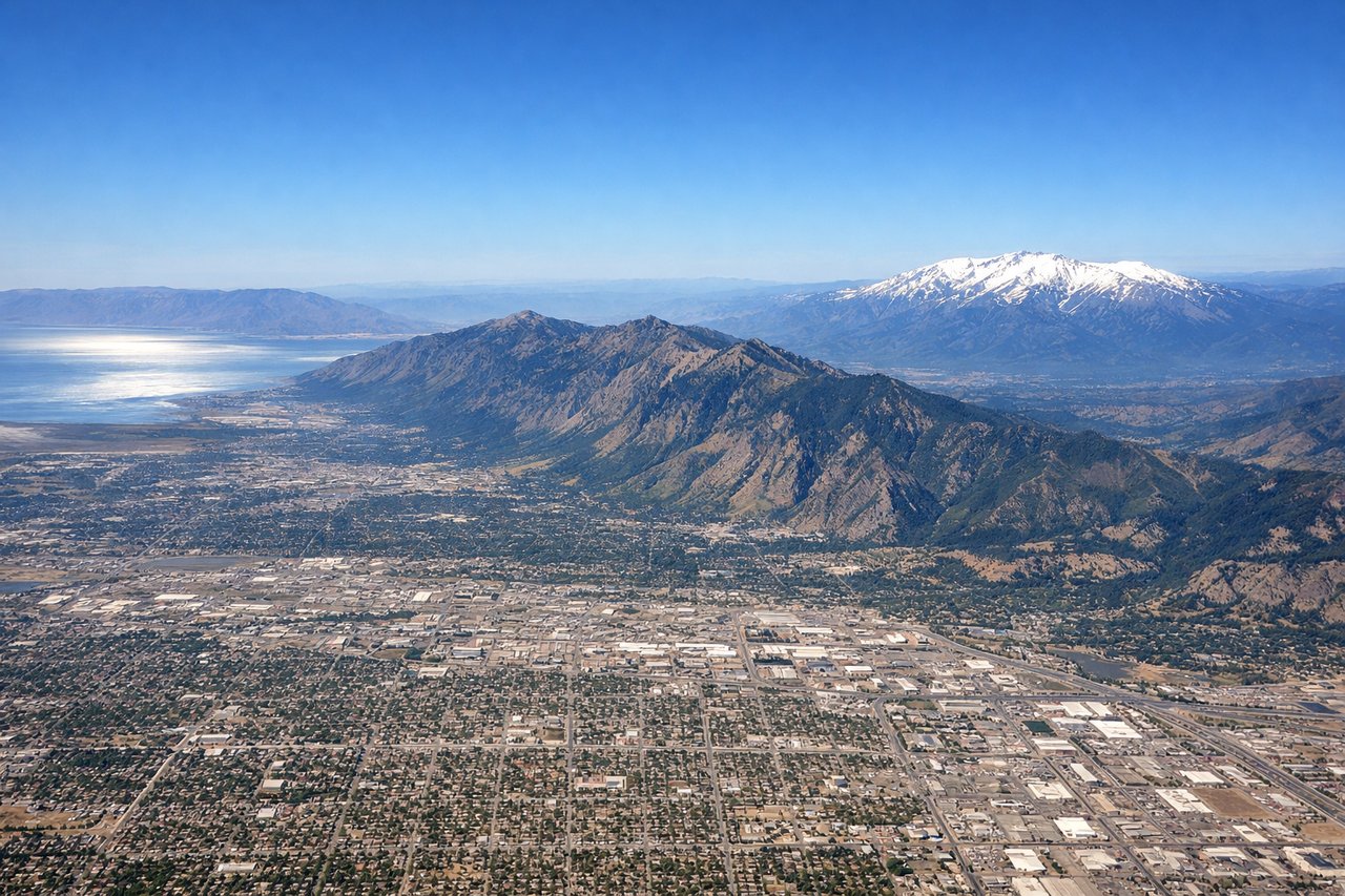
Takeoff from SLC
LEFTDeparting SLC on the south-facing runways, the aircraft climbs with the Wasatch Front rising immediately to the east, giving passengers a close, dramatic view of peaks like Mount Olympus and Twin Peaks right off the wingtip. The right side only offers the flatter Great Salt Lake and Oquirrh Mountains, less immediately striking.
Landing at ABQ
LEFTOn approach into Albuquerque from the north, the Sandia Mountains dominate the view to the east of the city, their sheer western face catching the light as the plane descends toward the Rio Grande valley. The right side shows only the flatter West Mesa and volcanic cones, a much subtler feature.
Will your flight be in sunlight?
Pick a date and time in the Sun Map to watch the sun move across your whole flight.
About This Route
Which side of the plane should I sit on flying from Salt Lake City International (SLC) to Albuquerque International Sunport (ABQ)?
Sit on the Left side of the plane for the best views on flights from Salt Lake City to Albuquerque. The left (east) side delivers the dramatic Wasatch Front at takeoff, likely glimpses of the San Juan Mountains and Colorado Plateau canyon country during cruise, and the striking Sandia Mountains on final approach into Albuquerque—far more terrain drama than the flatter, less distinctive western views.
What can I see during takeoff from Salt Lake City International in Salt Lake City?
During takeoff from Salt Lake City International (SLC), sit on the Left side for the best views. Departing SLC on the south-facing runways, the aircraft climbs with the Wasatch Front rising immediately to the east, giving passengers a close, dramatic view of peaks like Mount Olympus and Twin Peaks right off the wingtip. The right side only offers the flatter Great Salt Lake and Oquirrh Mountains, less immediately striking. Notable sights include: Wasatch Range, Mount Olympus, Salt Lake Valley, Traverse Mountains.
What can I see when landing at Albuquerque International Sunport in Albuquerque?
When landing at Albuquerque International Sunport (ABQ), sit on the Left side for the best views. On approach into Albuquerque from the north, the Sandia Mountains dominate the view to the east of the city, their sheer western face catching the light as the plane descends toward the Rio Grande valley. The right side shows only the flatter West Mesa and volcanic cones, a much subtler feature. Notable sights include: Sandia Mountains, Rio Grande, Albuquerque skyline, West Mesa volcanoes.
How long is the flight from Salt Lake City to Albuquerque?
The flight from Salt Lake City International (SLC) to Albuquerque International Sunport (ABQ) takes about 1 hour 20 minutes. The shortest flight path between them is 493 miles (794 km); winds and air traffic control usually add a few percent.
What does the Salt Lake City to Albuquerque flight path pass over?
Colorado Plateau canyon country, San Rafael Swell, Four Corners region, distant San Juan Mountains