The left side wins on both ends of the flight: dramatic close-up views of the Wasatch Range at takeoff and a scenic descent over the LA basin with skyline and coastline visibility on arrival, while the right side offers comparatively flatter, less distinctive terrain throughout.
Flight Path
Great Basin desert ranges of western Utah and Nevada, including isolated fault-block mountains, followed by the Mojave Desert as the route approaches Southern California.
Great circle distance and headings ›

.jpg?width=600)
Phase by phase
Takeoff from SLC
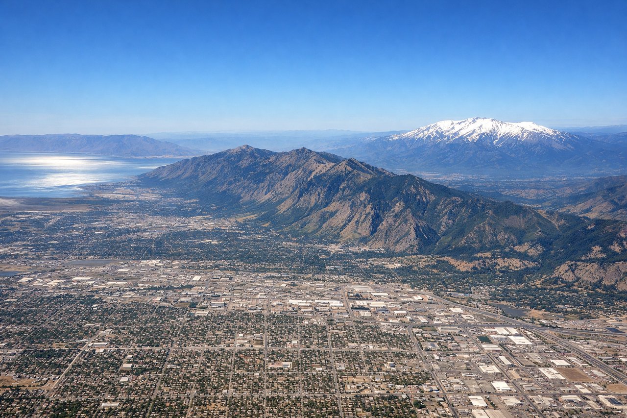
LEFTDeparting SLC to the south before turning southwest, the left (east) side faces the Wasatch Range rising abruptly over 6,000 feet above the valley floor, with Salt Lake City's grid visible at its base. The right side only shows the flatter Oquirrh Mountains and the Great Salt Lake's southern arm, less dramatic in comparison.

Landing at LAX
LEFTOn a typical west-flow arrival into LAX, the descent path crosses the San Gabriel Mountains before turning south over the Los Angeles basin, giving left-side passengers a sweeping view of downtown LA's skyline, the Hollywood Hills, and eventually the Pacific coastline as the aircraft lines up for final approach. The right side mostly shows the flatter San Fernando Valley and suburban sprawl.
Landmarks on this routeAll landmarks →
Will your flight be in sunlight?
See exactly which side of the plane gets sun and shade at your departure time.
About This Route
Which side of the plane should I sit on flying from Salt Lake City International (SLC) to Los Angeles International (LAX)?
Sit on the Left side of the plane for the best views on flights from Salt Lake City to Los Angeles. The left side wins on both ends of the flight: dramatic close-up views of the Wasatch Range at takeoff and a scenic descent over the LA basin with skyline and coastline visibility on arrival, while the right side offers comparatively flatter, less distinctive terrain throughout.
What can I see during takeoff from Salt Lake City International in Salt Lake City?
During takeoff from Salt Lake City International (SLC), sit on the Left side for the best views. Departing SLC to the south before turning southwest, the left (east) side faces the Wasatch Range rising abruptly over 6,000 feet above the valley floor, with Salt Lake City's grid visible at its base. The right side only shows the flatter Oquirrh Mountains and the Great Salt Lake's southern arm, less dramatic in comparison. Notable sights include: Wasatch Range, Mount Olympus, Salt Lake Valley, Great Salt Lake (distant).
What can I see when landing at Los Angeles International in Los Angeles?
When landing at Los Angeles International (LAX), sit on the Left side for the best views. On a typical west-flow arrival into LAX, the descent path crosses the San Gabriel Mountains before turning south over the Los Angeles basin, giving left-side passengers a sweeping view of downtown LA's skyline, the Hollywood Hills, and eventually the Pacific coastline as the aircraft lines up for final approach. The right side mostly shows the flatter San Fernando Valley and suburban sprawl. Notable sights include: Downtown Los Angeles skyline, Hollywood Hills, Pacific coastline, Palos Verdes Peninsula.
How long is the flight from Salt Lake City to Los Angeles?
The flight from Salt Lake City International (SLC) to Los Angeles International (LAX) takes 2h 05m.
What does the Salt Lake City to Los Angeles flight path pass over?
Great Basin desert ranges of western Utah and Nevada, including isolated fault-block mountains, followed by the Mojave Desert as the route approaches Southern California.