Albuquerque to Tampa is 1,495 miles (2,407 km), a flight of about 4 hours 15 minutes.
Both sides score equally for the full flight—the route crosses flat terrain (Mississippi Delta, Gulf Coast plains) with minimal dramatic scenery. However, the right side wins on landing quality: Tampa Bay's urban waterfront, the iconic Sunshine Skyway Bridge, and downtown skyline provide distinctive visual interest during descent. The left side's Sandia Mountains departure is slightly more dramatic than the right's flat desert, but the landing advantage tips the overall recommendation to the right.
Flight Path
Mississippi River valley (near Memphis area), Tennessee-Mississippi border region, Gulf Coastal Plain, scattered lakes and reservoirs across Louisiana and Mississippi
Great circle distance and headings ›.jpg?width=600)

Phase by phase
Takeoff from ABQ
LEFTAlbuquerque sits at 5,312 feet elevation with the Sandia Mountains immediately east. Left-side departures heading southeast capture the dramatic escarpment and foothills during climb-out, plus the Rio Grande valley floor. Right side shows only flat desert and urban sprawl.
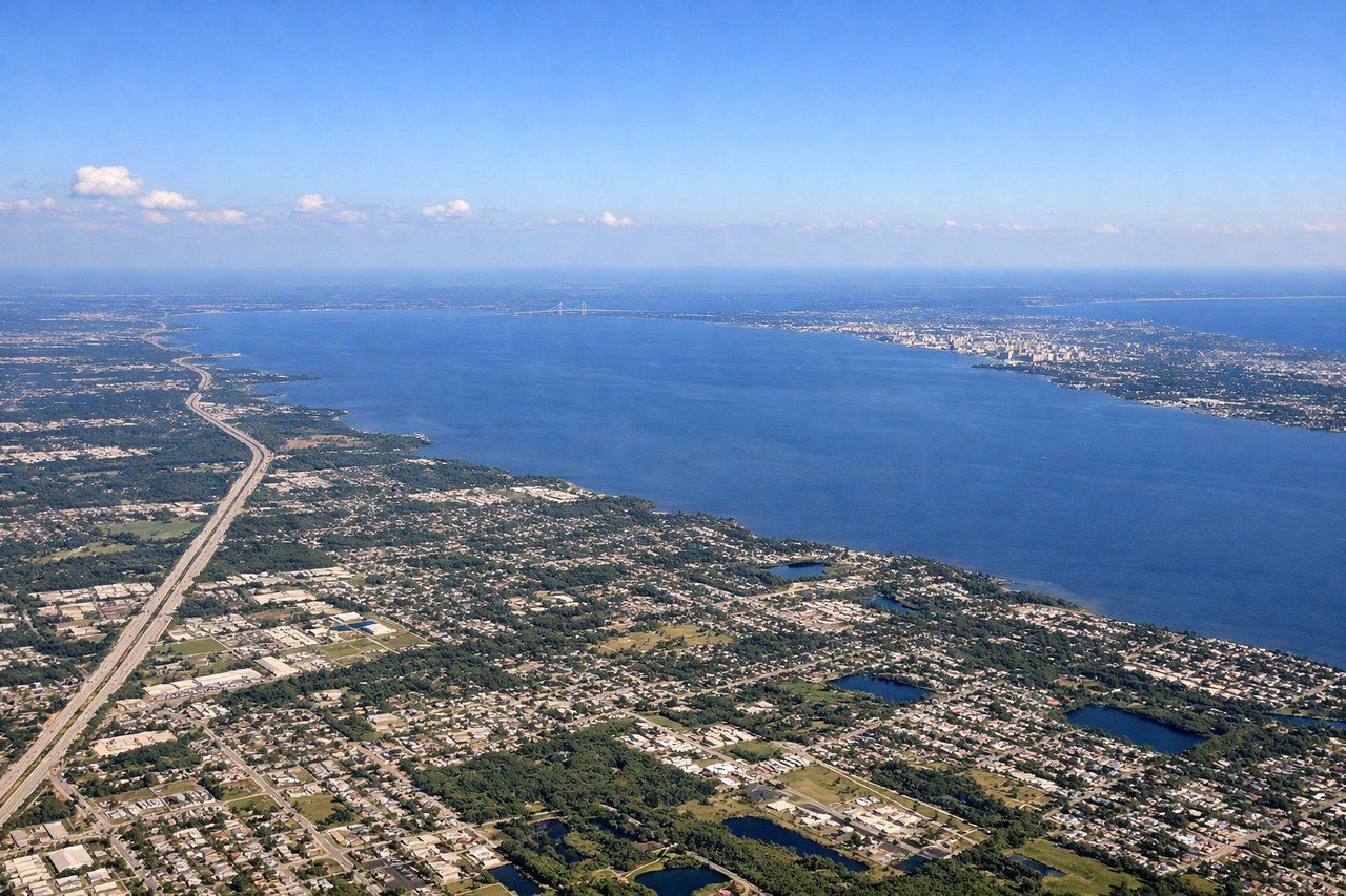
Landing at TPA
RIGHTTampa Bay approach from the east brings right-side views of Hillsborough Bay, the downtown skyline, and the distinctive Sunshine Skyway Bridge. Left side shows only open Gulf of Mexico and coastal marshland. The bay and bridge are iconic Tampa landmarks visible during final descent.
Landmarks on this routeAll landmarks →
Will your flight be in sunlight?
Pick a date and time in the Sun Map to watch the sun move across your whole flight.
About This Route
Which side of the plane should I sit on flying from Albuquerque International Sunport (ABQ) to Tampa International (TPA)?
Sit on the Right side of the plane for the best views on flights from Albuquerque to Tampa. Both sides score equally for the full flight—the route crosses flat terrain (Mississippi Delta, Gulf Coast plains) with minimal dramatic scenery. However, the right side wins on landing quality: Tampa Bay's urban waterfront, the iconic Sunshine Skyway Bridge, and downtown skyline provide distinctive visual interest during descent. The left side's Sandia Mountains departure is slightly more dramatic than the right's flat desert, but the landing advantage tips the overall recommendation to the right.
What can I see during takeoff from Albuquerque International Sunport in Albuquerque?
During takeoff from Albuquerque International Sunport (ABQ), sit on the Left side for the best views. Albuquerque sits at 5,312 feet elevation with the Sandia Mountains immediately east. Left-side departures heading southeast capture the dramatic escarpment and foothills during climb-out, plus the Rio Grande valley floor. Right side shows only flat desert and urban sprawl. Notable sights include: Sandia Mountains (east face), Rio Grande valley, Albuquerque urban grid, Kirtland Air Force Base runways.
What can I see when landing at Tampa International in Tampa?
When landing at Tampa International (TPA), sit on the Right side for the best views. Tampa Bay approach from the east brings right-side views of Hillsborough Bay, the downtown skyline, and the distinctive Sunshine Skyway Bridge. Left side shows only open Gulf of Mexico and coastal marshland. The bay and bridge are iconic Tampa landmarks visible during final descent. Notable sights include: Hillsborough Bay, Tampa downtown skyline, Sunshine Skyway Bridge, Ybor City district.
How long is the flight from Albuquerque to Tampa?
The flight from Albuquerque International Sunport (ABQ) to Tampa International (TPA) takes about 4 hours 15 minutes. The shortest flight path between them is 1,495 miles (2,407 km); winds and air traffic control usually add a few percent.
What does the Albuquerque to Tampa flight path pass over?
Mississippi River valley (near Memphis area), Tennessee-Mississippi border region, Gulf Coastal Plain, scattered lakes and reservoirs across Louisiana and Mississippi