Acapulco to Mexico City is 190 miles (306 km), a flight of about 1 hour.
Right side scores higher (3.5 vs 2.5) due to superior scenic variety across the full flight: dramatic coastal departure with Pacific views and Sierra Madre foothills, followed by the approach into Mexico City with iconic volcanic peaks (Popocatépetl and Iztaccíhuatl) framing the valley. Left side offers less distinctive terrain throughout the flight.
Flight Path
The flight path crosses the Sierra Madre del Sur mountain range transitioning from coastal terrain to the interior Mexican plateau. The Balsas River valley and surrounding foothills are visible during cruise. As the aircraft approaches Mexico City, the terrain rises into the Trans-Mexican Volcanic Belt with views of smaller volcanic cones and the Valley of Mexico's distinctive basin geography.
Great circle distance and headings ›
_(cropped).jpg?width=600)
Phase by phase
Takeoff from ACA
RIGHTRight side captures Acapulco's dramatic coastal departure with the Pacific Ocean, Acapulco Bay, and surrounding Sierra Madre del Sur foothills. Left side faces inland terrain with less immediate visual interest during climb-out.
Landing at MEX
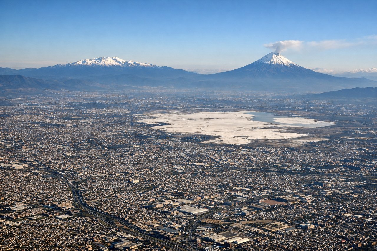
RIGHTRight side offers superior approach views into Mexico City, including the Valley of Mexico's urban sprawl, surrounding volcanic peaks (Popocatépetl and Iztaccíhuatl visible on clear days), and the city's distinctive geography. Left side shows similar terrain but from a less favorable angle for recognizing the city's landmarks.
Landmarks on this routeAll landmarks →
Will your flight be in sunlight?
Pick a date and time in the Sun Map to watch the sun move across your whole flight.
About This Route
Which side of the plane should I sit on flying from General Juan N Alvarez International (ACA) to Licenciado Benito Juarez International (MEX)?
Sit on the Right side of the plane for the best views on flights from Acapulco to Mexico City. Right side scores higher (3.5 vs 2.5) due to superior scenic variety across the full flight: dramatic coastal departure with Pacific views and Sierra Madre foothills, followed by the approach into Mexico City with iconic volcanic peaks (Popocatépetl and Iztaccíhuatl) framing the valley. Left side offers less distinctive terrain throughout the flight.
What can I see during takeoff from General Juan N Alvarez International in Acapulco?
During takeoff from General Juan N Alvarez International (ACA), sit on the Right side for the best views. Right side captures Acapulco's dramatic coastal departure with the Pacific Ocean, Acapulco Bay, and surrounding Sierra Madre del Sur foothills. Left side faces inland terrain with less immediate visual interest during climb-out. Notable sights include: Acapulco Bay and harbor, Pacific coastline, Sierra Madre del Sur ridgelines, Papagayo Peninsula.
What can I see when landing at Licenciado Benito Juarez International in Mexico City?
When landing at Licenciado Benito Juarez International (MEX), sit on the Right side for the best views. Right side offers superior approach views into Mexico City, including the Valley of Mexico's urban sprawl, surrounding volcanic peaks (Popocatépetl and Iztaccíhuatl visible on clear days), and the city's distinctive geography. Left side shows similar terrain but from a less favorable angle for recognizing the city's landmarks. Notable sights include: Mexico City metropolitan area, Valley of Mexico basin, Popocatépetl volcano (snow-capped peak), Iztaccíhuatl volcano, Benito Juárez International Airport.
How long is the flight from Acapulco to Mexico City?
The flight from General Juan N Alvarez International (ACA) to Licenciado Benito Juarez International (MEX) takes about 1 hour. The shortest flight path between them is 190 miles (306 km); winds and air traffic control usually add a few percent.
What does the Acapulco to Mexico City flight path pass over?
The flight path crosses the Sierra Madre del Sur mountain range transitioning from coastal terrain to the interior Mexican plateau. The Balsas River valley and surrounding foothills are visible during cruise. As the aircraft approaches Mexico City, the terrain rises into the Trans-Mexican Volcanic Belt with views of smaller volcanic cones and the Valley of Mexico's distinctive basin geography.