Mexico City to Acapulco is 190 miles (306 km), a flight of about 1 hour 15 minutes.
Left side scores higher due to the dramatic Sierra Madre del Sur coastal mountains visible throughout the flight and especially during landing approach, combined with Mexico City's urban departure scenery. The route crosses significant elevation changes and terminates at a scenic coastal destination. Right side faces predominantly open ocean and flat terrain with minimal landmark density.
Flight Path
Taxco region mountains, Guerrero state foothills, transition from high-altitude central plateau to coastal Sierra Madre del Sur range, Papanoa coastal plain
Great circle distance and headings ›_(cropped).jpg?width=600)

Phase by phase
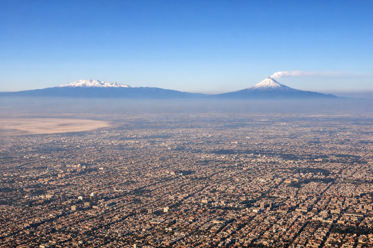
Takeoff from MEX
LEFTLeft side captures Mexico City's urban sprawl and the surrounding high-altitude valley basin during climb-out, with the Sierra Madre Oriental foothills visible to the northeast. Right side faces open terrain with less immediate visual interest during departure.
Landing at ACA
LEFTLeft side provides dramatic coastal approach with Acapulco Bay's distinctive crescent shape, the Sierra Madre del Sur mountains rising steeply from the coast, and the city's waterfront development visible during descent. Right side shows open Pacific Ocean with minimal scenic variation.
Landmarks on this routeAll landmarks →
Will your flight be in sunlight?
Pick a date and time in the Sun Map to watch the sun move across your whole flight.
About This Route
Which side of the plane should I sit on flying from Licenciado Benito Juarez International (MEX) to General Juan N Alvarez International (ACA)?
Sit on the Left side of the plane for the best views on flights from Mexico City to Acapulco. Left side scores higher due to the dramatic Sierra Madre del Sur coastal mountains visible throughout the flight and especially during landing approach, combined with Mexico City's urban departure scenery. The route crosses significant elevation changes and terminates at a scenic coastal destination. Right side faces predominantly open ocean and flat terrain with minimal landmark density.
What can I see during takeoff from Licenciado Benito Juarez International in Mexico City?
During takeoff from Licenciado Benito Juarez International (MEX), sit on the Left side for the best views. Left side captures Mexico City's urban sprawl and the surrounding high-altitude valley basin during climb-out, with the Sierra Madre Oriental foothills visible to the northeast. Right side faces open terrain with less immediate visual interest during departure. Notable sights include: Mexico City metropolitan area, Lake Texcoco remnants, Sierra Madre Oriental foothills, Popocatépetl volcano (distant, weather permitting).
What can I see when landing at General Juan N Alvarez International in Acapulco?
When landing at General Juan N Alvarez International (ACA), sit on the Left side for the best views. Left side provides dramatic coastal approach with Acapulco Bay's distinctive crescent shape, the Sierra Madre del Sur mountains rising steeply from the coast, and the city's waterfront development visible during descent. Right side shows open Pacific Ocean with minimal scenic variation. Notable sights include: Acapulco Bay crescent, Sierra Madre del Sur coastal peaks, Acapulco city waterfront and harbor, Pacific coastline with rocky headlands.
How long is the flight from Mexico City to Acapulco?
The flight from Licenciado Benito Juarez International (MEX) to General Juan N Alvarez International (ACA) takes about 1 hour 15 minutes. The shortest flight path between them is 190 miles (306 km); winds and air traffic control usually add a few percent.
What does the Mexico City to Acapulco flight path pass over?
Taxco region mountains, Guerrero state foothills, transition from high-altitude central plateau to coastal Sierra Madre del Sur range, Papanoa coastal plain