Right side scores higher due to Tokyo's dramatic approach over Mount Fuji, Tokyo Bay, and the vast Kanto metropolitan area during landing. While Adana's departure offers coastal and mountain views, the westbound flight spends 11+ hours over relatively featureless ocean and Central Asian terrain. Right-side landing scenery is far more visually distinctive and memorable than the takeoff from Adana.
Flown ADA to HND? Did we get it right?
Flight Path
Adana to Tokyo is 5,474 miles (8,809 km), a flight of about 11 hours 20 minutes.
Flight path crosses the Black Sea (minimal scenic value), then traverses the Caucasus Mountains and Caspian Sea region, continues over Kazakhstan and Uzbekistan steppes (flat, featureless), crosses the Altai Mountains and Mongolia (distant, low relief from cruise altitude), then descends into the Kanto Plain approaching Tokyo. Most of the cruise segment offers limited window scenery—primarily open ocean, steppes, and distant mountain ranges at the horizon.
Great circle distance and headings ›


Phase by phase
Takeoff from ADA
LEFTAdana sits on the Mediterranean coast with the Taurus Mountains rising immediately inland. Left-side departure offers immediate coastal views and mountain backdrop during climb-out.
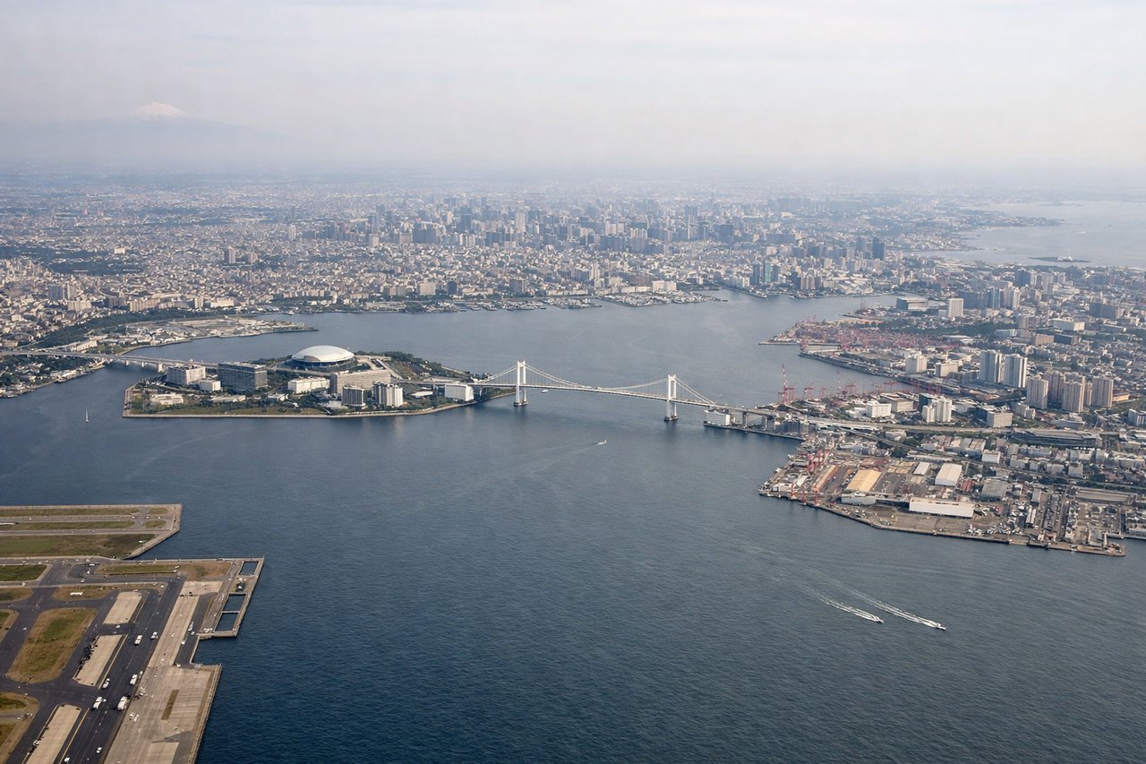
Landing at HND
RIGHTTokyo's approach from the west crosses the Kanto Plain and offers views of Mount Fuji (weather permitting), Tokyo Bay, and the sprawling metropolitan area. Right-side descent provides the most direct views of these landmarks during final approach to Haneda.
Will your flight be in sunlight?
Pick a date and time in the Sun Map to watch the sun move across your whole flight.
About This Route
Which side of the plane should I sit on flying from Adana (ADA) to Tokyo International (HND)?
Sit on the Right side of the plane for the best views on flights from Adana to Tokyo. Right side scores higher due to Tokyo's dramatic approach over Mount Fuji, Tokyo Bay, and the vast Kanto metropolitan area during landing. While Adana's departure offers coastal and mountain views, the westbound flight spends 11+ hours over relatively featureless ocean and Central Asian terrain. Right-side landing scenery is far more visually distinctive and memorable than the takeoff from Adana.
What can I see during takeoff from Adana in Adana?
During takeoff from Adana (ADA), sit on the Left side for the best views. Adana sits on the Mediterranean coast with the Taurus Mountains rising immediately inland. Left-side departure offers immediate coastal views and mountain backdrop during climb-out. Notable sights include: Mediterranean Sea shoreline, Taurus Mountains (northern backdrop), Adana city and harbor, Seyhan River delta.
What can I see when landing at Tokyo International in Tokyo?
When landing at Tokyo International (HND), sit on the Right side for the best views. Tokyo's approach from the west crosses the Kanto Plain and offers views of Mount Fuji (weather permitting), Tokyo Bay, and the sprawling metropolitan area. Right-side descent provides the most direct views of these landmarks during final approach to Haneda. Notable sights include: Mount Fuji (distant, southwest of Tokyo), Tokyo Bay with harbor infrastructure, Kanto Plain urban sprawl, Haneda Airport and surrounding reclaimed land.
How long is the flight from Adana to Tokyo?
The flight from Adana (ADA) to Tokyo International (HND) takes about 11 hours 20 minutes. The shortest flight path between them is 5,474 miles (8,809 km); winds and air traffic control usually add a few percent.
What does the Adana to Tokyo flight path pass over?
Flight path crosses the Black Sea (minimal scenic value), then traverses the Caucasus Mountains and Caspian Sea region, continues over Kazakhstan and Uzbekistan steppes (flat, featureless), crosses the Altai Mountains and Mongolia (distant, low relief from cruise altitude), then descends into the Kanto Plain approaching Tokyo. Most of the cruise segment offers limited window scenery—primarily open ocean, steppes, and distant mountain ranges at the horizon.