Right side scores higher (3.5 vs 2.5) because it captures Tokyo's iconic urban and bay scenery on departure, plus the dramatic Taurus Mountains and Mediterranean approach on arrival. Left side is dominated by flat Kanto and Anatolian terrain with minimal landmark density. The right side offers greater variety and more recognizable geographic features across the full flight.
Flown HND to ADA? Did we get it right?
Flight Path
Tokyo to Adana is 5,474 miles (8,809 km), a flight of about 11 hours 35 minutes.
Flight path crosses the Eurasian continent over central Asia: the Caspian Sea (southern edge visible), Caucasus Mountains (northern route passes south of peaks), Iranian plateau, and Mesopotamian plains before descending toward the Mediterranean and Turkish coast. The route typically follows a great-circle path over Kazakhstan, Uzbekistan, Turkmenistan, and Iran, with the Elburz Mountains visible on the southern approach to the Caspian.
Great circle distance and headings ›


Phase by phase
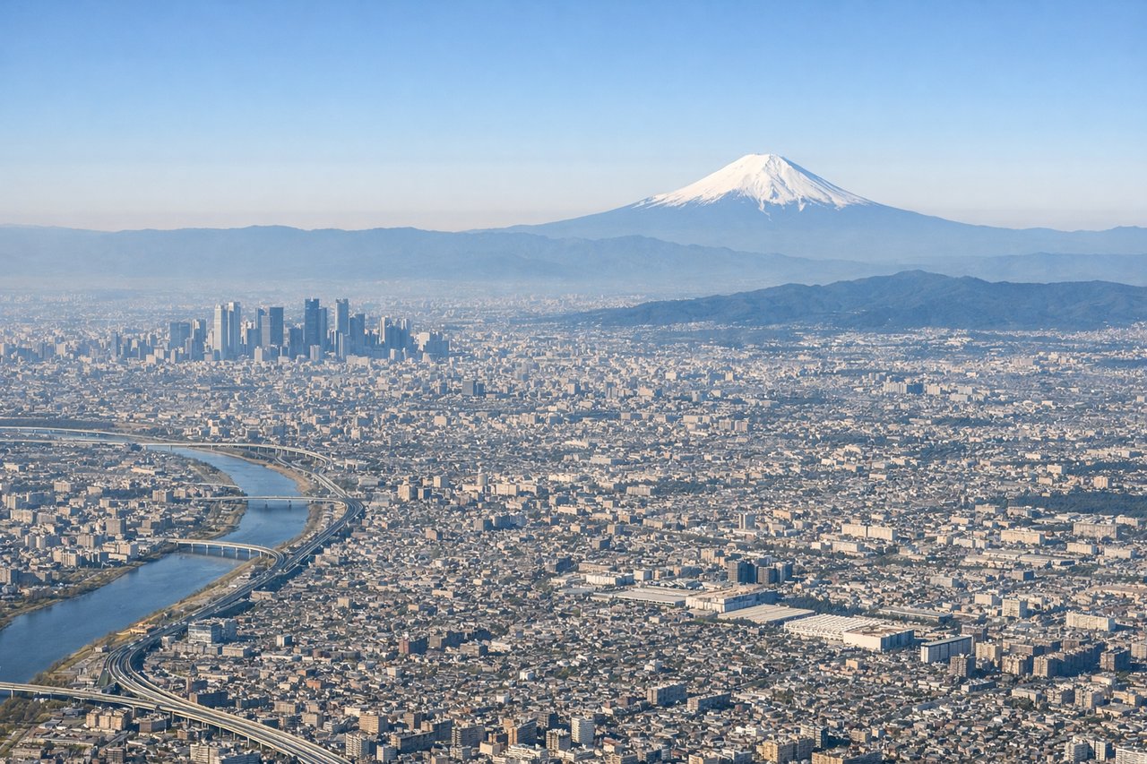
Takeoff from HND
RIGHTRight side captures Tokyo Bay, the Kanto Plain urban sprawl, and Mount Fuji on clear days during northwestward departure. Left side faces inland Kanto flatlands with minimal dramatic terrain.
Landing at ADA
RIGHTRight side offers the Cilician Plain approach into Adana, with the Taurus Mountains visible to the north and the Mediterranean coast to the south. Left side faces inland Anatolian plateau with minimal visual interest during descent.
Will your flight be in sunlight?
Pick a date and time in the Sun Map to watch the sun move across your whole flight.
About This Route
Which side of the plane should I sit on flying from Tokyo International (HND) to Adana (ADA)?
Sit on the Right side of the plane for the best views on flights from Tokyo to Adana. Right side scores higher (3.5 vs 2.5) because it captures Tokyo's iconic urban and bay scenery on departure, plus the dramatic Taurus Mountains and Mediterranean approach on arrival. Left side is dominated by flat Kanto and Anatolian terrain with minimal landmark density. The right side offers greater variety and more recognizable geographic features across the full flight.
What can I see during takeoff from Tokyo International in Tokyo?
During takeoff from Tokyo International (HND), sit on the Right side for the best views. Right side captures Tokyo Bay, the Kanto Plain urban sprawl, and Mount Fuji on clear days during northwestward departure. Left side faces inland Kanto flatlands with minimal dramatic terrain. Notable sights include: Tokyo Bay with harbor infrastructure, Mount Fuji (visible on clear days ~100 km southwest), Kanto Plain extending inland.
What can I see when landing at Adana in Adana?
When landing at Adana (ADA), sit on the Right side for the best views. Right side offers the Cilician Plain approach into Adana, with the Taurus Mountains visible to the north and the Mediterranean coast to the south. Left side faces inland Anatolian plateau with minimal visual interest during descent. Notable sights include: Taurus Mountains (northern horizon), Cilician Plain agricultural fields, Mediterranean Sea coastline, Adana city sprawl.
How long is the flight from Tokyo to Adana?
The flight from Tokyo International (HND) to Adana (ADA) takes about 11 hours 35 minutes. The shortest flight path between them is 5,474 miles (8,809 km); winds and air traffic control usually add a few percent.
What does the Tokyo to Adana flight path pass over?
Flight path crosses the Eurasian continent over central Asia: the Caspian Sea (southern edge visible), Caucasus Mountains (northern route passes south of peaks), Iranian plateau, and Mesopotamian plains before descending toward the Mediterranean and Turkish coast. The route typically follows a great-circle path over Kazakhstan, Uzbekistan, Turkmenistan, and Iran, with the Elburz Mountains visible on the southern approach to the Caspian.