While takeoff favors the right for river views, the landing approach dominates this route—the Andes and Cerro Chapelco are the visual highlight of the entire flight, and left-side seats capture this spectacularly during descent. The midpoint crossing of the Pampas is unremarkable from either side.
Flown AEP to CPC? Did we get it right?
Flight Path
Buenos Aires to San Martin Des Andes is 795 miles (1,280 km), a flight of about 2 hours 15 minutes.
After leaving the Río de la Plata region, the flight crosses the flat Pampas grasslands with scattered estancias (ranches) and occasional small towns—largely featureless from altitude. Around the midpoint near Bragado or Junín, you'll pass over agricultural plains with geometric field patterns. As you approach the foothills west of Neuquén, the terrain begins to rise and vegetation transitions from grassland to steppe. The Neuquén River valley becomes visible before the final approach into the Andes proper.
Great circle distance and headings ›Phase by phase
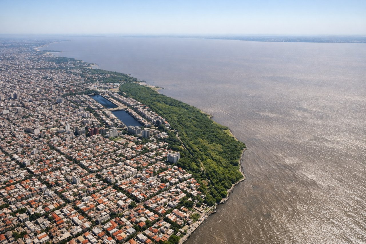
Takeoff from AEP
RIGHTAEP typically departs to the north or northeast. Right-side seats offer views of the Río de la Plata estuary and the northern suburbs of Buenos Aires as you climb out, with the river's wide expanse clearly visible. Left seats face inland toward the city proper.
Landing at CPC
LEFTApproaching CPC from the northeast typically means descending on a westerly or southwesterly heading. Left-side seats provide the superior view of the Andes as you descend into the San Martín de los Andes valley, with the snow-capped peaks of Cerro Chapelco and the surrounding cordillera filling the left window.
Will your flight be in sunlight?
Pick a date and time in the Sun Map to watch the sun move across your whole flight.
About This Route
Which side of the plane should I sit on flying from Aeroparque Jorge Newbery (AEP) to Aviador C Campos (CPC)?
Sit on the Left side of the plane for the best views on flights from Buenos Aires to San Martin Des Andes. While takeoff favors the right for river views, the landing approach dominates this route—the Andes and Cerro Chapelco are the visual highlight of the entire flight, and left-side seats capture this spectacularly during descent. The midpoint crossing of the Pampas is unremarkable from either side.
What can I see during takeoff from Aeroparque Jorge Newbery in Buenos Aires?
During takeoff from Aeroparque Jorge Newbery (AEP), sit on the Right side for the best views. AEP typically departs to the north or northeast. Right-side seats offer views of the Río de la Plata estuary and the northern suburbs of Buenos Aires as you climb out, with the river's wide expanse clearly visible. Left seats face inland toward the city proper. Notable sights include: Río de la Plata (wide brown estuary), northern Buenos Aires suburbs (Belgrano, Núñez districts), Tigre Delta waterways to the northeast, Paraná River confluence.
What can I see when landing at Aviador C Campos in San Martin Des Andes?
When landing at Aviador C Campos (CPC), sit on the Left side for the best views. Approaching CPC from the northeast typically means descending on a westerly or southwesterly heading. Left-side seats provide the superior view of the Andes as you descend into the San Martín de los Andes valley, with the snow-capped peaks of Cerro Chapelco and the surrounding cordillera filling the left window. Notable sights include: Cerro Chapelco (dominant snow-capped peak), Nahuel Huapi Lake (large glacial lake with distinctive shape), Andes cordillera ridgeline, San Martín de los Andes town nestled in the valley floor.
How long is the flight from Buenos Aires to San Martin Des Andes?
The flight from Aeroparque Jorge Newbery (AEP) to Aviador C Campos (CPC) takes about 2 hours 15 minutes. The shortest flight path between them is 795 miles (1,280 km); winds and air traffic control usually add a few percent.
What does the Buenos Aires to San Martin Des Andes flight path pass over?
After leaving the Río de la Plata region, the flight crosses the flat Pampas grasslands with scattered estancias (ranches) and occasional small towns—largely featureless from altitude. Around the midpoint near Bragado or Junín, you'll pass over agricultural plains with geometric field patterns. As you approach the foothills west of Neuquén, the terrain begins to rise and vegetation transitions from grassland to steppe. The Neuquén River valley becomes visible before the final approach into the Andes proper.