While the takeoff offers a nice but brief city view, the left side's approach into El Calafate delivers a dramatic, sustained view of Lago Argentino and the Andes that defines the flight's scenic character.
Flown AEP to FTE? Did we get it right?
Flight Path
Buenos Aires to El Calafate is 1,285 miles (2,068 km), a flight of about 3 hours 15 minutes.
Flat Pampas grassland giving way to the arid Patagonian steppe of Río Negro, Chubut, and Santa Cruz provinces, with occasional dry riverbeds visible from cruise altitude before the Andes come into view near El Calafate
Great circle distance and headings ›


Phase by phase
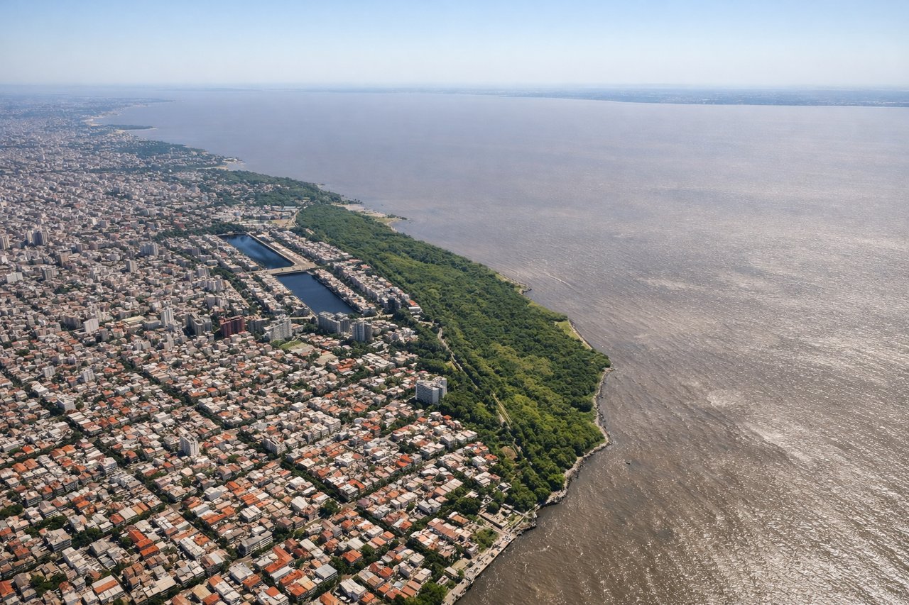
Takeoff from AEP
RIGHTDeparting AEP on runway 13 heading southeast, the aircraft banks slightly and the Buenos Aires waterfront and city skyline fall on the right side as the plane climbs out over the Río de la Plata. The left side mostly shows open river water toward Uruguay.
Landing at FTE
LEFTOn approach to FTE's runway 25, flights from the north typically track south past Lago Argentino before turning onto final, putting the turquoise lake and the jagged peaks of the southern Andes on the left side of the aircraft. This is the scenic highlight of the flight, a stark contrast to the flat steppe seen earlier.
Will your flight be in sunlight?
Pick a date and time in the Sun Map to watch the sun move across your whole flight.
About This Route
Which side of the plane should I sit on flying from Aeroparque Jorge Newbery (AEP) to El Calafate - Commander Armando Tola International Airport (FTE)?
Sit on the Left side of the plane for the best views on flights from Buenos Aires to El Calafate. While the takeoff offers a nice but brief city view, the left side's approach into El Calafate delivers a dramatic, sustained view of Lago Argentino and the Andes that defines the flight's scenic character.
What can I see during takeoff from Aeroparque Jorge Newbery in Buenos Aires?
During takeoff from Aeroparque Jorge Newbery (AEP), sit on the Right side for the best views. Departing AEP on runway 13 heading southeast, the aircraft banks slightly and the Buenos Aires waterfront and city skyline fall on the right side as the plane climbs out over the Río de la Plata. The left side mostly shows open river water toward Uruguay. Notable sights include: Buenos Aires skyline (Puerto Madero towers), Río de la Plata, Costanera coastline.
What can I see when landing at El Calafate - Commander Armando Tola International Airport in El Calafate?
When landing at El Calafate - Commander Armando Tola International Airport (FTE), sit on the Left side for the best views. On approach to FTE's runway 25, flights from the north typically track south past Lago Argentino before turning onto final, putting the turquoise lake and the jagged peaks of the southern Andes on the left side of the aircraft. This is the scenic highlight of the flight, a stark contrast to the flat steppe seen earlier. Notable sights include: Lago Argentino, southern Andes foothills, Patagonian steppe, El Calafate town.
How long is the flight from Buenos Aires to El Calafate?
The flight from Aeroparque Jorge Newbery (AEP) to El Calafate - Commander Armando Tola International Airport (FTE) takes about 3 hours 15 minutes. The shortest flight path between them is 1,285 miles (2,068 km); winds and air traffic control usually add a few percent.
What does the Buenos Aires to El Calafate flight path pass over?
Flat Pampas grassland giving way to the arid Patagonian steppe of Río Negro, Chubut, and Santa Cruz provinces, with occasional dry riverbeds visible from cruise altitude before the Andes come into view near El Calafate