Both sides face many hours of empty South Pacific, but the left side gets the payoff: the great-circle track makes landfall over southern Chile and Argentine Patagonia, giving a distant look at the southern Andes and Patagonian steppe before the descent into Buenos Aires reveals the Río de la Plata and city skyline, while the right side's scenery is limited to the Auckland takeoff alone.
Flight Path
The route's great-circle track carries it across the remote South Pacific at high southern latitudes before making landfall over southern Chile/Argentine Patagonia, passing near the southern Andes and Patagonian steppe, then continuing northeast across the Argentine Pampas toward Buenos Aires.
Great circle distance and headings ›
_(cropped).jpg?width=600)
Phase by phase
Takeoff from AKL
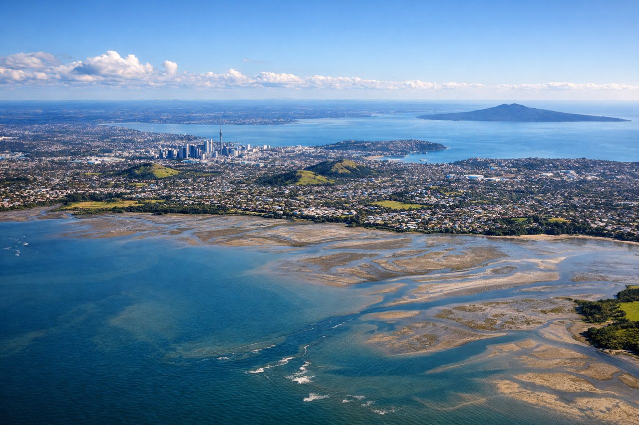
RIGHTAKL departs southwest on 23L over Manukau Harbour, but the aircraft's left turn onto its southeasterly track toward South America swings the right side toward Auckland's skyline, the Sky Tower, and the volcanic cone of Rangitoto Island in the Hauraki Gulf before the coastline falls away into open ocean.
Landing at EZE
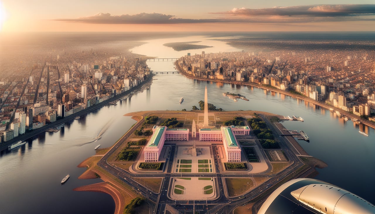
LEFTOn the long final descent into EZE the flight path crosses the flat green Pampas before turning toward the airport south of Buenos Aires, and the left side typically catches the wide brown Río de la Plata estuary with the Buenos Aires skyline low on the horizon just before the turn onto final.
Landmarks on this routeAll landmarks →
Will your flight be in sunlight?
See exactly which side of the plane gets sun and shade at your departure time.
About This Route
Which side of the plane should I sit on flying from Auckland International (AKL) to Ezeiza Ministro Pistarini (EZE)?
Sit on the Left side of the plane for the best views on flights from Auckland to Buenos Aires. Both sides face many hours of empty South Pacific, but the left side gets the payoff: the great-circle track makes landfall over southern Chile and Argentine Patagonia, giving a distant look at the southern Andes and Patagonian steppe before the descent into Buenos Aires reveals the Río de la Plata and city skyline, while the right side's scenery is limited to the Auckland takeoff alone.
What can I see during takeoff from Auckland International in Auckland?
During takeoff from Auckland International (AKL), sit on the Right side for the best views. AKL departs southwest on 23L over Manukau Harbour, but the aircraft's left turn onto its southeasterly track toward South America swings the right side toward Auckland's skyline, the Sky Tower, and the volcanic cone of Rangitoto Island in the Hauraki Gulf before the coastline falls away into open ocean. Notable sights include: Auckland city skyline and Sky Tower, Rangitoto Island volcanic cone, Hauraki Gulf islands, Waitemata Harbour.
What can I see when landing at Ezeiza Ministro Pistarini in Buenos Aires?
When landing at Ezeiza Ministro Pistarini (EZE), sit on the Left side for the best views. On the long final descent into EZE the flight path crosses the flat green Pampas before turning toward the airport south of Buenos Aires, and the left side typically catches the wide brown Río de la Plata estuary with the Buenos Aires skyline low on the horizon just before the turn onto final. Notable sights include: Río de la Plata estuary, Buenos Aires skyline including Puerto Madero towers, patchwork Pampas farmland, Paraná Delta wetlands to the north.
How long is the flight from Auckland to Buenos Aires?
The flight from Auckland International (AKL) to Ezeiza Ministro Pistarini (EZE) takes 11h 40m.
What does the Auckland to Buenos Aires flight path pass over?
The route's great-circle track carries it across the remote South Pacific at high southern latitudes before making landfall over southern Chile/Argentine Patagonia, passing near the southern Andes and Patagonian steppe, then continuing northeast across the Argentine Pampas toward Buenos Aires.