While the flight is dominated by roughly ten hours of open Pacific Ocean with no landmarks, the right side edges out due to the Andes and Patagonian terrain visible just after departure, whereas the left side offers only flat pampas at takeoff before the same featureless ocean cruise.
Flight Path
The route crosses the vast South Pacific Ocean with no islands or landmasses visible for the majority of the flight, passing well south of Easter Island and the Pitcairn group before approaching New Zealand's North Island.
Great circle distance and headings ›_(cropped).jpg?width=600)

Phase by phase
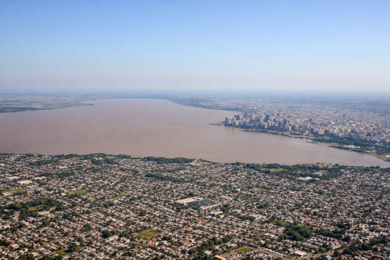
Takeoff from EZE
RIGHTDeparting EZE, the flight path curves south-southwest across the Argentine pampas before angling toward the Pacific, giving right-side passengers a view of the Andes foothills and Patagonian steppe as the plane climbs. Left-side passengers mostly see the flat, featureless plains of Buenos Aires province receding into haze.
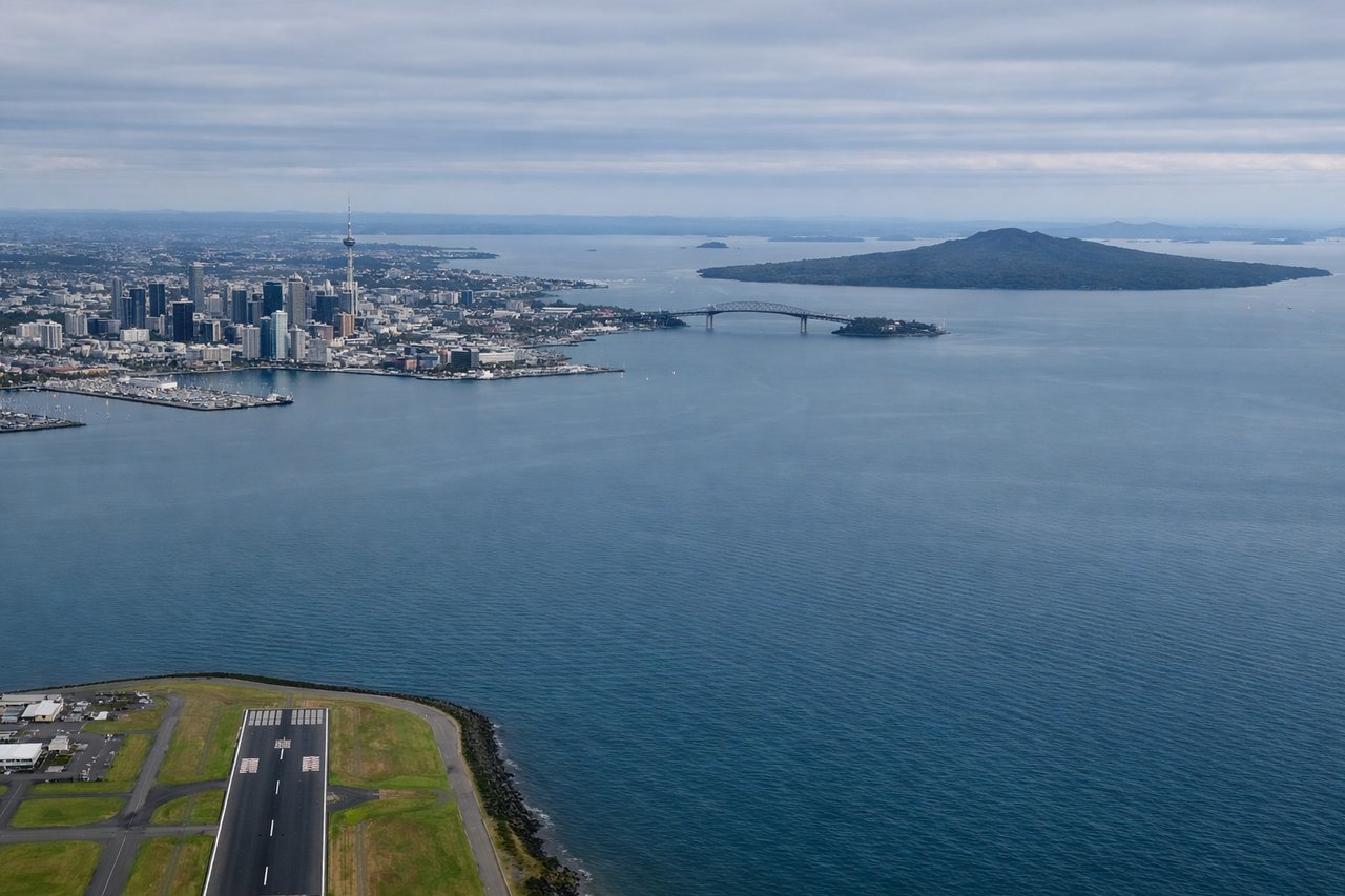
Landing at AKL
LEFTArriving at AKL on runway 23L, aircraft typically approach from the northeast over the Hauraki Gulf, banking south. Left-side passengers get a clear view of Auckland's skyline, Rangitoto Island's volcanic cone, and the Waitemata Harbour just before touchdown.
Landmarks on this routeAll landmarks →
Will your flight be in sunlight?
See exactly which side of the plane gets sun and shade at your departure time.
About This Route
Which side of the plane should I sit on flying from Ezeiza Ministro Pistarini (EZE) to Auckland International (AKL)?
Sit on the Right side of the plane for the best views on flights from Buenos Aires to Auckland. While the flight is dominated by roughly ten hours of open Pacific Ocean with no landmarks, the right side edges out due to the Andes and Patagonian terrain visible just after departure, whereas the left side offers only flat pampas at takeoff before the same featureless ocean cruise.
What can I see during takeoff from Ezeiza Ministro Pistarini in Buenos Aires?
During takeoff from Ezeiza Ministro Pistarini (EZE), sit on the Right side for the best views. Departing EZE, the flight path curves south-southwest across the Argentine pampas before angling toward the Pacific, giving right-side passengers a view of the Andes foothills and Patagonian steppe as the plane climbs. Left-side passengers mostly see the flat, featureless plains of Buenos Aires province receding into haze. Notable sights include: Rio de la Plata estuary, Buenos Aires suburban sprawl, distant Andes foothills, Patagonian steppe.
What can I see when landing at Auckland International in Auckland?
When landing at Auckland International (AKL), sit on the Left side for the best views. Arriving at AKL on runway 23L, aircraft typically approach from the northeast over the Hauraki Gulf, banking south. Left-side passengers get a clear view of Auckland's skyline, Rangitoto Island's volcanic cone, and the Waitemata Harbour just before touchdown. Notable sights include: Rangitoto Island, Waitemata Harbour, Auckland Sky Tower, Hauraki Gulf islands.
How long is the flight from Buenos Aires to Auckland?
The flight from Ezeiza Ministro Pistarini (EZE) to Auckland International (AKL) takes 11h 50m.
What does the Buenos Aires to Auckland flight path pass over?
The route crosses the vast South Pacific Ocean with no islands or landmasses visible for the majority of the flight, passing well south of Easter Island and the Pitcairn group before approaching New Zealand's North Island.