Right side scores higher (3.5 vs 2.5) due to superior scenic content on both departure and arrival. Auckland's harbor and Rangitoto Island provide dramatic early scenery, while the Qiongzhou Strait and Hainan's tropical coastline deliver compelling mid-descent views. Left side is dominated by open ocean for most of the flight with minimal landmark variety.
Flown AKL to HAK? Did we get it right?
Flight Path
Auckland to Haikou is 5,742 miles (9,241 km), a flight of about 11 hours 10 minutes.
Luzon Strait (between Philippines and Taiwan), South China Sea open waters, occasional tropical weather systems, Paracel Islands region (distant, not typically visible), approach to Hainan Island with its distinctive tropical vegetation and coastal development
Great circle distance and headings ›Phase by phase
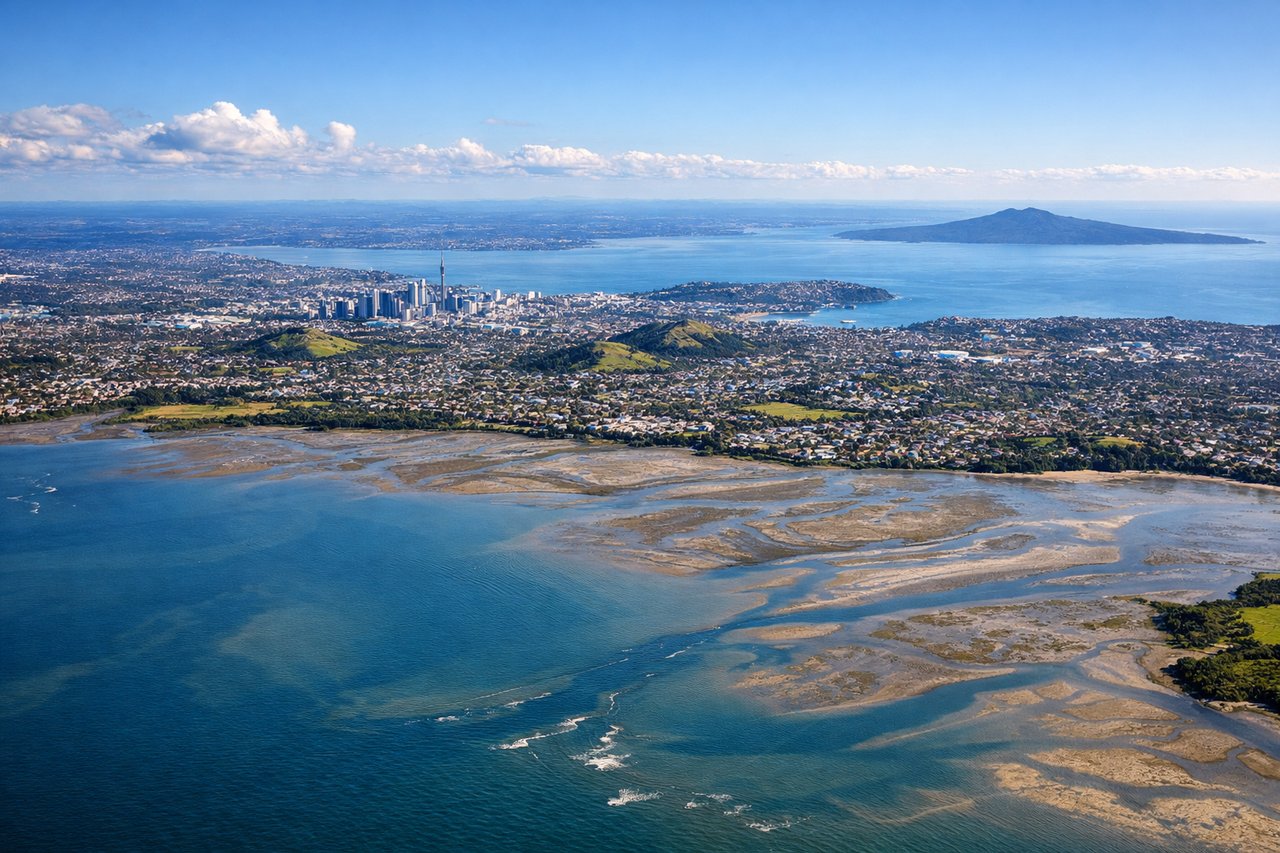
Takeoff from AKL
RIGHTRight side captures Auckland's harbor and Waitemata Estuary during the typical southwest departure, with the city skyline and coastal geography immediately visible. Left side departs over suburban terrain and the Tasman Sea with minimal early visual interest.
Landing at HAK
RIGHTRight side offers superior approach scenery into Haikou. The descent path typically brings aircraft over Qiongzhou Strait and the Hainan coastline, revealing tropical vegetation, coastal development, and the strait's turquoise waters. Left side descends over open South China Sea with minimal landmarks until final approach.
Will your flight be in sunlight?
Pick a date and time in the Sun Map to watch the sun move across your whole flight.
About This Route
Which side of the plane should I sit on flying from Auckland International (AKL) to Haikou Meilan International Airport (HAK)?
Sit on the Right side of the plane for the best views on flights from Auckland to Haikou. Right side scores higher (3.5 vs 2.5) due to superior scenic content on both departure and arrival. Auckland's harbor and Rangitoto Island provide dramatic early scenery, while the Qiongzhou Strait and Hainan's tropical coastline deliver compelling mid-descent views. Left side is dominated by open ocean for most of the flight with minimal landmark variety.
What can I see during takeoff from Auckland International in Auckland?
During takeoff from Auckland International (AKL), sit on the Right side for the best views. Right side captures Auckland's harbor and Waitemata Estuary during the typical southwest departure, with the city skyline and coastal geography immediately visible. Left side departs over suburban terrain and the Tasman Sea with minimal early visual interest. Notable sights include: Auckland CBD and waterfront, Waitemata Estuary, Rangitoto Island (volcanic cone visible across the harbor), North Shore suburbs.
What can I see when landing at Haikou Meilan International Airport in Haikou?
When landing at Haikou Meilan International Airport (HAK), sit on the Right side for the best views. Right side offers superior approach scenery into Haikou. The descent path typically brings aircraft over Qiongzhou Strait and the Hainan coastline, revealing tropical vegetation, coastal development, and the strait's turquoise waters. Left side descends over open South China Sea with minimal landmarks until final approach. Notable sights include: Qiongzhou Strait (turquoise waters separating Hainan from mainland), Hainan's northern coastline with tropical vegetation, Haikou's urban sprawl and harbor development, mangrove forests along the coast.
How long is the flight from Auckland to Haikou?
The flight from Auckland International (AKL) to Haikou Meilan International Airport (HAK) takes about 11 hours 10 minutes. The shortest flight path between them is 5,742 miles (9,241 km); winds and air traffic control usually add a few percent.
What does the Auckland to Haikou flight path pass over?
Luzon Strait (between Philippines and Taiwan), South China Sea open waters, occasional tropical weather systems, Paracel Islands region (distant, not typically visible), approach to Hainan Island with its distinctive tropical vegetation and coastal development