The right side scores 3.5 versus left's 2.5 because Auckland's approach delivers concentrated scenic drama—volcanic ranges, harbors, and urban skyline—while the departure from Haikou is brief coastal scenery before 10+ hours of open ocean. The landing sequence on the right substantially outweighs the modest takeoff advantage on the left.
Flown HAK to AKL? Did we get it right?
Flight Path
Haikou to Auckland is 5,742 miles (9,241 km), a flight of about 10 hours 35 minutes.
The flight path crosses the South China Sea, Philippine Sea, and western Pacific Ocean. Notable waypoints include passage south of the Philippines (Mindanao visible on some routing), crossing the equator over open ocean, and approaching New Zealand from the north across the Tasman Sea. No significant land features are visible during the 8-10 hour cruise phase; the route is predominantly over deep ocean with occasional tropical storm systems and scattered island groups (Fiji, Samoa region) potentially visible but typically 100+ miles from the standard flight corridor.
Great circle distance and headings ›


Phase by phase
Takeoff from HAK
LEFTHaikou's departure over the northern coast of Hainan Island offers immediate coastal scenery with the Qiongzhou Strait visible to the north, separating Hainan from Guangdong Province. The island's interior terrain provides brief topographic variation before ocean dominates.
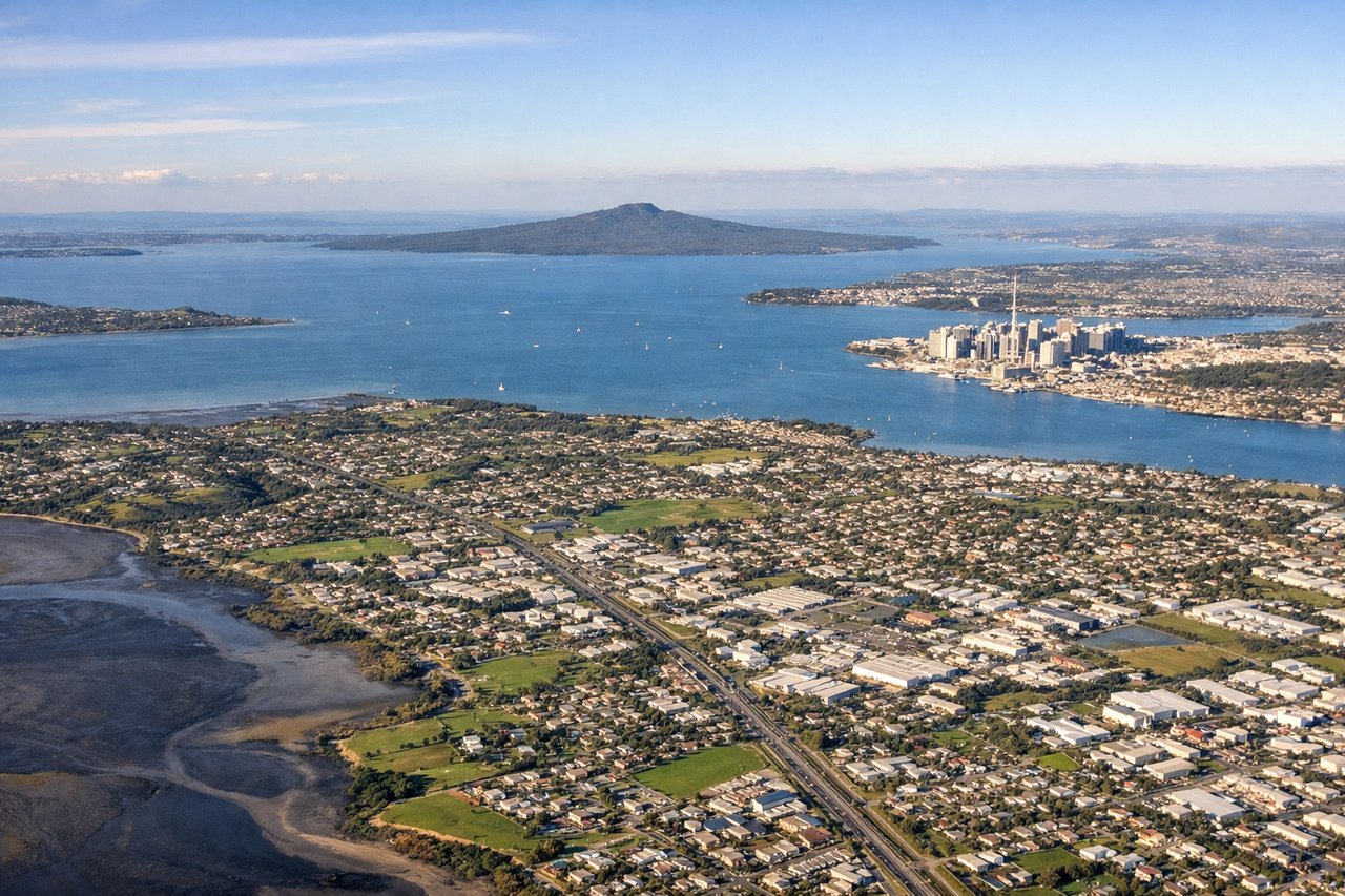
Landing at AKL
RIGHTAuckland's approach from the north-northeast crosses the Hauraki Gulf and enters over the Waitakere Ranges, providing dramatic volcanic terrain, the city's harbors (Waitemata and Manukau), and the isthmus geography. The landing sequence offers concentrated urban and topographic interest unavailable on the left.
Will your flight be in sunlight?
Pick a date and time in the Sun Map to watch the sun move across your whole flight.
About This Route
Which side of the plane should I sit on flying from Haikou Meilan International Airport (HAK) to Auckland International (AKL)?
Sit on the Right side of the plane for the best views on flights from Haikou to Auckland. The right side scores 3.5 versus left's 2.5 because Auckland's approach delivers concentrated scenic drama—volcanic ranges, harbors, and urban skyline—while the departure from Haikou is brief coastal scenery before 10+ hours of open ocean. The landing sequence on the right substantially outweighs the modest takeoff advantage on the left.
What can I see during takeoff from Haikou Meilan International Airport in Haikou?
During takeoff from Haikou Meilan International Airport (HAK), sit on the Left side for the best views. Haikou's departure over the northern coast of Hainan Island offers immediate coastal scenery with the Qiongzhou Strait visible to the north, separating Hainan from Guangdong Province. The island's interior terrain provides brief topographic variation before ocean dominates. Notable sights include: Qiongzhou Strait, Hainan Island coastline, Wenchang City to the northeast, South China Sea.
What can I see when landing at Auckland International in Auckland?
When landing at Auckland International (AKL), sit on the Right side for the best views. Auckland's approach from the north-northeast crosses the Hauraki Gulf and enters over the Waitakere Ranges, providing dramatic volcanic terrain, the city's harbors (Waitemata and Manukau), and the isthmus geography. The landing sequence offers concentrated urban and topographic interest unavailable on the left. Notable sights include: Waitakere Ranges, Hauraki Gulf, Waitemata Harbour, Auckland city skyline and isthmus.
How long is the flight from Haikou to Auckland?
The flight from Haikou Meilan International Airport (HAK) to Auckland International (AKL) takes about 10 hours 35 minutes. The shortest flight path between them is 5,742 miles (9,241 km); winds and air traffic control usually add a few percent.
What does the Haikou to Auckland flight path pass over?
The flight path crosses the South China Sea, Philippine Sea, and western Pacific Ocean. Notable waypoints include passage south of the Philippines (Mindanao visible on some routing), crossing the equator over open ocean, and approaching New Zealand from the north across the Tasman Sea. No significant land features are visible during the 8-10 hour cruise phase; the route is predominantly over deep ocean with occasional tropical storm systems and scattered island groups (Fiji, Samoa region) potentially visible but typically 100+ miles from the standard flight corridor.