Right side offers more dramatic geography: the Hudson Valley and Catskills on departure, then the Appalachian foothills and Ohio River valley during cruise, and finally the transition to the flat Midwest. Left side is mostly overland with fewer distinctive visual markers until the final approach to Chicago.
Flown ALB to MDW? Did we get it right?
Flight Path
Albany to Chicago is 716 miles (1,152 km), a flight of about 2 hours 5 minutes.
The flight crosses the Appalachian plateau, passing over Pennsylvania's ridge-and-valley topography (visible as parallel ridgelines running northeast-southwest), the Ohio River valley near the Pennsylvania-Ohio border, and transitions into the flat glaciated terrain of Ohio and Indiana. The Allegheny Mountains and their foothills dominate the midpoint; Lake Erie is visible to the north if flying a northern routing. The landscape gradually flattens as you approach the Midwest, with agricultural grid patterns becoming increasingly visible over Indiana.
Great circle distance and headings ›

Phase by phase
Takeoff from ALB
RIGHTRight side captures the Hudson River valley and Catskill Mountains as you climb westbound. Albany typically departs runway 02 (northbound) or 20 (southbound), but either way, a westbound climb-out shows the river system and ridge topography that defines the region's character.
Landing at MDW
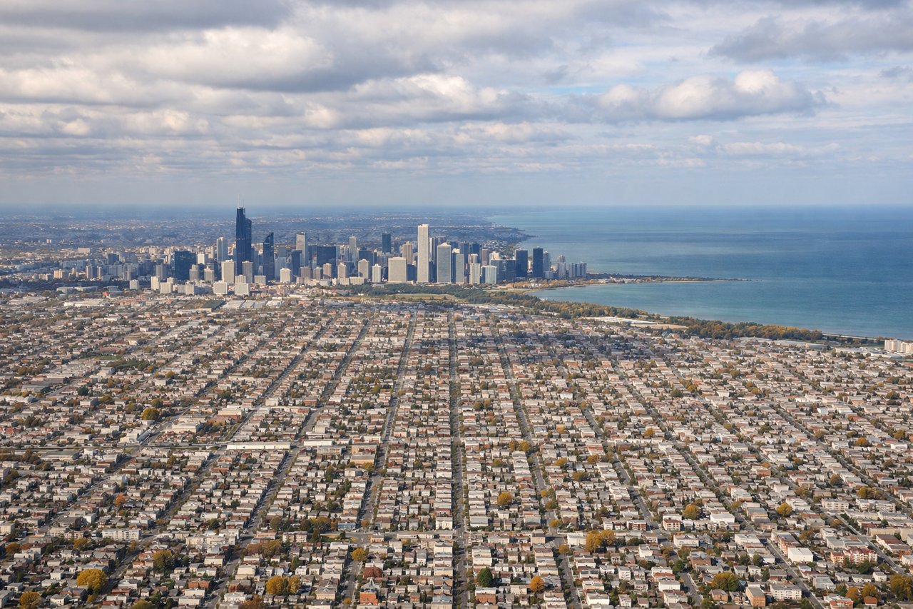
LEFTLeft side on approach to Midway (typically runway 31L/31R, heading east-northeast) shows Lake Michigan and Chicago's downtown skyline. The lake's western shore and the city's distinctive grid layout are prominent on final approach.
Will your flight be in sunlight?
Pick a date and time in the Sun Map to watch the sun move across your whole flight.
About This Route
Which side of the plane should I sit on flying from Albany International (ALB) to Chicago Midway International (MDW)?
Sit on the Right side of the plane for the best views on flights from Albany to Chicago. Right side offers more dramatic geography: the Hudson Valley and Catskills on departure, then the Appalachian foothills and Ohio River valley during cruise, and finally the transition to the flat Midwest. Left side is mostly overland with fewer distinctive visual markers until the final approach to Chicago.
What can I see during takeoff from Albany International in Albany?
During takeoff from Albany International (ALB), sit on the Right side for the best views. Right side captures the Hudson River valley and Catskill Mountains as you climb westbound. Albany typically departs runway 02 (northbound) or 20 (southbound), but either way, a westbound climb-out shows the river system and ridge topography that defines the region's character. Notable sights include: Hudson River (flowing south below), Catskill Mountains (southwest, appearing as a ridgeline), Mohawk River confluence (visible near Albany), Albany city grid (directly below during initial climb).
What can I see when landing at Chicago Midway International in Chicago?
When landing at Chicago Midway International (MDW), sit on the Left side for the best views. Left side on approach to Midway (typically runway 31L/31R, heading east-northeast) shows Lake Michigan and Chicago's downtown skyline. The lake's western shore and the city's distinctive grid layout are prominent on final approach. Notable sights include: Lake Michigan (large body of water, western shore visible), Chicago downtown skyline (recognizable cluster of tall buildings), Chicago Midway International Airport (visible as runway complex), Illinois prairie (flat terrain surrounding the city).
How long is the flight from Albany to Chicago?
The flight from Albany International (ALB) to Chicago Midway International (MDW) takes about 2 hours 5 minutes. The shortest flight path between them is 716 miles (1,152 km); winds and air traffic control usually add a few percent.
What does the Albany to Chicago flight path pass over?
The flight crosses the Appalachian plateau, passing over Pennsylvania's ridge-and-valley topography (visible as parallel ridgelines running northeast-southwest), the Ohio River valley near the Pennsylvania-Ohio border, and transitions into the flat glaciated terrain of Ohio and Indiana. The Allegheny Mountains and their foothills dominate the midpoint; Lake Erie is visible to the north if flying a northern routing. The landscape gradually flattens as you approach the Midwest, with agricultural grid patterns becoming increasingly visible over Indiana.