While takeoff slightly favors the right side (Ahmedabad's urban river scenery), the landing experience on the left side is substantially more dramatic. The Shivalik Range foothills and Doon Valley's distinctive enclosed geography provide genuine terrain drama during descent and approach—a feature absent on the right side's flat plains continuation. The landing experience carries greater weight on a short flight, making left the superior choice overall.
Flown AMD to DED? Did we get it right?
Flight Path
Ahmedabad to Dehra Dun is 599 miles (963 km), a flight of about 1 hour 15 minutes.
Mahi River valley (Gujarat-Rajasthan border), transition from Gujarat plains to Rajasthan's undulating terrain, scattered towns along NH-48 corridor, gradual elevation gain approaching Uttar Pradesh foothills
Great circle distance and headings ›Phase by phase
Takeoff from AMD
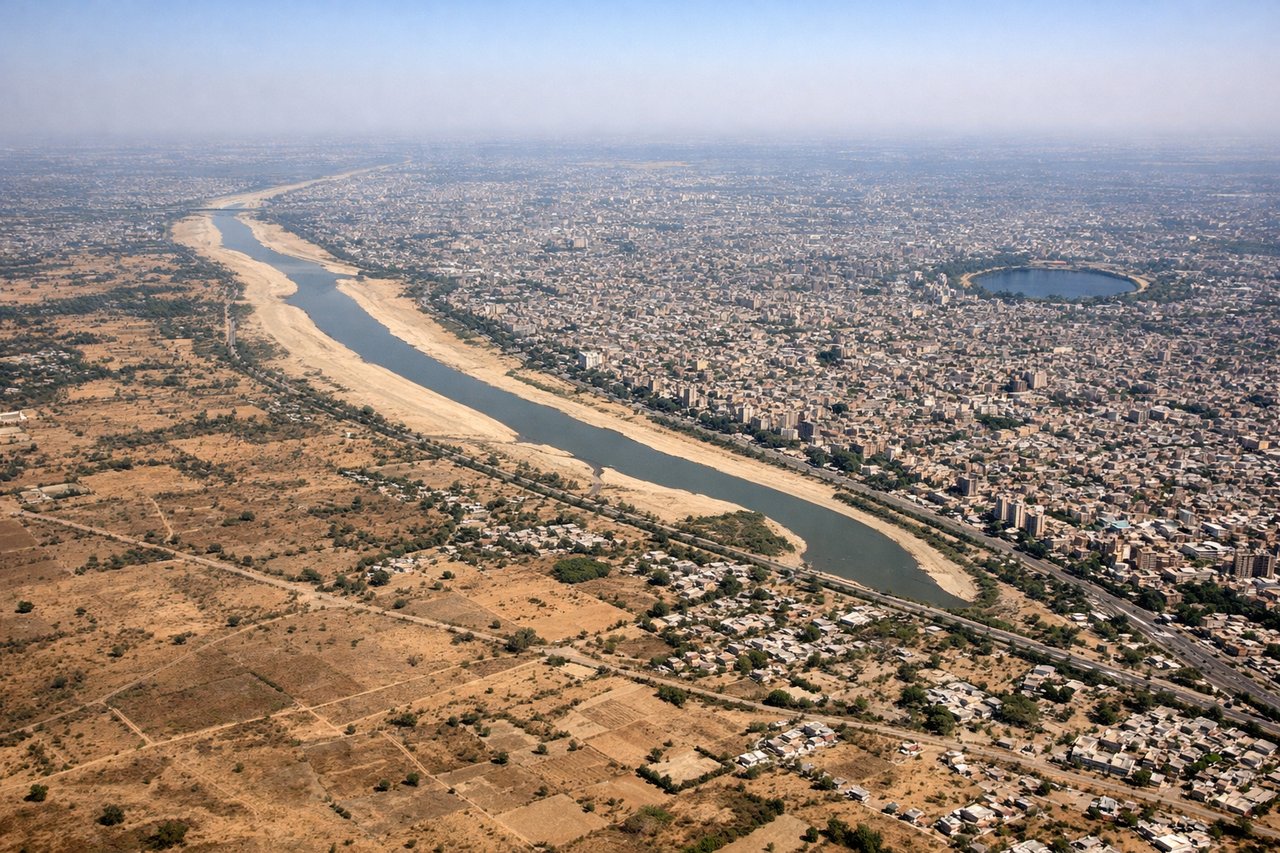
RIGHTRight side captures the urban sprawl of Ahmedabad during initial climb, with the Sabarmati River visible as a defining linear feature threading through the city. Left side departs over flat agricultural plains with minimal visual interest.
Landing at DED
LEFTLeft side offers the dramatic approach into Dehradun's Doon Valley, with the Shivalik Range foothills rising prominently as the aircraft descends. The valley's distinctive geography—hemmed by mountains on three sides—becomes increasingly visible. Right side shows only the continuation of the Gangetic plains with minimal terrain variation.
Will your flight be in sunlight?
Pick a date and time in the Sun Map to watch the sun move across your whole flight.
About This Route
Which side of the plane should I sit on flying from Ahmedabad (AMD) to Dehradun (DED)?
Sit on the Left side of the plane for the best views on flights from Ahmedabad to Dehra Dun. While takeoff slightly favors the right side (Ahmedabad's urban river scenery), the landing experience on the left side is substantially more dramatic. The Shivalik Range foothills and Doon Valley's distinctive enclosed geography provide genuine terrain drama during descent and approach—a feature absent on the right side's flat plains continuation. The landing experience carries greater weight on a short flight, making left the superior choice overall.
What can I see during takeoff from Ahmedabad in Ahmedabad?
During takeoff from Ahmedabad (AMD), sit on the Right side for the best views. Right side captures the urban sprawl of Ahmedabad during initial climb, with the Sabarmati River visible as a defining linear feature threading through the city. Left side departs over flat agricultural plains with minimal visual interest. Notable sights include: Sabarmati River, Ahmedabad urban grid, flat Gujarat plains extending westward.
What can I see when landing at Dehradun in Dehra Dun?
When landing at Dehradun (DED), sit on the Left side for the best views. Left side offers the dramatic approach into Dehradun's Doon Valley, with the Shivalik Range foothills rising prominently as the aircraft descends. The valley's distinctive geography—hemmed by mountains on three sides—becomes increasingly visible. Right side shows only the continuation of the Gangetic plains with minimal terrain variation. Notable sights include: Shivalik Range foothills, Doon Valley formation, Dehradun city nestled in valley floor, Yamuna River.
How long is the flight from Ahmedabad to Dehra Dun?
The flight from Ahmedabad (AMD) to Dehradun (DED) takes about 1 hour 15 minutes. The shortest flight path between them is 599 miles (963 km); winds and air traffic control usually add a few percent.
What does the Ahmedabad to Dehra Dun flight path pass over?
Mahi River valley (Gujarat-Rajasthan border), transition from Gujarat plains to Rajasthan's undulating terrain, scattered towns along NH-48 corridor, gradual elevation gain approaching Uttar Pradesh foothills