Both sides score equally for the full flight due to the route's geography: the departure from Amsterdam offers modest urban and polder scenery, while the arrival into Panama City Beach provides comparable coastal and beach development views. However, the right side edges ahead slightly because the approach into ECP delivers more visually distinctive features (barrier islands, shallow bay waters, beach development contrast) compared to the departure's relatively flat polder landscape. The landing sequence on the right is more scenic than the takeoff on the left.
Flown AMS to ECP? Did we get it right?
Flight Path
Amsterdam to Panama City Beach is 4,612 miles (7,422 km), a flight of about 8 hours 45 minutes.
The flight crosses the Atlantic Ocean for approximately 5 hours with minimal scenic features—open water dominates the mid-cruise phase. Notable waypoints include the Irish coast (if visible during westbound departure routing), the Azores region (far to the south of typical routing), and the approach to the North American continent near Newfoundland or Nova Scotia. The eastern seaboard of the United States becomes visible during descent, with the Appalachian foothills visible from altitude before the final approach to the Florida Panhandle. The majority of the flight is over open ocean with no significant landmarks visible from cruise altitude.
Great circle distance and headings ›


Phase by phase
Takeoff from AMS
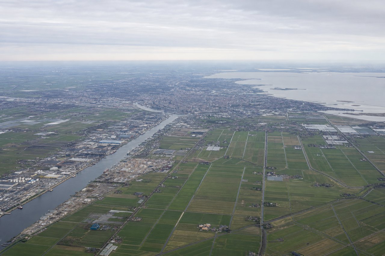
LEFTLeft side captures Amsterdam's urban waterscape and the North Sea coast during initial climb. Schiphol's departure procedures typically route northwestward or northeastward depending on runway and wind, offering views of the Ijsselmeer (inland sea) and the Dutch polder landscape with its distinctive water management features.
Landing at ECP
RIGHTRight side offers superior approach scenery into Panama City Beach. The descent and approach into ECP typically follows a southbound or southeastbound vector (runway 34 in common conditions), providing views of the Florida Panhandle coastline, the Gulf of Mexico, and the distinctive barrier islands and beach development of the Panama City area.
Will your flight be in sunlight?
Pick a date and time in the Sun Map to watch the sun move across your whole flight.
About This Route
Which side of the plane should I sit on flying from Schiphol (AMS) to Northwest Florida Beaches International Airport (ECP)?
Sit on the Right side of the plane for the best views on flights from Amsterdam to Panama City Beach. Both sides score equally for the full flight due to the route's geography: the departure from Amsterdam offers modest urban and polder scenery, while the arrival into Panama City Beach provides comparable coastal and beach development views. However, the right side edges ahead slightly because the approach into ECP delivers more visually distinctive features (barrier islands, shallow bay waters, beach development contrast) compared to the departure's relatively flat polder landscape. The landing sequence on the right is more scenic than the takeoff on the left.
What can I see during takeoff from Schiphol in Amsterdam?
During takeoff from Schiphol (AMS), sit on the Left side for the best views. Left side captures Amsterdam's urban waterscape and the North Sea coast during initial climb. Schiphol's departure procedures typically route northwestward or northeastward depending on runway and wind, offering views of the Ijsselmeer (inland sea) and the Dutch polder landscape with its distinctive water management features. Notable sights include: Ijsselmeer (large inland water body), Amsterdam city center and harbor districts, North Sea coastline, Dutch polder grid pattern with canals and dikes.
What can I see when landing at Northwest Florida Beaches International Airport in Panama City Beach?
When landing at Northwest Florida Beaches International Airport (ECP), sit on the Right side for the best views. Right side offers superior approach scenery into Panama City Beach. The descent and approach into ECP typically follows a southbound or southeastbound vector (runway 34 in common conditions), providing views of the Florida Panhandle coastline, the Gulf of Mexico, and the distinctive barrier islands and beach development of the Panama City area. Notable sights include: Gulf of Mexico coastline, Panama City Beach barrier islands and development, St. Andrew Bay, coastal dune systems and beach erosion patterns.
How long is the flight from Amsterdam to Panama City Beach?
The flight from Schiphol (AMS) to Northwest Florida Beaches International Airport (ECP) takes about 8 hours 45 minutes. The shortest flight path between them is 4,612 miles (7,422 km); winds and air traffic control usually add a few percent.
What does the Amsterdam to Panama City Beach flight path pass over?
The flight crosses the Atlantic Ocean for approximately 5 hours with minimal scenic features—open water dominates the mid-cruise phase. Notable waypoints include the Irish coast (if visible during westbound departure routing), the Azores region (far to the south of typical routing), and the approach to the North American continent near Newfoundland or Nova Scotia. The eastern seaboard of the United States becomes visible during descent, with the Appalachian foothills visible from altitude before the final approach to the Florida Panhandle. The majority of the flight is over open ocean with no significant landmarks visible from cruise altitude.