While the takeoff offers interesting Dutch delta views from the left, the landing approach on the right provides far more dramatic and visually distinctive scenery—the Great Rift Valley, volcanic highlands, and East African topography are significantly more impressive than the relatively flat Netherlands departure.
Flown AMS to NBO? Did we get it right?
Flight Path
Amsterdam to Nairobi is 4,149 miles (6,677 km), a flight of about 7 hours 25 minutes.
The flight path crosses the Mediterranean Sea south of Greece and Crete, then continues over Libya's Saharan plateau (relatively featureless from altitude), crosses into Egypt over the Nile Delta region, then proceeds southeast over Sudan and South Sudan's savanna and river systems before entering East Africa. Notable midpoint landmarks include the Nile Delta (visible as a bright green fan-shaped feature against desert), the Red Sea to the east, and the transition from North African desert to East African highlands as you approach Kenya.
Great circle distance and headings ›


Phase by phase
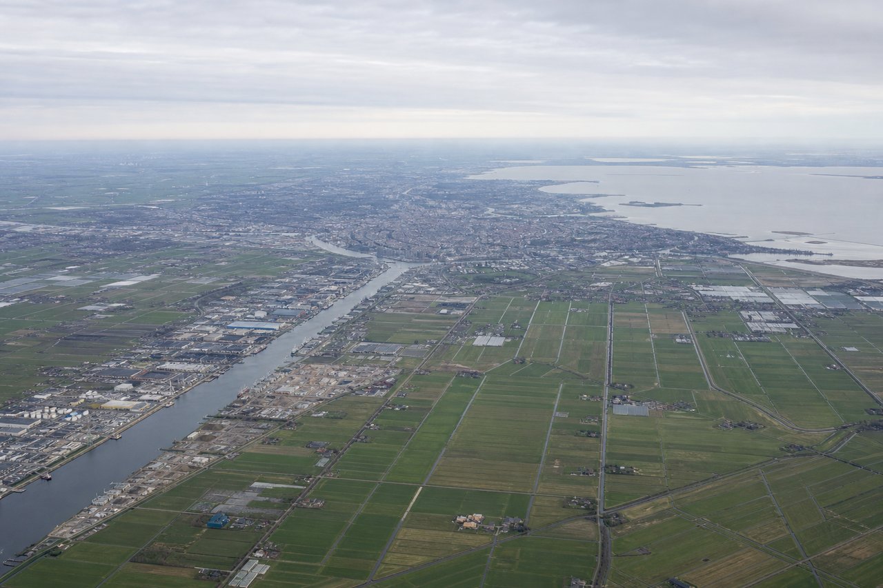
Takeoff from AMS
LEFTLeft side offers views of the North Sea coast and the Rhine-Meuse Delta as the aircraft climbs southeast. You'll see the intricate waterways, polders, and coastal geography that define the Netherlands' landscape during the initial climb-out.
Landing at NBO
RIGHTRight side provides excellent views during descent into Nairobi. You'll see the East African highlands, the Great Rift Valley escarpment, and the Nairobi National Park area as the aircraft approaches from the northwest. The terrain becomes increasingly dramatic with volcanic peaks and the distinctive valley topography.
Will your flight be in sunlight?
Pick a date and time in the Sun Map to watch the sun move across your whole flight.
About This Route
Which side of the plane should I sit on flying from Schiphol (AMS) to Jomo Kenyatta International (NBO)?
Sit on the Right side of the plane for the best views on flights from Amsterdam to Nairobi. While the takeoff offers interesting Dutch delta views from the left, the landing approach on the right provides far more dramatic and visually distinctive scenery—the Great Rift Valley, volcanic highlands, and East African topography are significantly more impressive than the relatively flat Netherlands departure.
What can I see during takeoff from Schiphol in Amsterdam?
During takeoff from Schiphol (AMS), sit on the Left side for the best views. Left side offers views of the North Sea coast and the Rhine-Meuse Delta as the aircraft climbs southeast. You'll see the intricate waterways, polders, and coastal geography that define the Netherlands' landscape during the initial climb-out. Notable sights include: North Sea coastline, Rhine-Meuse Delta wetlands, Ijsselmeer lake, Belgian coast to the south.
What can I see when landing at Jomo Kenyatta International in Nairobi?
When landing at Jomo Kenyatta International (NBO), sit on the Right side for the best views. Right side provides excellent views during descent into Nairobi. You'll see the East African highlands, the Great Rift Valley escarpment, and the Nairobi National Park area as the aircraft approaches from the northwest. The terrain becomes increasingly dramatic with volcanic peaks and the distinctive valley topography. Notable sights include: Great Rift Valley escarpment, Mount Kenya (distant, on horizon), Nairobi National Park, Ngong Hills.
How long is the flight from Amsterdam to Nairobi?
The flight from Schiphol (AMS) to Jomo Kenyatta International (NBO) takes about 7 hours 25 minutes. The shortest flight path between them is 4,149 miles (6,677 km); winds and air traffic control usually add a few percent.
What does the Amsterdam to Nairobi flight path pass over?
The flight path crosses the Mediterranean Sea south of Greece and Crete, then continues over Libya's Saharan plateau (relatively featureless from altitude), crosses into Egypt over the Nile Delta region, then proceeds southeast over Sudan and South Sudan's savanna and river systems before entering East Africa. Notable midpoint landmarks include the Nile Delta (visible as a bright green fan-shaped feature against desert), the Red Sea to the east, and the transition from North African desert to East African highlands as you approach Kenya.