Both sides score equally for the full flight due to the long ocean-dominated cruise phase (5+ hours over Caribbean and Atlantic), which limits either side to 2.0 maximum. However, the right side wins on landing quality: the Panama Canal, Gatun Lake, and Panama City skyline provide distinctive, recognizable landmarks during approach that significantly outweigh the left side's Caribbean Sea views. The takeoff sides are roughly equivalent, but the landing advantage gives right the edge.
Flown AMS to PAC? Did we get it right?
Flight Path
Amsterdam to Panama City is 5,489 miles (8,834 km), a flight of about 9 hours 15 minutes.
The flight crosses the Atlantic Ocean and Caribbean Sea with minimal visible landmarks during cruise. Notable waypoints include the Azores region (if visible during westbound routing), the Caribbean basin, and approach to Central America. The Yucatan Peninsula may be visible during descent toward Panama if the aircraft routes south of typical transatlantic corridors. Most of the 9+ hour flight is over open ocean with no significant terrain features.
Great circle distance and headings ›Phase by phase
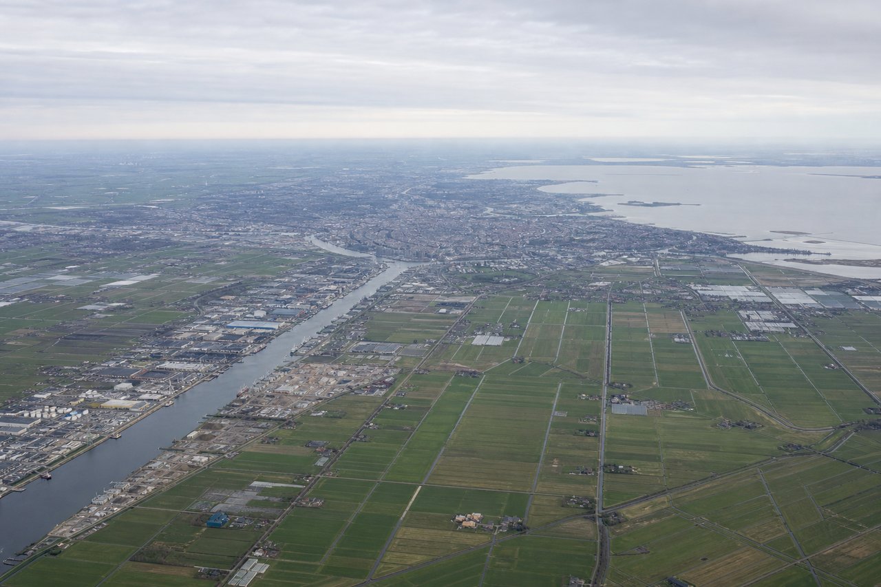
Takeoff from AMS
LEFTLeft side captures Amsterdam's urban sprawl, the Ijsselmeer lake system, and the North Sea coastline during initial climb. Right side shows flat polder farmland with minimal visual interest during departure.
Landing at PAC
RIGHTRight side offers superior approach scenery: the Panama Canal's Gatun Lake, the Bridge of the Americas, and Panama City's skyline are visible during descent and final approach. Left side shows primarily Caribbean Sea and less distinctive terrain.
Will your flight be in sunlight?
Pick a date and time in the Sun Map to watch the sun move across your whole flight.
About This Route
Which side of the plane should I sit on flying from Schiphol (AMS) to Marcos A Gelabert International (PAC)?
Sit on the Right side of the plane for the best views on flights from Amsterdam to Panama City. Both sides score equally for the full flight due to the long ocean-dominated cruise phase (5+ hours over Caribbean and Atlantic), which limits either side to 2.0 maximum. However, the right side wins on landing quality: the Panama Canal, Gatun Lake, and Panama City skyline provide distinctive, recognizable landmarks during approach that significantly outweigh the left side's Caribbean Sea views. The takeoff sides are roughly equivalent, but the landing advantage gives right the edge.
What can I see during takeoff from Schiphol in Amsterdam?
During takeoff from Schiphol (AMS), sit on the Left side for the best views. Left side captures Amsterdam's urban sprawl, the Ijsselmeer lake system, and the North Sea coastline during initial climb. Right side shows flat polder farmland with minimal visual interest during departure. Notable sights include: Ijsselmeer (large freshwater lake northeast of Schiphol), North Sea coastline, Amsterdam city grid and harbor, Schiphol's runway complex.
What can I see when landing at Marcos A Gelabert International in Panama City?
When landing at Marcos A Gelabert International (PAC), sit on the Right side for the best views. Right side offers superior approach scenery: the Panama Canal's Gatun Lake, the Bridge of the Americas, and Panama City's skyline are visible during descent and final approach. Left side shows primarily Caribbean Sea and less distinctive terrain. Notable sights include: Gatun Lake (massive artificial reservoir), Bridge of the Americas (iconic cable-stayed bridge), Panama City skyline and harbor, Panama Canal approach channel.
How long is the flight from Amsterdam to Panama City?
The flight from Schiphol (AMS) to Marcos A Gelabert International (PAC) takes about 9 hours 15 minutes. The shortest flight path between them is 5,489 miles (8,834 km); winds and air traffic control usually add a few percent.
What does the Amsterdam to Panama City flight path pass over?
The flight crosses the Atlantic Ocean and Caribbean Sea with minimal visible landmarks during cruise. Notable waypoints include the Azores region (if visible during westbound routing), the Caribbean basin, and approach to Central America. The Yucatan Peninsula may be visible during descent toward Panama if the aircraft routes south of typical transatlantic corridors. Most of the 9+ hour flight is over open ocean with no significant terrain features.