The right side wins overall primarily for the Amsterdam departure, which offers one of Europe's most distinctive aerial views — the canal ring is genuinely spectacular from 3,000-5,000 feet. The landing advantage on the left is real but the HCMC approach view, while interesting, is less uniquely dramatic. Over the long flight the right side also faces south across the Indian subcontinent, giving views of the Ganges plain and Mekong delta approaches.
Flown AMS to SGN? Did we get it right?
Flight Path
Amsterdam to Ho Chi Minh City is 6,120 miles (9,849 km), a flight of about 11 hours 30 minutes.
Route typically tracks southeast over Germany and Austria, then across Turkey and the Black Sea region, over Iran and the Persian Gulf states, across the Arabian Sea, over the Indian subcontinent (crossing the Ganges plain and potentially the Deccan Plateau), then over the Bay of Bengal, across the Malay Peninsula or Gulf of Thailand, and descending over the Mekong Delta into Ho Chi Minh City. The Himalayas may be visible as a distant white line on the northern horizon depending on exact routing. The Irrawaddy and Mekong river systems are visible from altitude over Myanmar and Indochina.
Great circle distance and headings ›


Phase by phase
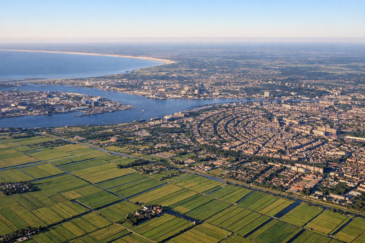
Takeoff from AMS
RIGHTSchiphol's primary departure runways (18R/36L and 18C/36C) mean southbound departures track over the Haarlemmermeer polder and then Amsterdam city. Right side gives you Amsterdam's canal ring, the IJ waterway, and the city center as you climb out heading southeast. Left side faces open polder farmland toward Leiden.

Landing at SGN
LEFTTan Son Nhat's main arrival runway 25L/07R means aircraft typically approach from the east over the city. On a runway 25L approach heading west, the left side faces south over central Ho Chi Minh City — District 1's dense urban grid, the Saigon River bends, and the sprawling low-rise urban fabric are all clearly visible. Right side faces north toward industrial outskirts.
Will your flight be in sunlight?
Pick a date and time in the Sun Map to watch the sun move across your whole flight.
About This Route
Which side of the plane should I sit on flying from Schiphol (AMS) to Tansonnhat International (SGN)?
Sit on the Right side of the plane for the best views on flights from Amsterdam to Ho Chi Minh City. The right side wins overall primarily for the Amsterdam departure, which offers one of Europe's most distinctive aerial views — the canal ring is genuinely spectacular from 3,000-5,000 feet. The landing advantage on the left is real but the HCMC approach view, while interesting, is less uniquely dramatic. Over the long flight the right side also faces south across the Indian subcontinent, giving views of the Ganges plain and Mekong delta approaches.
What can I see during takeoff from Schiphol in Amsterdam?
During takeoff from Schiphol (AMS), sit on the Right side for the best views. Schiphol's primary departure runways (18R/36L and 18C/36C) mean southbound departures track over the Haarlemmermeer polder and then Amsterdam city. Right side gives you Amsterdam's canal ring, the IJ waterway, and the city center as you climb out heading southeast. Left side faces open polder farmland toward Leiden. Notable sights include: Amsterdam canal ring (grachtengordel), IJ waterway and Amsterdam Centraal area, Haarlemmermeer polder grid, Amstel River threading south through the city.
What can I see when landing at Tansonnhat International in Ho Chi Minh City?
When landing at Tansonnhat International (SGN), sit on the Left side for the best views. Tan Son Nhat's main arrival runway 25L/07R means aircraft typically approach from the east over the city. On a runway 25L approach heading west, the left side faces south over central Ho Chi Minh City — District 1's dense urban grid, the Saigon River bends, and the sprawling low-rise urban fabric are all clearly visible. Right side faces north toward industrial outskirts. Notable sights include: Saigon River and its distinctive bend through the city, District 1 urban core, Ben Nghe Channel, sprawling low-rise residential districts of HCMC.
How long is the flight from Amsterdam to Ho Chi Minh City?
The flight from Schiphol (AMS) to Tansonnhat International (SGN) takes about 11 hours 30 minutes. The shortest flight path between them is 6,120 miles (9,849 km); winds and air traffic control usually add a few percent.
What does the Amsterdam to Ho Chi Minh City flight path pass over?
Route typically tracks southeast over Germany and Austria, then across Turkey and the Black Sea region, over Iran and the Persian Gulf states, across the Arabian Sea, over the Indian subcontinent (crossing the Ganges plain and potentially the Deccan Plateau), then over the Bay of Bengal, across the Malay Peninsula or Gulf of Thailand, and descending over the Mekong Delta into Ho Chi Minh City. The Himalayas may be visible as a distant white line on the northern horizon depending on exact routing. The Irrawaddy and Mekong river systems are visible from altitude over Myanmar and Indochina.