Amsterdam to Dawson Creek is 4,340 miles (6,985 km), a flight of about 10 hours.
While the takeoff from Amsterdam offers interesting Dutch water and polder views, the landing approach into Dawson Creek on the right side showcases the dramatic transition from boreal forest to the northern Rocky Mountains and Cassiar ranges—far more visually striking and geographically distinctive than the relatively flat Dutch landscape.
Flight Path
The flight path crosses the Atlantic Ocean (no landmarks visible for roughly 4-5 hours), then enters North American airspace over Newfoundland and Labrador. Over central Canada, you'll pass over the Canadian Shield (visible as vast boreal forest with lakes and rivers), the Great Lakes region (if routed south), and eventually the transition zone between the Canadian prairies and the foothills of the Rocky Mountains in Alberta and British Columbia. The most notable midpoint feature is the transition from flat prairie to increasingly mountainous terrain as you approach western Canada, typically visible in the final 2-3 hours of flight.
Great circle distance and headings ›


Phase by phase
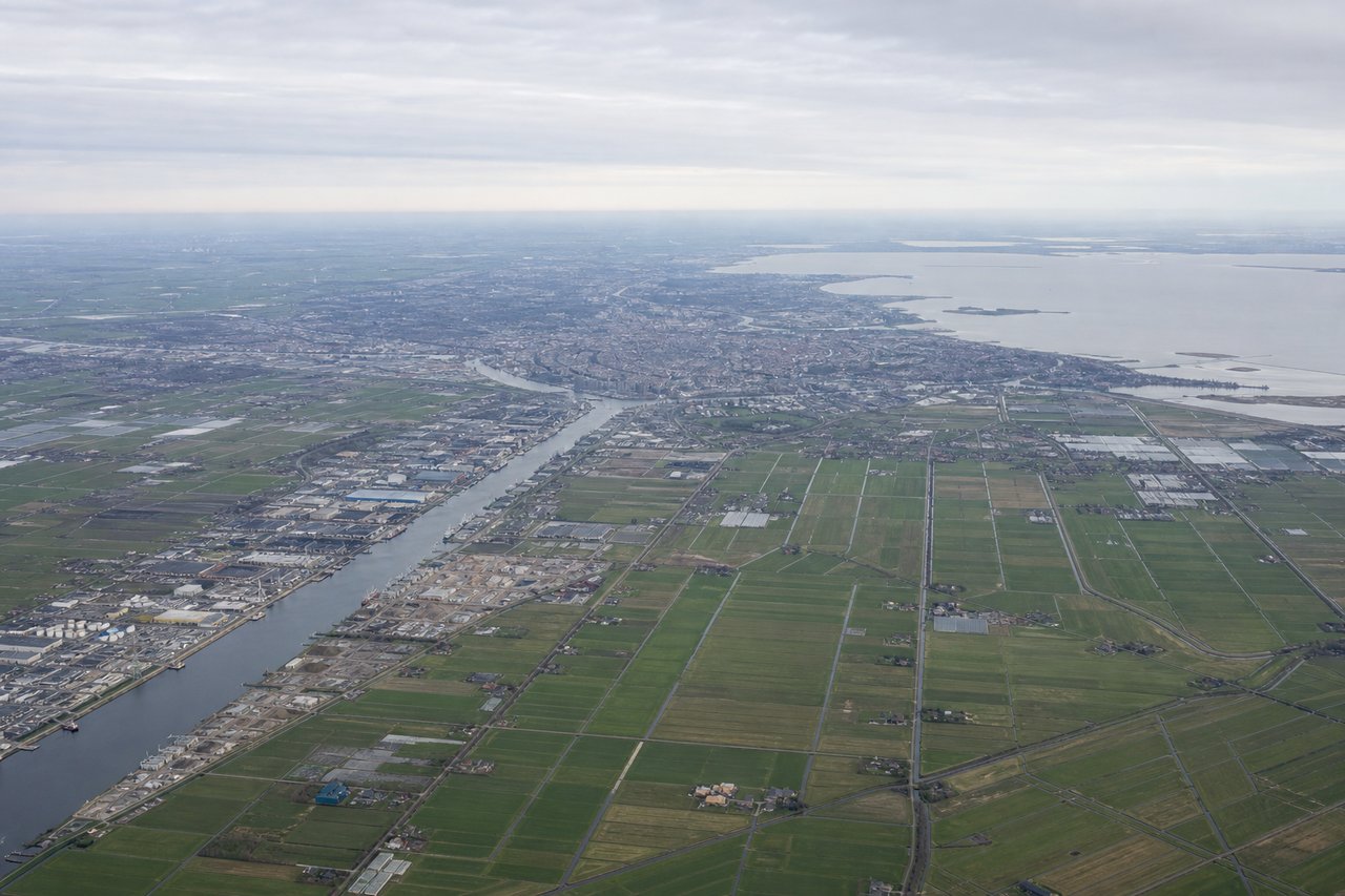
Takeoff from AMS
LEFTLeft side offers views of the North Sea coast and the Dutch inland waterways system as the aircraft climbs northwestward out of Schiphol. You'll see the characteristic patchwork of polders, canals, and the coastline near Den Helder.
Landing at YDQ
RIGHTRight side provides views of the Rocky Mountains and the Cassiar Mountains as you descend into Dawson Creek from the southeast. The terrain transitions from boreal forest to visible mountain ridges, giving dramatic perspective on the northern BC landscape.
Landmarks on this routeAll landmarks →
Will your flight be in sunlight?
Pick a date and time in the Sun Map to watch the sun move across your whole flight.
About This Route
Which side of the plane should I sit on flying from Schiphol (AMS) to Dawson Creek (YDQ)?
Sit on the Right side of the plane for the best views on flights from Amsterdam to Dawson Creek. While the takeoff from Amsterdam offers interesting Dutch water and polder views, the landing approach into Dawson Creek on the right side showcases the dramatic transition from boreal forest to the northern Rocky Mountains and Cassiar ranges—far more visually striking and geographically distinctive than the relatively flat Dutch landscape.
What can I see during takeoff from Schiphol in Amsterdam?
During takeoff from Schiphol (AMS), sit on the Left side for the best views. Left side offers views of the North Sea coast and the Dutch inland waterways system as the aircraft climbs northwestward out of Schiphol. You'll see the characteristic patchwork of polders, canals, and the coastline near Den Helder. Notable sights include: North Sea coastline, Markermeer lake, Afsluitdijk (the major dike), inland polder canal network.
What can I see when landing at Dawson Creek in Dawson Creek?
When landing at Dawson Creek (YDQ), sit on the Right side for the best views. Right side provides views of the Rocky Mountains and the Cassiar Mountains as you descend into Dawson Creek from the southeast. The terrain transitions from boreal forest to visible mountain ridges, giving dramatic perspective on the northern BC landscape. Notable sights include: Rocky Mountains (northern ranges), Cassiar Mountains, Finlay River valley, boreal forest canopy.
How long is the flight from Amsterdam to Dawson Creek?
The flight from Schiphol (AMS) to Dawson Creek (YDQ) takes about 10 hours. The shortest flight path between them is 4,340 miles (6,985 km); winds and air traffic control usually add a few percent.
What does the Amsterdam to Dawson Creek flight path pass over?
The flight path crosses the Atlantic Ocean (no landmarks visible for roughly 4-5 hours), then enters North American airspace over Newfoundland and Labrador. Over central Canada, you'll pass over the Canadian Shield (visible as vast boreal forest with lakes and rivers), the Great Lakes region (if routed south), and eventually the transition zone between the Canadian prairies and the foothills of the Rocky Mountains in Alberta and British Columbia. The most notable midpoint feature is the transition from flat prairie to increasingly mountainous terrain as you approach western Canada, typically visible in the final 2-3 hours of flight.