The takeoff from Anchorage offers more dramatic and visually distinctive scenery with the Chugach Mountains and coastal features. While the Detroit landing provides urban and Great Lakes interest, the Anchorage departure features more pronounced natural landmarks visible from the window.
Flight Path
The flight path crosses interior Alaska and Canada, passing over the Alaska Range (visible from altitude if on a southern routing), then proceeds southeast across British Columbia and Alberta. The Rocky Mountains may be visible if the aircraft maintains a southern corridor. Over the Great Plains of the northern United States (Montana, North Dakota, Minnesota), the landscape transitions to agricultural patchwork and scattered lakes. The flight typically crosses the Great Lakes region in the final descent phase, with Lake Michigan and Lake Huron potentially visible depending on exact routing. No single dramatic midpoint landmark dominates this route; the scenery transitions gradually from subarctic mountains to boreal forest to temperate plains to Great Lakes basin.
Great circle distance and headings ›

.jpg?width=600)

Phase by phase
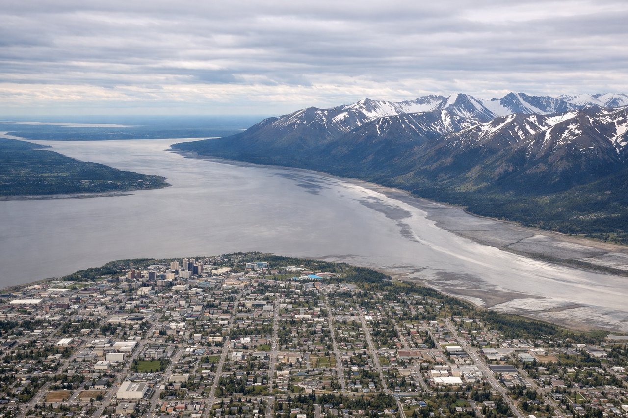
Takeoff from ANC
LEFTLeft side offers immediate views of the Chugach Mountains as the aircraft climbs out southeastward from Anchorage. The range dominates the landscape directly off the left wing during the initial climb phase.
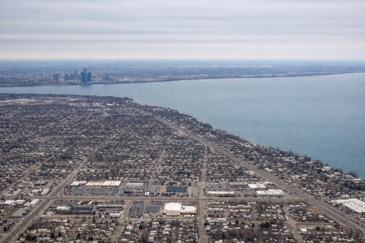
Landing at DTW
RIGHTRight side provides views of the Detroit metropolitan area and the Great Lakes as the aircraft descends into DTW. Lake St. Clair and the Detroit River are visible on approach from the north, with the city's urban sprawl clearly defined.
Landmarks on this routeAll landmarks →
Will your flight be in sunlight?
See exactly which side of the plane gets sun and shade at your departure time.
About This Route
Which side of the plane should I sit on flying from Ted Stevens Anchorage International (ANC) to Detroit Metro Wayne Co (DTW)?
Sit on the Left side of the plane for the best views on flights from Anchorage to Detroit. The takeoff from Anchorage offers more dramatic and visually distinctive scenery with the Chugach Mountains and coastal features. While the Detroit landing provides urban and Great Lakes interest, the Anchorage departure features more pronounced natural landmarks visible from the window.
What can I see during takeoff from Ted Stevens Anchorage International in Anchorage?
During takeoff from Ted Stevens Anchorage International (ANC), sit on the Left side for the best views. Left side offers immediate views of the Chugach Mountains as the aircraft climbs out southeastward from Anchorage. The range dominates the landscape directly off the left wing during the initial climb phase. Notable sights include: Chugach Mountains, Cook Inlet (western view), Turnagain Arm, Anchorage urban area.
What can I see when landing at Detroit Metro Wayne Co in Detroit?
When landing at Detroit Metro Wayne Co (DTW), sit on the Right side for the best views. Right side provides views of the Detroit metropolitan area and the Great Lakes as the aircraft descends into DTW. Lake St. Clair and the Detroit River are visible on approach from the north, with the city's urban sprawl clearly defined. Notable sights include: Lake St. Clair, Detroit River, Detroit metropolitan area, Lake Erie (distant).
How long is the flight from Anchorage to Detroit?
The flight from Ted Stevens Anchorage International (ANC) to Detroit Metro Wayne Co (DTW) takes Approximately 4 hours 45 minutes to 5 hours 15 minutes.
What does the Anchorage to Detroit flight path pass over?
The flight path crosses interior Alaska and Canada, passing over the Alaska Range (visible from altitude if on a southern routing), then proceeds southeast across British Columbia and Alberta. The Rocky Mountains may be visible if the aircraft maintains a southern corridor. Over the Great Plains of the northern United States (Montana, North Dakota, Minnesota), the landscape transitions to agricultural patchwork and scattered lakes. The flight typically crosses the Great Lakes region in the final descent phase, with Lake Michigan and Lake Huron potentially visible depending on exact routing. No single dramatic midpoint landmark dominates this route; the scenery transitions gradually from subarctic mountains to boreal forest to temperate plains to Great Lakes basin.