The takeoff scenery from Anchorage—the Chugach Mountains and Cook Inlet—is more visually dramatic and distinctive than the landing approach into Grand Rapids. The left side during departure offers the most memorable views of this route.
Flown ANC to GRR? Did we get it right?
Flight Path
Anchorage to Grand Rapids is 2,870 miles (4,620 km), a flight of about 5 hours.
The flight path crosses the Alaska-Canada border and traverses the interior of British Columbia and Alberta, passing near or over the Rocky Mountains (visible from either side depending on exact routing), the Mackenzie River system, and the boreal forest landscape of western Canada. The route then descends into the Great Lakes region, crossing over the Canadian Shield and the northern Michigan peninsula before approaching Grand Rapids from the northwest.
Great circle distance and headings ›


Phase by phase
Takeoff from ANC
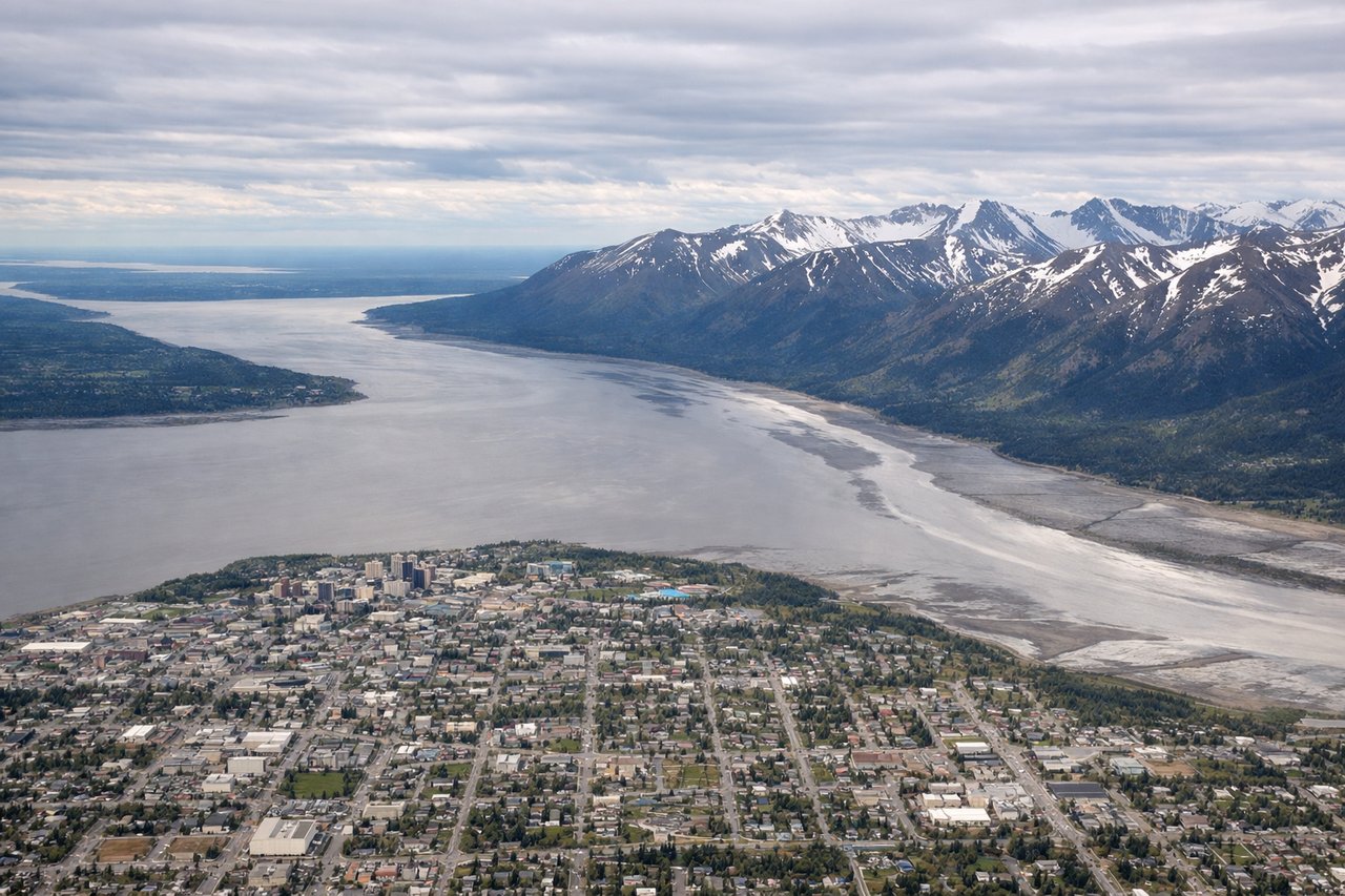
LEFTLeft side offers immediate views of the Chugach Mountains and Cook Inlet as the aircraft climbs out northeastward from Anchorage. The terrain rises dramatically to the left, providing striking alpine scenery within the first 10-15 minutes of flight.
Landing at GRR
RIGHTRight side provides views of the Grand River and the urban landscape of Grand Rapids during descent. The river's distinctive curves and the city's layout are clearly visible from the right side as the aircraft approaches from the northwest.
Will your flight be in sunlight?
Pick a date and time in the Sun Map to watch the sun move across your whole flight.
About This Route
Which side of the plane should I sit on flying from Ted Stevens Anchorage International (ANC) to Gerald R Ford International (GRR)?
Sit on the Left side of the plane for the best views on flights from Anchorage to Grand Rapids. The takeoff scenery from Anchorage—the Chugach Mountains and Cook Inlet—is more visually dramatic and distinctive than the landing approach into Grand Rapids. The left side during departure offers the most memorable views of this route.
What can I see during takeoff from Ted Stevens Anchorage International in Anchorage?
During takeoff from Ted Stevens Anchorage International (ANC), sit on the Left side for the best views. Left side offers immediate views of the Chugach Mountains and Cook Inlet as the aircraft climbs out northeastward from Anchorage. The terrain rises dramatically to the left, providing striking alpine scenery within the first 10-15 minutes of flight. Notable sights include: Chugach Mountains, Cook Inlet, Knik Arm, Anchorage urban area.
What can I see when landing at Gerald R Ford International in Grand Rapids?
When landing at Gerald R Ford International (GRR), sit on the Right side for the best views. Right side provides views of the Grand River and the urban landscape of Grand Rapids during descent. The river's distinctive curves and the city's layout are clearly visible from the right side as the aircraft approaches from the northwest. Notable sights include: Grand River, Grand Rapids urban area, Lake Michigan (distant), forested Michigan landscape.
How long is the flight from Anchorage to Grand Rapids?
The flight from Ted Stevens Anchorage International (ANC) to Gerald R Ford International (GRR) takes about 5 hours. The shortest flight path between them is 2,870 miles (4,620 km); winds and air traffic control usually add a few percent.
What does the Anchorage to Grand Rapids flight path pass over?
The flight path crosses the Alaska-Canada border and traverses the interior of British Columbia and Alberta, passing near or over the Rocky Mountains (visible from either side depending on exact routing), the Mackenzie River system, and the boreal forest landscape of western Canada. The route then descends into the Great Lakes region, crossing over the Canadian Shield and the northern Michigan peninsula before approaching Grand Rapids from the northwest.