While takeoff offers good Andean views on the right, the landing approach on the left provides more dramatic and visually distinctive scenery with the Wasatch Range and Great Salt Lake—two major, easily recognizable landmarks that make the overall flight more rewarding from the left side.
Flight Path
The flight path crosses the high Andes plateau northwestward, passing over the Altiplano region of southern Peru with sparse settlements and high-altitude terrain. As you progress north and west, you'll cross into lower elevations and eventually reach the desert regions of northern Mexico and the southwestern United States. The midpoint roughly corresponds to the Peru-Bolivia border region or northern Chile, characterized by extremely arid, high-altitude plateau with minimal visible features. Later stages cross the Sonoran and Chihuahuan deserts before reaching the Great Basin and the Wasatch Front.
Great circle distance and headings ›
.jpg?width=600)


Phase by phase
Takeoff from ANS
RIGHTClimbing northeast from Andahuaylas, the right side offers immediate views of the high Andes peaks surrounding the valley. You'll see the dramatic escarpment and ridgelines that define this region as you gain altitude.
Landing at SLC
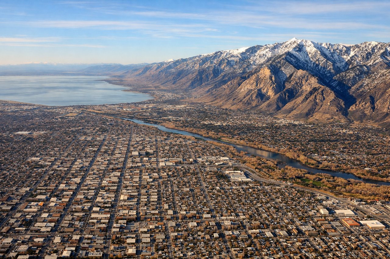
LEFTOn descent into Salt Lake City from the northeast, the left side provides the best views of the Wasatch Range and the Great Salt Lake. You'll see the dramatic mountain wall rising east of the city and the distinctive blue water body to the west.
Landmarks on this routeAll landmarks →
Will your flight be in sunlight?
See exactly which side of the plane gets sun and shade at your departure time.
About This Route
Which side of the plane should I sit on flying from Andahuaylas (ANS) to Salt Lake City International (SLC)?
Sit on the Left side of the plane for the best views on flights from Andahuaylas to Salt Lake City. While takeoff offers good Andean views on the right, the landing approach on the left provides more dramatic and visually distinctive scenery with the Wasatch Range and Great Salt Lake—two major, easily recognizable landmarks that make the overall flight more rewarding from the left side.
What can I see during takeoff from Andahuaylas in Andahuaylas?
During takeoff from Andahuaylas (ANS), sit on the Right side for the best views. Climbing northeast from Andahuaylas, the right side offers immediate views of the high Andes peaks surrounding the valley. You'll see the dramatic escarpment and ridgelines that define this region as you gain altitude. Notable sights include: Andes mountain ridges east of Andahuaylas, Pampas River valley below, high-altitude plateau terrain.
What can I see when landing at Salt Lake City International in Salt Lake City?
When landing at Salt Lake City International (SLC), sit on the Left side for the best views. On descent into Salt Lake City from the northeast, the left side provides the best views of the Wasatch Range and the Great Salt Lake. You'll see the dramatic mountain wall rising east of the city and the distinctive blue water body to the west. Notable sights include: Wasatch Range peaks, Great Salt Lake, Salt Lake City urban grid, Utah Valley to the south.
How long is the flight from Andahuaylas to Salt Lake City?
The flight from Andahuaylas (ANS) to Salt Lake City International (SLC) takes 6h 15m.
What does the Andahuaylas to Salt Lake City flight path pass over?
The flight path crosses the high Andes plateau northwestward, passing over the Altiplano region of southern Peru with sparse settlements and high-altitude terrain. As you progress north and west, you'll cross into lower elevations and eventually reach the desert regions of northern Mexico and the southwestern United States. The midpoint roughly corresponds to the Peru-Bolivia border region or northern Chile, characterized by extremely arid, high-altitude plateau with minimal visible features. Later stages cross the Sonoran and Chihuahuan deserts before reaching the Great Basin and the Wasatch Front.