Aomori to Tokyo is 362 miles (582 km), a flight of about 1 hour 10 minutes.
The left side wins overall because while the right side offers good views of Mutsu Bay on departure, the left side during the flight tracks the Pacific coastline of Tohoku and then delivers the spectacular Tokyo metropolitan approach. The left also gives views of the Ou Mountains running down the spine of Honshu during cruise, and the payoff over Tokyo Bay on landing is the highlight of the route.
Flight Path
The flight tracks roughly south-southwest over the Tohoku region of Honshu. Notable features along the route include the Ou Mountain Range running parallel to the flight path on the right (west), with volcanic peaks including Iwate-san and Kurikoma visible on clear days. The Kitakami lowlands and river valley are visible below on the left side. Further south, the Zao volcanic group appears to the right. As the flight descends toward the Kanto Plain, the broad flat agricultural expanse of Ibaraki and Chiba prefectures becomes visible, transitioning into the massive urban sprawl of Greater Tokyo.
Great circle distance and headings ›Phase by phase
Takeoff from AOJ
RIGHTAomori Airport's primary runway is oriented roughly north-south (runway 06/24). Departures heading south toward Tokyo typically use runway 24, climbing out over the city of Aomori and Aomori Bay to the right. The right side gives you a clear view of Mutsu Bay and the Shimokita Peninsula curving into the sea.
Landing at HND
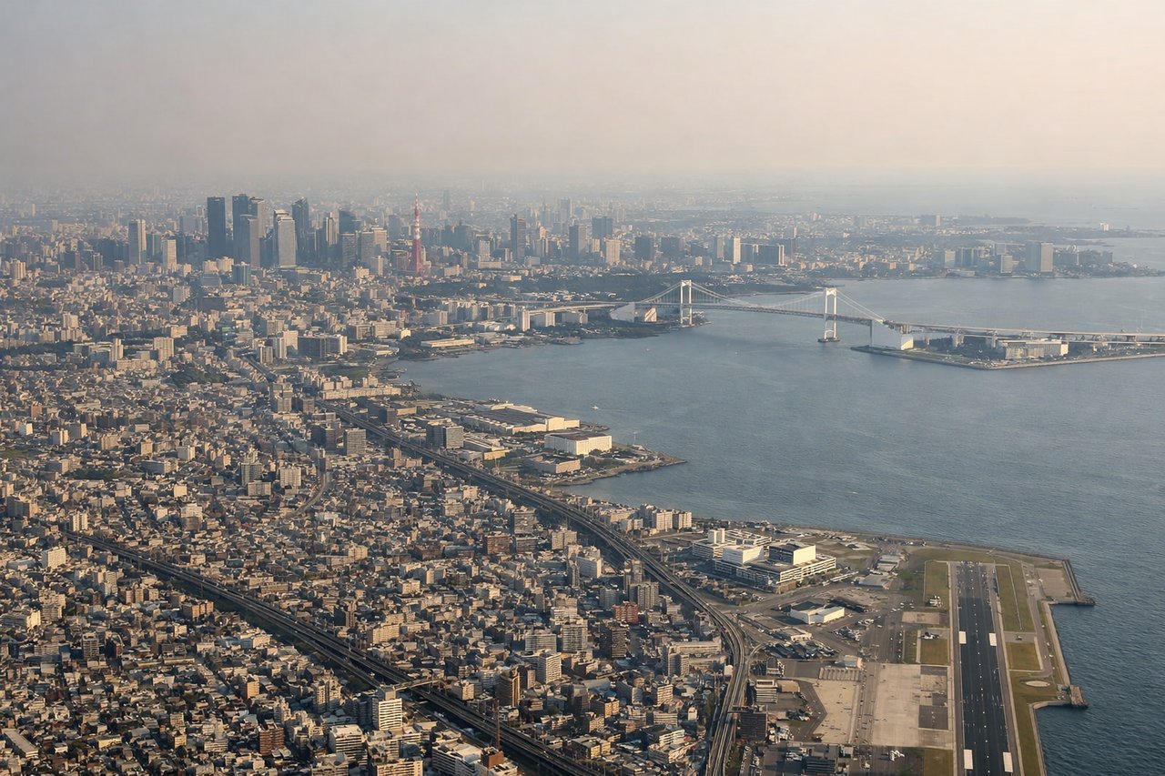
LEFTFlights into Haneda typically approach from the north over Tokyo Bay on runway 34L/34R or from the south. On the common northward approach over the bay, the left side faces west toward the Tokyo skyline, giving clear views of the city center, Tokyo Tower, and the dense urban fabric of the Kanto Plain. The right side faces east over the open bay with less to see.
Landmarks on this routeAll landmarks →
Will your flight be in sunlight?
Pick a date and time in the Sun Map to watch the sun move across your whole flight.
About This Route
Which side of the plane should I sit on flying from Aomori (AOJ) to Tokyo International (HND)?
Sit on the Left side of the plane for the best views on flights from Aomori to Tokyo. The left side wins overall because while the right side offers good views of Mutsu Bay on departure, the left side during the flight tracks the Pacific coastline of Tohoku and then delivers the spectacular Tokyo metropolitan approach. The left also gives views of the Ou Mountains running down the spine of Honshu during cruise, and the payoff over Tokyo Bay on landing is the highlight of the route.
What can I see during takeoff from Aomori in Aomori?
During takeoff from Aomori (AOJ), sit on the Right side for the best views. Aomori Airport's primary runway is oriented roughly north-south (runway 06/24). Departures heading south toward Tokyo typically use runway 24, climbing out over the city of Aomori and Aomori Bay to the right. The right side gives you a clear view of Mutsu Bay and the Shimokita Peninsula curving into the sea. Notable sights include: Aomori Bay and port area, Mutsu Bay, Shimokita Peninsula, Hakkoda Mountains to the southwest.
What can I see when landing at Tokyo International in Tokyo?
When landing at Tokyo International (HND), sit on the Left side for the best views. Flights into Haneda typically approach from the north over Tokyo Bay on runway 34L/34R or from the south. On the common northward approach over the bay, the left side faces west toward the Tokyo skyline, giving clear views of the city center, Tokyo Tower, and the dense urban fabric of the Kanto Plain. The right side faces east over the open bay with less to see. Notable sights include: Tokyo Bay, Tokyo city skyline and waterfront, Rainbow Bridge and Odaiba, Yokohama port area to the south.
How long is the flight from Aomori to Tokyo?
The flight from Aomori (AOJ) to Tokyo International (HND) takes about 1 hour 10 minutes. The shortest flight path between them is 362 miles (582 km); winds and air traffic control usually add a few percent.
What does the Aomori to Tokyo flight path pass over?
The flight tracks roughly south-southwest over the Tohoku region of Honshu. Notable features along the route include the Ou Mountain Range running parallel to the flight path on the right (west), with volcanic peaks including Iwate-san and Kurikoma visible on clear days. The Kitakami lowlands and river valley are visible below on the left side. Further south, the Zao volcanic group appears to the right. As the flight descends toward the Kanto Plain, the broad flat agricultural expanse of Ibaraki and Chiba prefectures becomes visible, transitioning into the massive urban sprawl of Greater Tokyo.