Atlanta to Augusta is 1,075 miles (1,730 km), a flight of about 2 hours 45 minutes.
Both sides score equally low (1.5) due to the short 1-hour flight over relatively flat Piedmont and New England terrain with minimal dramatic geography. Left wins marginally on takeoff scenery (Atlanta urban area and airport complexity) which provides more visual interest during the departure phase, offsetting the right side's modest landing advantage along the Kennebec River.
Flight Path
The flight path crosses the Piedmont plateau of Georgia and South Carolina, then transitions into the New England uplands of southern Maine. Notable features include the Savannah River drainage basin (visible as a broad valley system), scattered lakes and reservoirs in the Piedmont (Lake Hartwell area), and the transition zone where the terrain begins to rise toward the White Mountains region. No major mountain ranges or dramatic topography are visible; the landscape remains predominantly forested rolling terrain throughout the cruise phase.
Great circle distance and headings ›Phase by phase
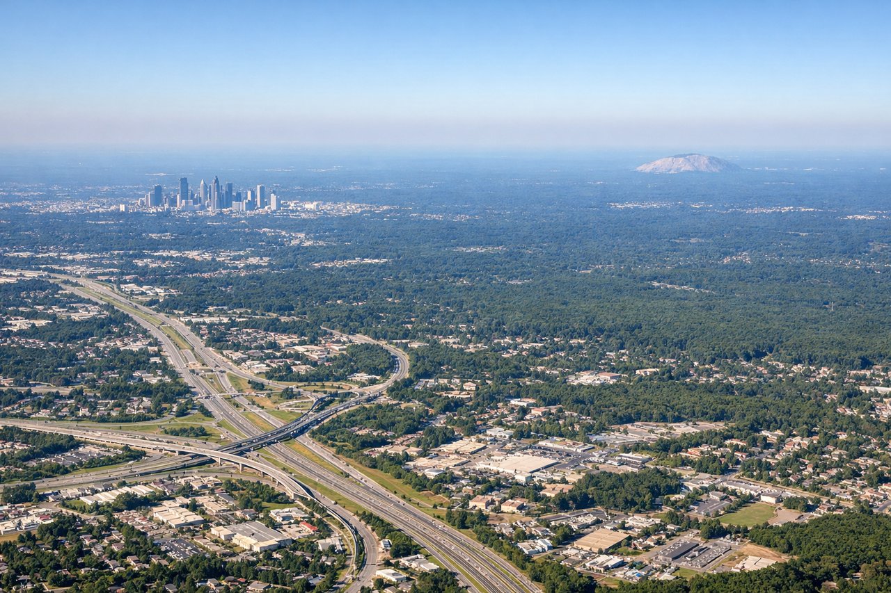
Takeoff from ATL
LEFTLeft side offers brief views of Atlanta's urban sprawl and the Piedmont terrain during initial climb before the aircraft turns northeast. Right side faces open terrain with fewer immediate landmarks.
Landing at AUG
RIGHTRight side provides views of the Kennebec River valley and Augusta's riverfront approach during descent into AUG. Left side faces open woodland with fewer distinctive features during the final approach.
Landmarks on this routeAll landmarks →
Will your flight be in sunlight?
Pick a date and time in the Sun Map to watch the sun move across your whole flight.
About This Route
Which side of the plane should I sit on flying from The William B Hartsfield Atlanta International (ATL) to Augusta State (AUG)?
Sit on the Left side of the plane for the best views on flights from Atlanta to Augusta. Both sides score equally low (1.5) due to the short 1-hour flight over relatively flat Piedmont and New England terrain with minimal dramatic geography. Left wins marginally on takeoff scenery (Atlanta urban area and airport complexity) which provides more visual interest during the departure phase, offsetting the right side's modest landing advantage along the Kennebec River.
What can I see during takeoff from The William B Hartsfield Atlanta International in Atlanta?
During takeoff from The William B Hartsfield Atlanta International (ATL), sit on the Left side for the best views. Left side offers brief views of Atlanta's urban sprawl and the Piedmont terrain during initial climb before the aircraft turns northeast. Right side faces open terrain with fewer immediate landmarks. Notable sights include: Downtown Atlanta skyline, Hartsfield-Jackson airport complex, Piedmont plateau terrain.
What can I see when landing at Augusta State in Augusta?
When landing at Augusta State (AUG), sit on the Right side for the best views. Right side provides views of the Kennebec River valley and Augusta's riverfront approach during descent into AUG. Left side faces open woodland with fewer distinctive features during the final approach. Notable sights include: Kennebec River, Augusta downtown waterfront, forested Piedmont terrain.
How long is the flight from Atlanta to Augusta?
The flight from The William B Hartsfield Atlanta International (ATL) to Augusta State (AUG) takes about 2 hours 45 minutes. The shortest flight path between them is 1,075 miles (1,730 km); winds and air traffic control usually add a few percent.
What does the Atlanta to Augusta flight path pass over?
The flight path crosses the Piedmont plateau of Georgia and South Carolina, then transitions into the New England uplands of southern Maine. Notable features include the Savannah River drainage basin (visible as a broad valley system), scattered lakes and reservoirs in the Piedmont (Lake Hartwell area), and the transition zone where the terrain begins to rise toward the White Mountains region. No major mountain ranges or dramatic topography are visible; the landscape remains predominantly forested rolling terrain throughout the cruise phase.