Atlanta to Charlotte is 227 miles (365 km), a flight of about 50 minutes.
The right side misses the Atlanta departure views but captures the Blue Ridge foothills rolling into the Piedmont through the cruise phase and delivers the best approach view of Uptown Charlotte. On a short flight like this, the landing view is the highlight, and right side wins it clearly.
Flight Path
The flight tracks northeast over the Georgia-South Carolina Piedmont, crossing the broad rolling terrain of the Carolina Piedmont. The Broad River and Catawba River watersheds are visible below. The southern foothills of the Blue Ridge Mountains are faintly visible to the northwest during cruise, and Kings Mountain State Park area appears as a patch of forested ridgeline terrain roughly 20 miles west of the flight path near the state line.
Great circle distance and headings ›Phase by phase
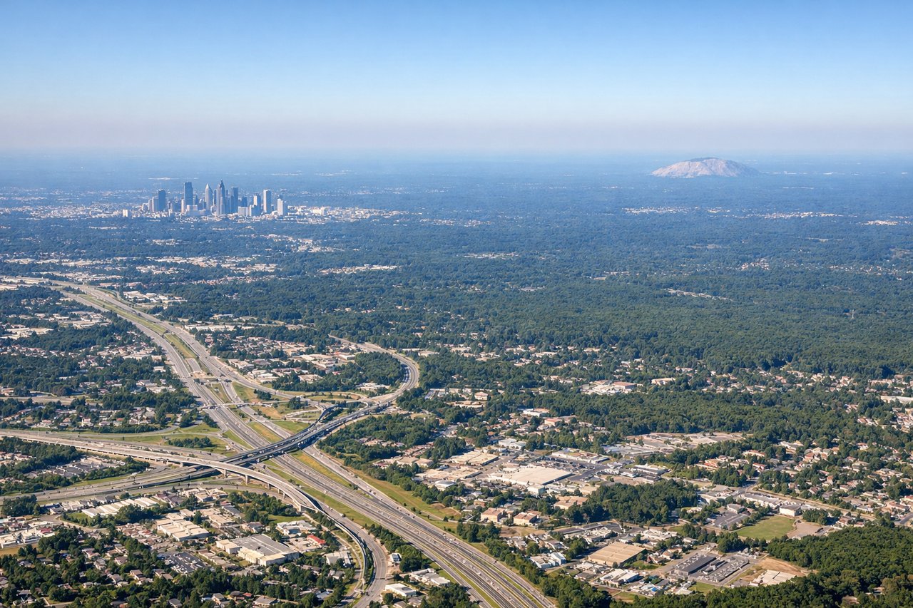
Takeoff from ATL
LEFTATL typically departs northeast on runways 8L/8R or 9L/9R, putting the left (north) side over downtown Atlanta's skyline and the Chattahoochee River corridor. You get a clear look at the city grid and Midtown before climbing out over the Piedmont.

Landing at CLT
RIGHTCLT primarily lands on runways 18C/18L/18R (heading south) or 23 (heading southwest), meaning the right (west/northwest) side looks toward Uptown Charlotte's skyline during the approach. The city center sits just northwest of the airport and is clearly visible on descent.
Landmarks on this routeAll landmarks →
Will your flight be in sunlight?
Pick a date and time in the Sun Map to watch the sun move across your whole flight.
About This Route
Which side of the plane should I sit on flying from The William B Hartsfield Atlanta International (ATL) to Charlotte Douglas International (CLT)?
Sit on the Right side of the plane for the best views on flights from Atlanta to Charlotte. The right side misses the Atlanta departure views but captures the Blue Ridge foothills rolling into the Piedmont through the cruise phase and delivers the best approach view of Uptown Charlotte. On a short flight like this, the landing view is the highlight, and right side wins it clearly.
What can I see during takeoff from The William B Hartsfield Atlanta International in Atlanta?
During takeoff from The William B Hartsfield Atlanta International (ATL), sit on the Left side for the best views. ATL typically departs northeast on runways 8L/8R or 9L/9R, putting the left (north) side over downtown Atlanta's skyline and the Chattahoochee River corridor. You get a clear look at the city grid and Midtown before climbing out over the Piedmont. Notable sights include: Downtown Atlanta skyline, Midtown Atlanta towers, Chattahoochee River, Stone Mountain (distant to the northeast).
What can I see when landing at Charlotte Douglas International in Charlotte?
When landing at Charlotte Douglas International (CLT), sit on the Right side for the best views. CLT primarily lands on runways 18C/18L/18R (heading south) or 23 (heading southwest), meaning the right (west/northwest) side looks toward Uptown Charlotte's skyline during the approach. The city center sits just northwest of the airport and is clearly visible on descent. Notable sights include: Uptown Charlotte skyline, Lake Norman (to the north, visible on longer finals), Lake Wylie (southwest), Catawba River corridor.
How long is the flight from Atlanta to Charlotte?
The flight from The William B Hartsfield Atlanta International (ATL) to Charlotte Douglas International (CLT) takes about 50 minutes. The shortest flight path between them is 227 miles (365 km); winds and air traffic control usually add a few percent.
What does the Atlanta to Charlotte flight path pass over?
The flight tracks northeast over the Georgia-South Carolina Piedmont, crossing the broad rolling terrain of the Carolina Piedmont. The Broad River and Catawba River watersheds are visible below. The southern foothills of the Blue Ridge Mountains are faintly visible to the northwest during cruise, and Kings Mountain State Park area appears as a patch of forested ridgeline terrain roughly 20 miles west of the flight path near the state line.