The left side wins on both ends of the flight: distant Appalachian foothills and the Atlanta skyline during departure, followed by the iconic Potomac River Visual approach past the Washington Monument and Capitol on arrival. The right side offers only flat Piedmont terrain with no comparable landmarks.
Flight Path
The route crosses the Piedmont region of South Carolina and North Carolina, passing east of the Blue Ridge Mountains near the Charlotte/Winston-Salem area, with the Appalachian foothills visible as a distant western backdrop before the descent into the Potomac River valley.
Great circle distance and headings ›Phase by phase
Takeoff from ATL
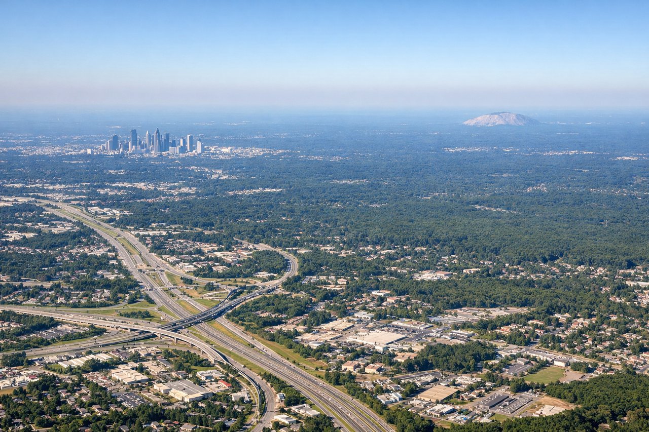
LEFTDeparting ATL and turning onto the northeast track toward DCA, the climb affords a view back toward downtown Atlanta's skyline and, further out, the low ridgelines of the Appalachian foothills sitting to the northwest of the flight path. The right side only shows the flat Piedmont farmland south of the airport with no real landmarks.
Landing at DCA
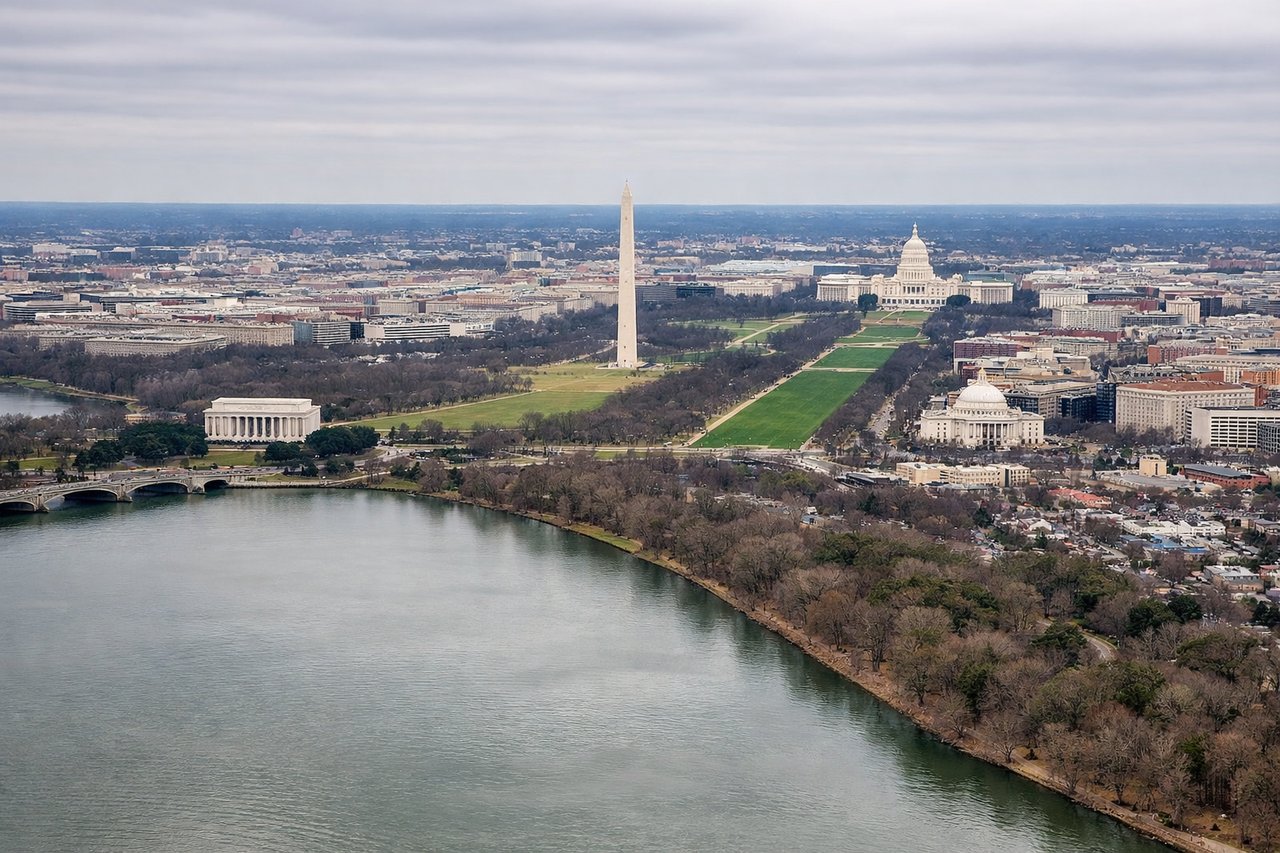
LEFTOn the River Visual approach to Runway 19, the aircraft tracks south along the Potomac, putting downtown Washington's monuments on the left side of the cabin. Passengers get a close, low-altitude view of the Washington Monument, Capitol dome, and National Mall just before touchdown, while the right side only shows the Virginia riverbank and Pentagon rooftop briefly.
Landmarks on this routeAll landmarks →
Will your flight be in sunlight?
See exactly which side of the plane gets sun and shade at your departure time.
About This Route
Which side of the plane should I sit on flying from The William B Hartsfield Atlanta International (ATL) to Ronald Reagan Washington National (DCA)?
Sit on the Left side of the plane for the best views on flights from Atlanta to Washington. The left side wins on both ends of the flight: distant Appalachian foothills and the Atlanta skyline during departure, followed by the iconic Potomac River Visual approach past the Washington Monument and Capitol on arrival. The right side offers only flat Piedmont terrain with no comparable landmarks.
What can I see during takeoff from The William B Hartsfield Atlanta International in Atlanta?
During takeoff from The William B Hartsfield Atlanta International (ATL), sit on the Left side for the best views. Departing ATL and turning onto the northeast track toward DCA, the climb affords a view back toward downtown Atlanta's skyline and, further out, the low ridgelines of the Appalachian foothills sitting to the northwest of the flight path. The right side only shows the flat Piedmont farmland south of the airport with no real landmarks. Notable sights include: Downtown Atlanta skyline, Piedmont foothills, distant Blue Ridge ridgelines.
What can I see when landing at Ronald Reagan Washington National in Washington?
When landing at Ronald Reagan Washington National (DCA), sit on the Left side for the best views. On the River Visual approach to Runway 19, the aircraft tracks south along the Potomac, putting downtown Washington's monuments on the left side of the cabin. Passengers get a close, low-altitude view of the Washington Monument, Capitol dome, and National Mall just before touchdown, while the right side only shows the Virginia riverbank and Pentagon rooftop briefly. Notable sights include: Washington Monument, U.S. Capitol dome, National Mall, Potomac River.
How long is the flight from Atlanta to Washington?
The flight from The William B Hartsfield Atlanta International (ATL) to Ronald Reagan Washington National (DCA) takes 1h 40m.
What does the Atlanta to Washington flight path pass over?
The route crosses the Piedmont region of South Carolina and North Carolina, passing east of the Blue Ridge Mountains near the Charlotte/Winston-Salem area, with the Appalachian foothills visible as a distant western backdrop before the descent into the Potomac River valley.