Right side wins overall. The Atlanta departure view of the city skyline and Stone Mountain is the most dramatic single moment of the flight. During cruise the route passes over the Caribbean and Amazon basin where both sides are similar. The São Paulo approach on the left is good but the urban sprawl is less dramatic than the Atlanta departure.
Flown ATL to GRU? Did we get it right?
Flight Path
Atlanta to Sao Paulo is 4,667 miles (7,510 km), a flight of about 9 hours 45 minutes.
After departing Georgia the route crosses the Gulf of Mexico, then Cuba and the Caribbean Sea, crossing the Venezuelan coast near Caracas. The flight then tracks over the vast Amazon basin — an unbroken green canopy with the Amazon River and its tributaries visible as brown winding channels on clear days. The route crosses into the Brazilian cerrado before descending toward São Paulo through the Serra da Mantiqueira highlands.
Great circle distance and headings ›

Phase by phase
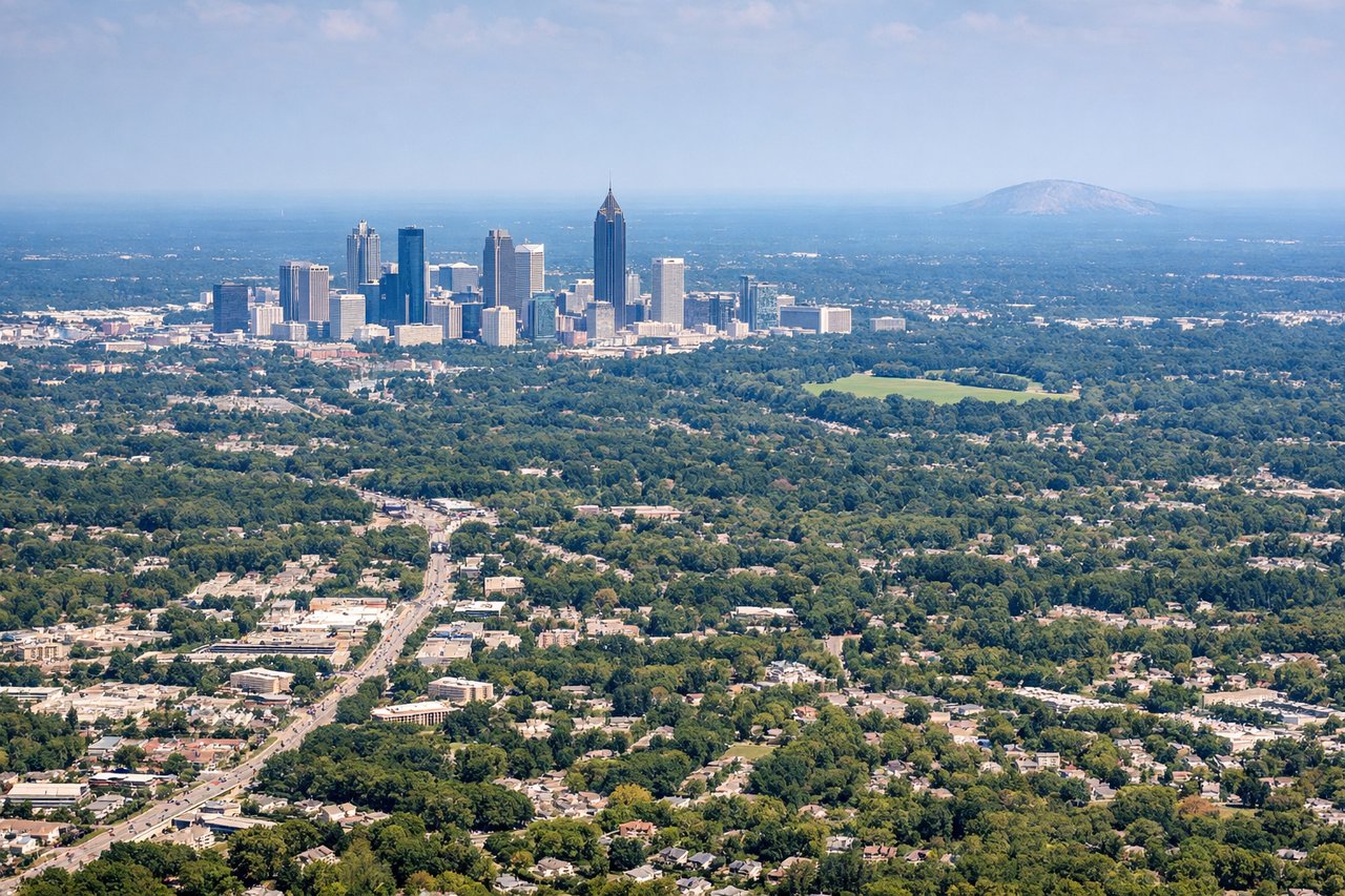
Takeoff from ATL
RIGHTATL typically departs southbound on runways 26L/26R or 28L/28R, then turns south toward GRU. Right side gives you the Atlanta skyline to the northwest as you climb out, with the downtown cluster of towers clearly visible. Left side faces away toward the western suburbs with little of interest.

Landing at GRU
LEFTGRU approaches from the northeast over the Serra da Mantiqueira foothills, and left-side passengers get views of the São Paulo metropolitan sprawl extending to the southwest, including the dense urban core of the city. Right side faces toward less populated areas east of the airport.
Will your flight be in sunlight?
Pick a date and time in the Sun Map to watch the sun move across your whole flight.
About This Route
Which side of the plane should I sit on flying from The William B Hartsfield Atlanta International (ATL) to Guarulhos (GRU)?
Sit on the Right side of the plane for the best views on flights from Atlanta to Sao Paulo. Right side wins overall. The Atlanta departure view of the city skyline and Stone Mountain is the most dramatic single moment of the flight. During cruise the route passes over the Caribbean and Amazon basin where both sides are similar. The São Paulo approach on the left is good but the urban sprawl is less dramatic than the Atlanta departure.
What can I see during takeoff from The William B Hartsfield Atlanta International in Atlanta?
During takeoff from The William B Hartsfield Atlanta International (ATL), sit on the Right side for the best views. ATL typically departs southbound on runways 26L/26R or 28L/28R, then turns south toward GRU. Right side gives you the Atlanta skyline to the northwest as you climb out, with the downtown cluster of towers clearly visible. Left side faces away toward the western suburbs with little of interest. Notable sights include: Atlanta downtown skyline, Stone Mountain (visible to the northeast as a granite dome), Lake Lanier reservoir to the north, Hartsfield terminal complex below.
What can I see when landing at Guarulhos in Sao Paulo?
When landing at Guarulhos (GRU), sit on the Left side for the best views. GRU approaches from the northeast over the Serra da Mantiqueira foothills, and left-side passengers get views of the São Paulo metropolitan sprawl extending to the southwest, including the dense urban core of the city. Right side faces toward less populated areas east of the airport. Notable sights include: São Paulo city center and Paulista Avenue corridor, Billings and Guarapiranga reservoirs to the south, Tietê River snaking through the metro area, Serra da Mantiqueira foothills to the north.
How long is the flight from Atlanta to Sao Paulo?
The flight from The William B Hartsfield Atlanta International (ATL) to Guarulhos (GRU) takes about 9 hours 45 minutes. The shortest flight path between them is 4,667 miles (7,510 km); winds and air traffic control usually add a few percent.
What does the Atlanta to Sao Paulo flight path pass over?
After departing Georgia the route crosses the Gulf of Mexico, then Cuba and the Caribbean Sea, crossing the Venezuelan coast near Caracas. The flight then tracks over the vast Amazon basin — an unbroken green canopy with the Amazon River and its tributaries visible as brown winding channels on clear days. The route crosses into the Brazilian cerrado before descending toward São Paulo through the Serra da Mantiqueira highlands.