Right-side seats capture the more dramatic scenery: Atlanta's urban landscape during departure and the transition through Georgia's Piedmont region. The westbound flight path offers more varied terrain than the landing approach.
Flown ATL to GVT? Did we get it right?
Flight Path
Atlanta to Greenvile is 672 miles (1,082 km), a flight of about 2 hours 5 minutes.
As you cross from Georgia into Alabama, watch for the Tallapoosa River valley and the transition from Piedmont plateau to the Alabama Black Belt region. The terrain gradually flattens and becomes more agricultural with scattered pine forests. Around the Georgia-Alabama border, you may see the Cheaha Mountain area as a slight elevation change in the landscape. Continuing west into Texas, the terrain becomes increasingly flat and open as you approach the Red River valley and north-central Texas prairie.
Great circle distance and headings ›

Phase by phase
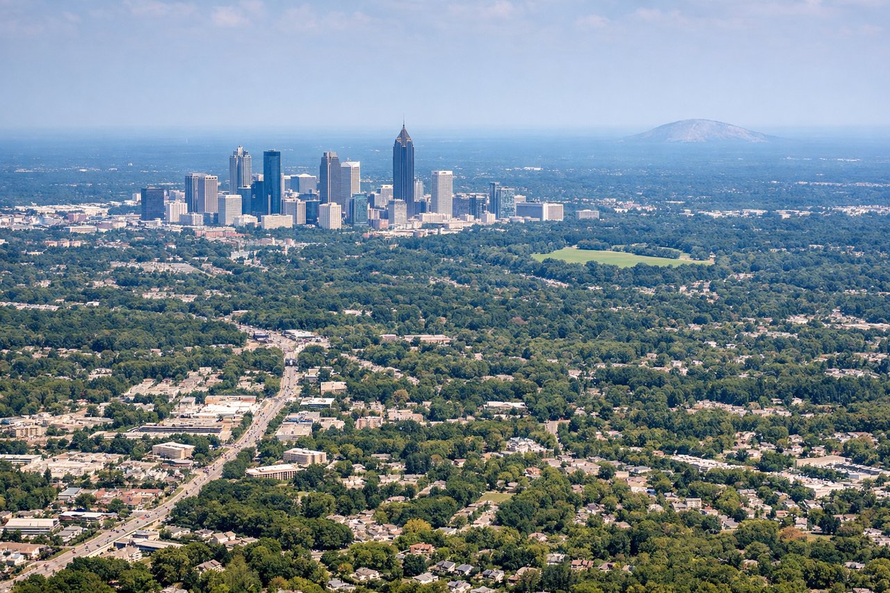
Takeoff from ATL
RIGHTRight-side seats offer views of Atlanta's urban sprawl and the Piedmont region as you climb westward. You'll see the city grid fade into suburban development and tree-covered rolling terrain characteristic of northern Georgia.
Landing at GVT
LEFTLeft-side seats provide views during the descent approach into Majors Airport near Greenville. You'll see the Red River valley and the transition from Texas prairie to the airport's location in the rolling terrain west of the city.
Will your flight be in sunlight?
Pick a date and time in the Sun Map to watch the sun move across your whole flight.
About This Route
Which side of the plane should I sit on flying from The William B Hartsfield Atlanta International (ATL) to Majors (GVT)?
Sit on the Right side of the plane for the best views on flights from Atlanta to Greenvile. Right-side seats capture the more dramatic scenery: Atlanta's urban landscape during departure and the transition through Georgia's Piedmont region. The westbound flight path offers more varied terrain than the landing approach.
What can I see during takeoff from The William B Hartsfield Atlanta International in Atlanta?
During takeoff from The William B Hartsfield Atlanta International (ATL), sit on the Right side for the best views. Right-side seats offer views of Atlanta's urban sprawl and the Piedmont region as you climb westward. You'll see the city grid fade into suburban development and tree-covered rolling terrain characteristic of northern Georgia. Notable sights include: Downtown Atlanta skyline, Hartsfield-Jackson runways and taxiways, suburban sprawl extending north and west, Piedmont plateau terrain.
What can I see when landing at Majors in Greenvile?
When landing at Majors (GVT), sit on the Left side for the best views. Left-side seats provide views during the descent approach into Majors Airport near Greenville. You'll see the Red River valley and the transition from Texas prairie to the airport's location in the rolling terrain west of the city. Notable sights include: Red River valley floor, Texas prairie grassland, Greenville city lights and development, rolling terrain of north-central Texas.
How long is the flight from Atlanta to Greenvile?
The flight from The William B Hartsfield Atlanta International (ATL) to Majors (GVT) takes about 2 hours 5 minutes. The shortest flight path between them is 672 miles (1,082 km); winds and air traffic control usually add a few percent.
What does the Atlanta to Greenvile flight path pass over?
As you cross from Georgia into Alabama, watch for the Tallapoosa River valley and the transition from Piedmont plateau to the Alabama Black Belt region. The terrain gradually flattens and becomes more agricultural with scattered pine forests. Around the Georgia-Alabama border, you may see the Cheaha Mountain area as a slight elevation change in the landscape. Continuing west into Texas, the terrain becomes increasingly flat and open as you approach the Red River valley and north-central Texas prairie.