While the takeoff offers good views of Atlanta and the Blue Ridge foothills, the landing descent provides more dramatic and distinctive scenery—the Tennessee River's meanders and the Cumberland Plateau escarpment are visually striking and geographically significant. Right side captures these features best.
Flown ATL to HSV? Did we get it right?
Flight Path
Atlanta to Huntsville is 151 miles (243 km), a flight of about 50 minutes.
The flight path crosses northwest Georgia, passing over the Etowah River valley and the southern Appalachian foothills. The terrain transitions from the Piedmont region near Atlanta to the Ridge and Valley province, with increasingly pronounced ridgelines and valleys running northeast-southwest. The landscape becomes progressively more forested and less urbanized as you move northwest toward Huntsville.
Great circle distance and headings ›Phase by phase
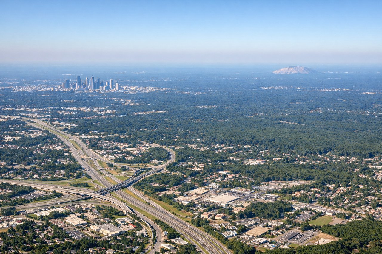
Takeoff from ATL
LEFTLeft side captures the northward climb-out path over the Atlanta metropolitan area and the foothills of the Blue Ridge Mountains in the distance. You'll see the urban sprawl transition to forested terrain and ridgelines.
Landing at HSV
RIGHTRight side on descent into Huntsville provides views of the Tennessee River valley and the Cumberland Plateau escarpment. The river's distinctive meanders and the plateau's dramatic edge are striking visual features during final approach.
Will your flight be in sunlight?
Pick a date and time in the Sun Map to watch the sun move across your whole flight.
About This Route
Which side of the plane should I sit on flying from The William B Hartsfield Atlanta International (ATL) to Huntsville International Airport (HSV)?
Sit on the Right side of the plane for the best views on flights from Atlanta to Huntsville. While the takeoff offers good views of Atlanta and the Blue Ridge foothills, the landing descent provides more dramatic and distinctive scenery—the Tennessee River's meanders and the Cumberland Plateau escarpment are visually striking and geographically significant. Right side captures these features best.
What can I see during takeoff from The William B Hartsfield Atlanta International in Atlanta?
During takeoff from The William B Hartsfield Atlanta International (ATL), sit on the Left side for the best views. Left side captures the northward climb-out path over the Atlanta metropolitan area and the foothills of the Blue Ridge Mountains in the distance. You'll see the urban sprawl transition to forested terrain and ridgelines. Notable sights include: Atlanta downtown skyline, Chattahoochee River valley, Blue Ridge Mountain foothills (north), suburban sprawl of northern Atlanta metro.
What can I see when landing at Huntsville International Airport in Huntsville?
When landing at Huntsville International Airport (HSV), sit on the Right side for the best views. Right side on descent into Huntsville provides views of the Tennessee River valley and the Cumberland Plateau escarpment. The river's distinctive meanders and the plateau's dramatic edge are striking visual features during final approach. Notable sights include: Tennessee River with prominent meanders, Cumberland Plateau eastern escarpment, Huntsville urban area, Monte Sano Mountain.
How long is the flight from Atlanta to Huntsville?
The flight from The William B Hartsfield Atlanta International (ATL) to Huntsville International Airport (HSV) takes about 50 minutes. The shortest flight path between them is 151 miles (243 km); winds and air traffic control usually add a few percent.
What does the Atlanta to Huntsville flight path pass over?
The flight path crosses northwest Georgia, passing over the Etowah River valley and the southern Appalachian foothills. The terrain transitions from the Piedmont region near Atlanta to the Ridge and Valley province, with increasingly pronounced ridgelines and valleys running northeast-southwest. The landscape becomes progressively more forested and less urbanized as you move northwest toward Huntsville.