Right-side seats provide superior scenery for the majority of the flight. Takeoff offers excellent views of Atlanta's urban landscape and Piedmont terrain, and the eastbound flight path keeps coastal features visible on the right during cruise as you approach the Carolina coast.
Flown ATL to ILM? Did we get it right?
Flight Path
Atlanta to Wilmington is 376 miles (606 km), a flight of about 1 hour 15 minutes.
The flight path crosses the Piedmont plateau of central Georgia and South Carolina, then transitions into the Atlantic Coastal Plain. Notable features include the Savannah River valley (visible as a linear depression in the terrain around the Georgia-South Carolina border), scattered lakes and reservoirs throughout the Piedmont, and the gradual flattening of terrain as you approach the coastal plain. The landscape transitions from forested rolling hills to increasingly flat, pine-dominated terrain with visible agricultural fields and wetlands as you near the coast. The Neuse River and other tidal rivers become visible in the final 20 minutes of descent as you approach the North Carolina coast.
Great circle distance and headings ›Phase by phase
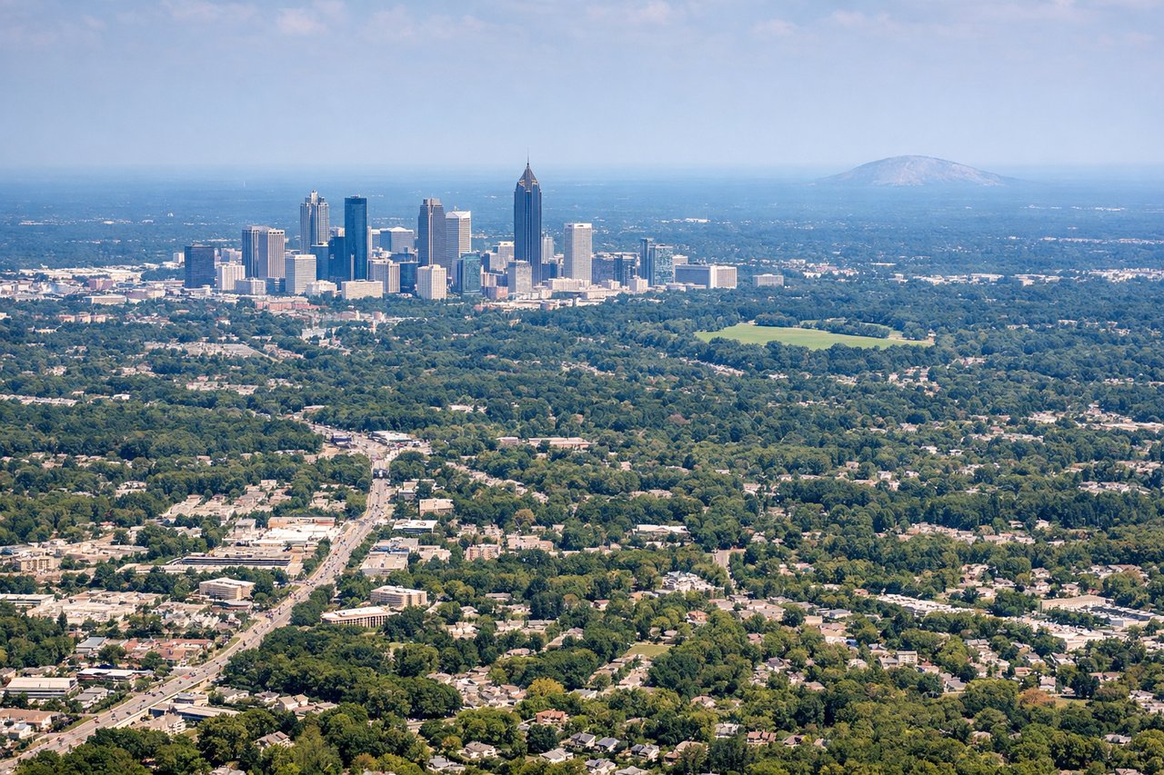
Takeoff from ATL
RIGHTRight-side seats capture the Atlanta metropolitan area and the Piedmont terrain as you climb northeast. You'll see the city grid, surrounding suburban sprawl, and the rolling hills of the Georgia Piedmont receding beneath you.
Landing at ILM
LEFTLeft-side seats offer views of the Cape Fear River estuary, Wilmington's downtown waterfront, and the Atlantic coastline as you descend toward ILM. The river and coastal geography provide distinctive visual landmarks during final approach.
Will your flight be in sunlight?
Pick a date and time in the Sun Map to watch the sun move across your whole flight.
About This Route
Which side of the plane should I sit on flying from The William B Hartsfield Atlanta International (ATL) to Wilmington International (ILM)?
Sit on the Right side of the plane for the best views on flights from Atlanta to Wilmington. Right-side seats provide superior scenery for the majority of the flight. Takeoff offers excellent views of Atlanta's urban landscape and Piedmont terrain, and the eastbound flight path keeps coastal features visible on the right during cruise as you approach the Carolina coast.
What can I see during takeoff from The William B Hartsfield Atlanta International in Atlanta?
During takeoff from The William B Hartsfield Atlanta International (ATL), sit on the Right side for the best views. Right-side seats capture the Atlanta metropolitan area and the Piedmont terrain as you climb northeast. You'll see the city grid, surrounding suburban sprawl, and the rolling hills of the Georgia Piedmont receding beneath you. Notable sights include: Downtown Atlanta skyline, Hartsfield-Jackson runways and taxiways, Piedmont plateau terrain, suburban development corridors extending north and east.
What can I see when landing at Wilmington International in Wilmington?
When landing at Wilmington International (ILM), sit on the Left side for the best views. Left-side seats offer views of the Cape Fear River estuary, Wilmington's downtown waterfront, and the Atlantic coastline as you descend toward ILM. The river and coastal geography provide distinctive visual landmarks during final approach. Notable sights include: Cape Fear River estuary and meanders, Wilmington downtown waterfront district, Atlantic Ocean horizon, coastal marshlands and barrier islands.
How long is the flight from Atlanta to Wilmington?
The flight from The William B Hartsfield Atlanta International (ATL) to Wilmington International (ILM) takes about 1 hour 15 minutes. The shortest flight path between them is 376 miles (606 km); winds and air traffic control usually add a few percent.
What does the Atlanta to Wilmington flight path pass over?
The flight path crosses the Piedmont plateau of central Georgia and South Carolina, then transitions into the Atlantic Coastal Plain. Notable features include the Savannah River valley (visible as a linear depression in the terrain around the Georgia-South Carolina border), scattered lakes and reservoirs throughout the Piedmont, and the gradual flattening of terrain as you approach the coastal plain. The landscape transitions from forested rolling hills to increasingly flat, pine-dominated terrain with visible agricultural fields and wetlands as you near the coast. The Neuse River and other tidal rivers become visible in the final 20 minutes of descent as you approach the North Carolina coast.