The right side captures nearly the entire scenic arc of the flight: a glimpse of Atlanta's skyline on departure, the southern Rockies and Colorado Plateau near Flagstaff during cruise, and finally Lake Mead and the Las Vegas Strip on arrival. The left side stays largely over flat plains and empty desert with far fewer identifiable features.
Flight Path
Southern Rocky Mountain foothills near Albuquerque, the Sandia Mountains, the Painted Desert and Colorado Plateau near Flagstaff, and the Grand Canyon's eastern rim visible to the north of the flight path
Great circle distance and headings ›.jpeg?width=600)

.jpg?width=600)
.jpg?width=600)
.jpeg?width=600)


Phase by phase

Takeoff from ATL
RIGHTDeparting ATL to the west, the right side offers a brief but clear view of downtown Atlanta's skyline and the wooded Piedmont hills just north of the airport before the city gives way to suburban sprawl. The left side mostly shows flat, tree-covered exurbs with little definition.
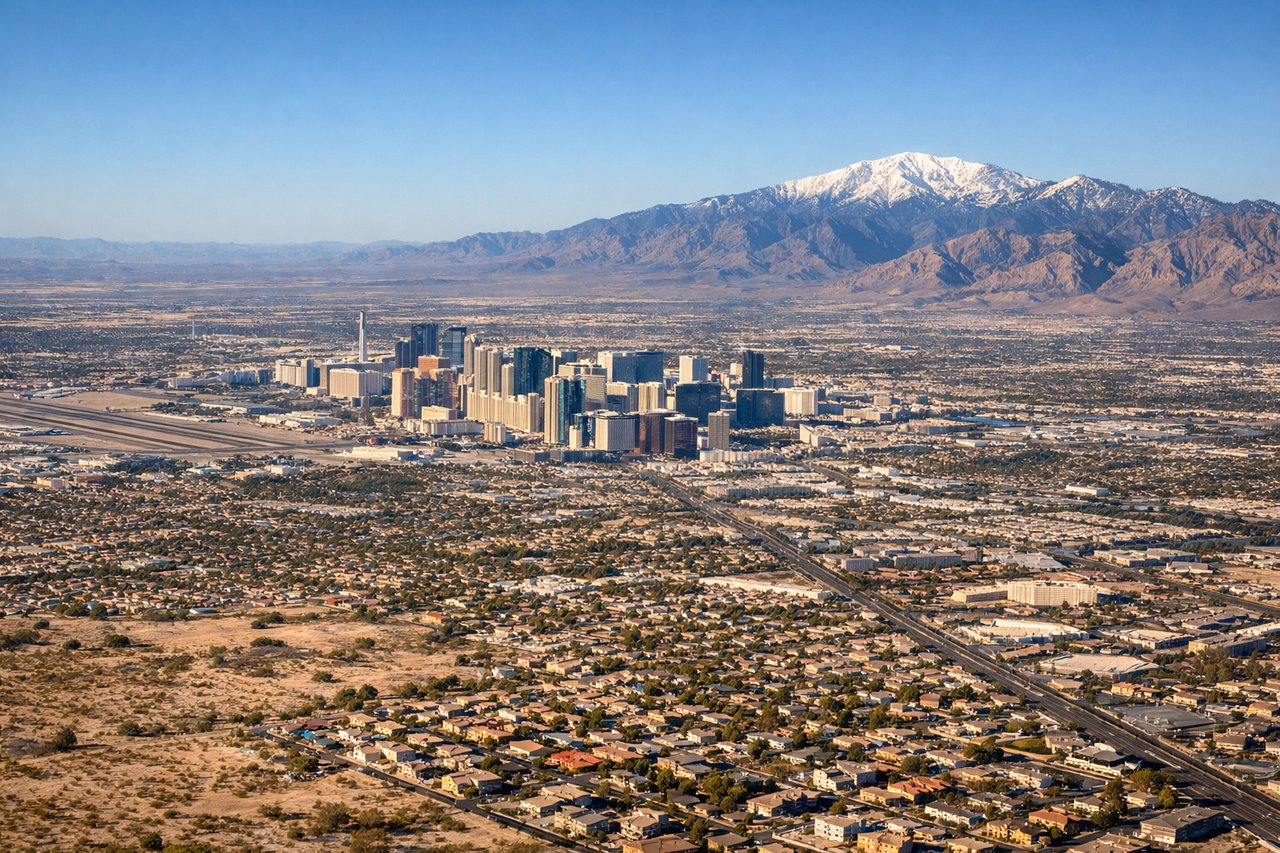
Landing at LAS
RIGHTOn the typical eastbound approach into LAS, the aircraft descends past Lake Mead and then turns onto final for runway 26, putting the Las Vegas Strip and its distinctive towers on the right side of the cabin. The left side instead faces the emptier desert basin south of the valley with less to see.
Landmarks on this routeAll landmarks →
Will your flight be in sunlight?
See exactly which side of the plane gets sun and shade at your departure time.
About This Route
Which side of the plane should I sit on flying from The William B Hartsfield Atlanta International (ATL) to Mc Carran International (LAS)?
Sit on the Right side of the plane for the best views on flights from Atlanta to Las Vegas. The right side captures nearly the entire scenic arc of the flight: a glimpse of Atlanta's skyline on departure, the southern Rockies and Colorado Plateau near Flagstaff during cruise, and finally Lake Mead and the Las Vegas Strip on arrival. The left side stays largely over flat plains and empty desert with far fewer identifiable features.
What can I see during takeoff from The William B Hartsfield Atlanta International in Atlanta?
During takeoff from The William B Hartsfield Atlanta International (ATL), sit on the Right side for the best views. Departing ATL to the west, the right side offers a brief but clear view of downtown Atlanta's skyline and the wooded Piedmont hills just north of the airport before the city gives way to suburban sprawl. The left side mostly shows flat, tree-covered exurbs with little definition. Notable sights include: Downtown Atlanta skyline, Chattahoochee River, Piedmont foothills.
What can I see when landing at Mc Carran International in Las Vegas?
When landing at Mc Carran International (LAS), sit on the Right side for the best views. On the typical eastbound approach into LAS, the aircraft descends past Lake Mead and then turns onto final for runway 26, putting the Las Vegas Strip and its distinctive towers on the right side of the cabin. The left side instead faces the emptier desert basin south of the valley with less to see. Notable sights include: Las Vegas Strip skyline, Spring Mountains, Lake Mead (earlier in descent), Frenchman Mountain.
How long is the flight from Atlanta to Las Vegas?
The flight from The William B Hartsfield Atlanta International (ATL) to Mc Carran International (LAS) takes 4h 10m.
What does the Atlanta to Las Vegas flight path pass over?
Southern Rocky Mountain foothills near Albuquerque, the Sandia Mountains, the Painted Desert and Colorado Plateau near Flagstaff, and the Grand Canyon's eastern rim visible to the north of the flight path