The left side sees the Strip and Lake Mead on departure and has the better view of the Colorado Plateau and southern Rockies to the north during cruise. The right side's Atlanta skyline approach is strong, but the rest of its flight is flatter and less dramatic.
Flown LAS to ATL? Did we get it right?
Flight Path
Las Vegas to Atlanta is 1,743 miles (2,805 km), a flight of about 3 hours 55 minutes.
Lake Mead and the Colorado River near Las Vegas, the Colorado Plateau and Grand Canyon region of northern Arizona and southern Utah, the southern Rockies in northern New Mexico, the Texas Panhandle and Oklahoma plains, the Mississippi River near Memphis, and the southern Appalachian foothills before Atlanta. The exact routing varies with winds and traffic.
Great circle distance and headings ›


Phase by phase

Takeoff from LAS
LEFTAssuming a typical south-flow departure from 19L/19R, the jet climbs SSW and then banks left toward the east. That puts the left windows on the inside of the turn, facing the Strip, downtown, and the desert ranges. The right side mostly sees the Spring Mountains and Red Rock country in the distance, which is nice but less dramatic.
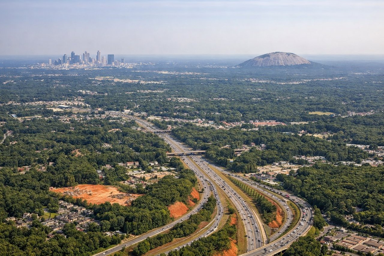
Landing at ATL
RIGHTIn west-flow operations, arrivals from the west typically run east on a downwind leg north of the airport and then turn right back toward the west onto final. That puts the right windows on the inside of the turn, facing Atlanta's skyline and the five parallel Hartsfield-Jackson runways. The left side mostly sees northern suburbs and tree-covered land.
Will your flight be in sunlight?
Pick a date and time in the Sun Map to watch the sun move across your whole flight.
About This Route
Which side of the plane should I sit on flying from Mc Carran International (LAS) to The William B Hartsfield Atlanta International (ATL)?
Sit on the Left side of the plane for the best views on flights from Las Vegas to Atlanta. The left side sees the Strip and Lake Mead on departure and has the better view of the Colorado Plateau and southern Rockies to the north during cruise. The right side's Atlanta skyline approach is strong, but the rest of its flight is flatter and less dramatic.
What can I see during takeoff from Mc Carran International in Las Vegas?
During takeoff from Mc Carran International (LAS), sit on the Left side for the best views. Assuming a typical south-flow departure from 19L/19R, the jet climbs SSW and then banks left toward the east. That puts the left windows on the inside of the turn, facing the Strip, downtown, and the desert ranges. The right side mostly sees the Spring Mountains and Red Rock country in the distance, which is nice but less dramatic. Notable sights include: The Las Vegas Strip and downtown, Frenchman Mountain, Lake Mead, Mount Charleston in the Spring Mountains.
What can I see when landing at The William B Hartsfield Atlanta International in Atlanta?
When landing at The William B Hartsfield Atlanta International (ATL), sit on the Right side for the best views. In west-flow operations, arrivals from the west typically run east on a downwind leg north of the airport and then turn right back toward the west onto final. That puts the right windows on the inside of the turn, facing Atlanta's skyline and the five parallel Hartsfield-Jackson runways. The left side mostly sees northern suburbs and tree-covered land. Notable sights include: Downtown and Midtown Atlanta skyline, Stone Mountain, the Hartsfield-Jackson runway complex, the I-75/I-85 Downtown Connector.
How long is the flight from Las Vegas to Atlanta?
The flight from Mc Carran International (LAS) to The William B Hartsfield Atlanta International (ATL) takes about 3 hours 55 minutes. The shortest flight path between them is 1,743 miles (2,805 km); winds and air traffic control usually add a few percent.
What does the Las Vegas to Atlanta flight path pass over?
Lake Mead and the Colorado River near Las Vegas, the Colorado Plateau and Grand Canyon region of northern Arizona and southern Utah, the southern Rockies in northern New Mexico, the Texas Panhandle and Oklahoma plains, the Mississippi River near Memphis, and the southern Appalachian foothills before Atlanta. The exact routing varies with winds and traffic.